Welcome to the Virtual Base Camp, the starting point for your exploration of the polar regions with PolarTREC teachers and researchers!
2009 Expedition Timeline
Expeditions
Early Spring Plankton and Benthos
What Are They Doing?
A diverse team of researchers participated in the first of three research cruises in the 2009 season in support of the Bering Sea Ecosystem Study (BEST) and the Bering Sea Integrated Ecosystem Research Program (BSIERP). Scientists on board the ship documented late winter ocean conditions, studied the biological communities found in sea ice, monitored the early spring plankton bloom, and investigated light penetration through open water and ice cover. Additionally, researchers examined the benthic communities living on the seafloor and observed an important benthic predator, the walrus. The region of the Bering Sea where the team worked is biologically rich and supports highly productive ecological communities of bivalves, gastropods, and polychaetes. These benthic communities have been changing over the past several decades, perhaps as a result of competing fish species moving north as the Bering Sea's waters warm.
Expedition Map
Ocean, Atmosphere, Sea Ice, and Snowpack Interactions
What Are They Doing?
Team researchers investigated air-surface chemical interactions in the Arctic, and how these might evolve in future climates. Their efforts were part of the Ocean, Atmosphere, Sea Ice, Snowpack (OASIS) program – an international program that involves scientists from the United States, Canada, France, Germany, Italy, and the UK.
To gather data, the team used state-of-the-art chemical and biological sensors, micrometeorological instrumentation, Lidars, and tethered balloons to measure chemical and biological exchanges between the atmosphere and ice, ocean, and snow surfaces. The study focused on the impacts of these chemical reservoirs on tropospheric chemistry, climate, and their feedbacks in the Arctic. By seeking the answer to key questions about the nature of these surfaces, including how, where, and which chemical substances and aerosols are processed and activated in snow surfaces, the team pursued big-picture climate issues and contributed to predictions about climate change in the arctic.
Expedition Map
Geologic Climate Research in Siberia
What Are They Doing?
An international team of researchers from the United States, Germany, Russia, and Austria traveled to northeast Russia to conduct a large-scale scientific drilling project in Lake El'gygytgyn (pronounced el'geegitgin), a crater lake created 3.6 million years ago by the impact of a meteorite measuring about 18 km in diameter. The team worked on the lake ice throughout the winter, using a customized light-weight drill rig to obtain drill cores of layered muds from two sites in the lake.
Lake El'gygytgyn possesses a unique record of prehistoric climate change in the arctic. Because this basin was never glaciated, an uninterrupted sediment sequence of nearly 400 m (1312 feet) has accumulated at the bottom of the lake. Sediment cores collected during this expedition were used to gather information about the history of the basin and were compared with similar paleoclimate records from other parts of the world, helping researchers to better understand the arctic's role in global climate change.
The team also drilled a short distance into the highly fractured rock layer below the sediments to learn more about meteorite impacts. Because of the particularly well-preserved rock structure in Lake El'gygytgyn, the team was able to learn how igneous target rocks in this area responded to impacts, potentially providing the basis for important understanding related to cratering processes on Mars.
Geologists used the data collected from the project to reconstruct past climate records on longer time scales, improve understanding of the climate system, and better inform scientists who predict future climate change.
Expedition Map
Spring Plankton and Changing Ice Cover
What Are They Doing?
A diverse research team aboard the U.S. Coast Guard Cutter (USCGC) Healy conducted sampling along a series of transects over the eastern Bering Sea. Research on the ship was multidisciplinary, with scientists using a variety of techniques to document ocean conditions and the productivity of the Bering Sea ecosystem. Research teams measured the temperature, salinity, and nutrient content of the sea water, changes in sea ice cover, and the concentration of nutrients used and released by phytoplankton. They also conducted surveys of zooplankton, fish, seabirds, and marine mammals such as walrus and seal to assess the health of these populations. A major focus of this cruise was characterizing the phytoplankton bloom associated with the edge of the melting sea ice.
These measurements helped give scientists an indication of the status of the Bering Sea ecosystem and an indication of any changes that could affect the use of its resources, and the economic, social, and cultural sustainability of the people who depend on it. This is the second 2009 cruise in support of the Bering Sea Ecosystem Study (BEST) and the Bering Sea Integrated Ecosystem Research Program (BSIERP).
Expedition Map
Prehistoric Human Response to Climate Change
What Are They Doing?
For this project, the research team collected and analyzed archaeological and paleoenvironmental data from three widely separated but environmentally comparable sites within the northern circumpolar region, the Yli-li area of Northern Finland, the Wemindji area of James Bay, Canada, and in the Kamchatka Peninsula region of Russia.
The circumpolar North is widely seen as an observatory for changing relations between human societies and their environments. The goal of the research team was to learn about the prehistoric society and economy of these areas in order to better understand human adaptation to significant environmental changes that took place between 6,000 and 4,000 years ago. Data gathered from this project helped enable more effective collaboration between social, natural and medical sciences.
This project was part of a the first circumpolar humanities research initiative called Histories From the North: Environments, Movements, Narratives (BOREAS), which involved collaboration of researchers from Europe, the US, Canada, and Russia and is part of the International Polar Year.
Expedition Map
CReSIS Greenland Ice Sheet Studies
What Are They Doing?
Much of our knowledge of past climate comes from ice cores drilled from the Greenland ice sheet. These records stretch back more than 100,000 years, but existing ice cores do not include clear records from the Eemian stage, the second-to-latest interglacial period, which occurred about 130,000 years ago. During this period, evidence indicates that temperatures were about 3-5 ˚C warmer than present, so more information would help us understand and predict how our climate is likely to evolve in the warming future.
Under the North Greenland Eemian (NEEM) ice drilling project, an international team of researchers worked to obtain complete and undisturbed layers of ice from the Eemian by drilling a new core in northwest Greenland. Choosing the right spot to drill was critically important to the project’s success. NEEM scientists collaborated with researchers from the Center for the Remote Sensing of Ice Sheets (CReSIS) at the University of Kansas. The CReSIS team provided Radar Echo Sounding profiles over the ice sheet, which provided information on ice layer thickness and variability over time and space and helped NEEM researchers select the drill site.
The NEEM team began deep drilling at the site in 2009, and CReSIS scientists were able to compare the detailed information collected from the core with their radar data in order to better understand variations in snow accumulation and other environmental parameters. This helped improve the accuracy of the Radar Echo Sounding profiles.
Lawrence, KS
United States
Expedition Map
Summer Ice Free Conditions
What Are They Doing?
A diverse research team aboard the U.S. Coast Guard Cutter (USCGS) Healy conducted sampling along a series of transects over the eastern Bering Sea. Research on the ship was multidisciplinary, with scientists using a variety of techniques to document ocean conditions and the productivity of the Bering Sea ecosystem. Researchers measured the temperature, salinity, and nutrient content of the sea water and the concentration of nutrients used and released by phytoplankton. They also conducted surveys of zooplankton, fish, seabirds, and marine mammals such as walruses and seals to assess the health of these populations.
These measurements helped give scientists an indication of the status of the Bering Sea ecosystem and any changes that might affect the use of its resources, and the economic, social, and cultural sustainability of the people who depend on it. This was the third 2009 cruise in support of the Bering Sea Ecosystem Study (BEST) and the Bering Sea Integrated Ecosystem Research Program (BSIERP).
Stockton, CA
United States
Expedition Map
Greenland Education Tour 09
What Are They Doing?
The expedition members visited several research sites in Greenland as part of an initiative to foster enhanced international scientific cooperation between the countries of the United States, Greenland, and Denmark.
The expedition members spent several days learning about the research conducted in Greenland, the logistics involved in supporting the research, and they gained first-hand experience conducting experiments and developing inquiry-based educational activities.
The 2009 expedition built on the 2008 expedition and was supported by the National Science Foundation. The project was developed through cooperation with the U.S.-Denmark-Greenland Joint Committee, which was established in 2004 to broaden and deepen cooperation among the United States, the Kingdom of Denmark, and Greenland.
Expedition Map
High Arctic Change 09
What Are They Doing?
The research team, which included undergraduate geoscience students participating in the Research Experiences for Undergraduates Program, traveled to Svalbard, Norway, to investigate how climate change affects sediment transport and deposition associated with the tidewater glaciers, icebergs, meltwater streams, and marine currents. Tidewater glaciers are among the fastest changing systems in the Arctic, offering the team the opportunity to monitor rapidly changing and dynamic systems.
The research team sampled glacier and iceberg ice for debris concentrations and performed CTD casts to define where the sediment from the glacier was being transported and deposited. Glacial sediments deposited on the bottom of the fiord were collected to identify the structures forming on the fjord floor and their relation to observed glacial processes. Bathymetric maps of the seafloor were obtained by using a small sub-bottom profiler and established baseline data allowing researchers to determine the rate of sediment infilling of the fjord by the glaciers. The team also utilized aerial photographs and GPS mapping to determine the position of the glacier as well as its rate of retreat compared to 2005 data. Using this data, the team determined if relationships can be derived between sedimentation, meteorological, glaciological, and oceanic variables that allow for the historic sedimentation record to be better interpreted.
The Svalbard archipelago has been marked by the retreat of glaciers, reductions in sea ice, and measurable warming throughout the Holocene period, and more specifically during the past 90 years. The region is an ideal location for this study because it has preserved the geologic records of climate change since the last ice age and into the 20th century. The Arctic is particularly sensitive to climate change and climatically induced environmental changes in this region can instigate further changes of global consequences. Melting glacial systems and their contribution to sea level rise will have consequences on shorelines globally.
Expedition Map
Seabird Ecology in the Bering Sea
What Are They Doing?
The research team studied the foraging behavior of seabirds nesting in the Pribilof Islands. Specifically, they were interested in two piscivorous seabirds – the Thick-billed Murres and Black-legged Kittiwakes – on St. George and St. Paul Islands.
The team conducted this research to determine how climate warming and sea ice retreat from the southern portions of the Bering Sea will impact seabird nesting success and population growth rates on these islands.
To help gather data, team researchers used Global Positioning System (GPS) technology to track breeding seabirds when they foraged at sea. They also employed time-depth recorders (TDRs) to determine the amount of time the birds spent on the water surface, as well as how deep and often they dived.
The information they gathered using this equipment and their direct observation helped to confirm where birds from each island find food and how sea ice extent affects the feeding locations and trip length. They also got a better understanding of the effects of foraging behavior on colony diet, reproductive success, and adult survival.
This project contributed to a larger collaborative effort between the National Science Foundation and the North Pacific Research Board called the Bering Sea Integrated Ecosystem Research Program.
Expedition Map
Alaska Climate Variation 09
What Are They Doing?
The goal of this project was to reconstruct the behavior of atmospheric circulation, specifically the Aleutian Low pressure system, over the past 10,000 years and to assess how its variability relates to past shifts in climate. In the summer of 2009, the research team recovered sediment cores and conducted monitoring at nine lake sites in southern Alaska. They used the physical and chemical characteristics of the samples they collected to reconstruct a record of past climate in this area. The data was compared with records across the Arctic and sub-Arctic to better understand climate variation overall. Information gathered as part of this project helped researchers better understand modern climate warming in the context of the long-term climate changes that took place in the region.
Additionally, the research team discovered that two of the lakes visited contain unique sediment layers called varves, which provide a lot of information about past climate changes. These are among only a few varved lakes presently known in Alaska.
Expedition Map
Polar Bear Response to Sea Ice Loss
What Are They Doing?
Polar bears, Ursus maritimus, spend most of their time on the sea ice – where they travel, hunt, and sometimes even give birth. However, during the summer the sea ice retreats northward and leaves some polar bears on shore for several months. These bears may not be able hunt and may face warmer temperatures than they do on the ice. The research team investigated how the polar bears cope with these difficult conditions on shore, and attempted to determine if they possess adaptations similar to bears that hibernate in the winter.
A research team made up of scientists from the University of Wyoming, United States Geological Survey (USGS), and the United States Fish and Wildlife Service (USFWS) used the U.S. Coast Guard icebreaker Polar Sea and on-board helicopters to approach polar bears on the sea ice and collect measurements and samples to determine the overall physical condition of the animals. The research team recaptured bears that were originally tested in May 2009, to compare data from before and after the summer of 2009. Measurements included weight and length of the bear as well as overall appearance. In addition, the researchers measured body fat, muscle condition, and took blood samples.
Knowing how polar bears adjust when living on shore, and why they may not be able to adjust will provide important information to indigenous people, U.S. and international management agencies, conservation groups, and policy maker's for addressing the polar bear's needs in the future.
Expedition Map
Microorganisms in Antarctic Glacier Ice
What Are They Doing?
Are microorganisms metabolically active in glacier ice? To address this exciting question, the research team traveled to the McMurdo Dry Valleys – one of the harshest environments on Earth – to study the biology, geology, and chemistry of basal ice – the dynamic layer of ice closest to the bedrock at the base of a glacier. The team used a tunnel cut into the side of Taylor Glacier to reach the basal ice layer. Data collected from field measurements and laboratory experiments helped researchers understand the connections between available nutrients, geochemical properties, and gas composition. This information helped determine if evidence for metabolism of microorganisms living in the ice could be found, and to link this to the types of cells present.
In addition, the research team investigated the similarities and differences among microorganisms in different types of ice within the basal ice zone. Some layers in the basal ice zone are clear and have little sediment. Other layers have high concentrations of debris. The basal ice zones of polar glaciers show similarities with the layered deposits evident in images of the northern ice cap on Mars. The findings from this project may be of interest to scientists studying potential habitats for microbial life on Mars and on the survival in of microorganisms in ice because the frozen environments in Antarctica and Mars may have many similarities.
Expedition Map
Antarctic Undersea ROV 09
What Are They Doing?
The research team continued to explore remote regions of the seafloor around McMurdo Station, Antarctica with a remotely operated vehicle (ROV) for underwater research. The ROV was deployed through a small (15 cm) hole in the sea ice, enabling access to regions beyond scuba diving depths (at 40-170 m) and allowing the research team to survey very large areas of overlapping seafloor.
The research team used the ROV to locate historical experimental structures on the sea floor around McMurdo Station and to investigate the colonization of these structures by species of sessile invertebrates. The ROV was able to take videos and photographs of these ecological communities, which permitted the team to identify size, type, and species of organisms living on the structures. This provided an unprecedented opportunity to explore and document the rates and patterns of ecological succession from one of the most extreme habitats in the world.
The team also tested protocols for conducting sonar mapping with the new ROV as a first step towards creating high-resolution, bathymetric maps of the entire seafloor around McMurdo Station. The ROV's continued development and testing ensures its flexibility to be used for a variety of types of research projects in the future.
Learn more about Project SCINI at the official project website.
Expedition Map
Ice Core Drilling in West Antarctica
What Are They Doing?
Using a large hollow drill, the WAIS Divide Ice Core Drilling team collected a 3,500-meter-long ice core, or sample of ice, from the West Antarctic Ice Sheet. Because of the weight of the overlying snowpack, snow that falls and accumulates on ice sheets re-crystallizes and forms annual layers over time. The ice core recovered during the project had annual resolution, or distinct yearly markings, for the past 40,000 years!
In ice sheets, the compression of snow traps small bubbles of air in the layers of ice. By measuring concentrations of greenhouse gasses and non-greenhouse gasses and their isotopes trapped within bubbles in the ice, the team developed climate records dating back to 100,000 years before present.
This ice core provided the first Southern Hemisphere climate and greenhouse gas records of comparable time, resolution, and duration to ice cores previously recovered in Greenland. The ice core enabled scientists to make detailed comparisons of greenhouse gas concentrations and environmental conditions between the Northern and Southern hemispheres with a greater level of detail than previously possible. The biology of the ice collected was also investigated.
Learn more about this process here
Expedition Map
IceCube In-Ice Antarctic Telescope
What Are They Doing?
A large international team of scientists and drilling technicians worked throughout the austral summer to continue to assemble and test the world's largest scientific instrument, the in-ice IceCube Neutrino Detector. Neutrinos are incredibly common (about 10 million pass through your body as you read this) subatomic particles that have no electric charge and almost no mass. They are created by radioactive decay and nuclear reactions, such as those on the sun and other stars. Neutrinos rarely react with other particles or forces; in fact, most of them pass through objects (like you, or the entire earth) without any interaction. This makes them ideal for carrying information from distant parts of the universe, but it also makes them very hard to detect. All neutrino detectors rely on observing the extremely rare instances when a neutrino does collide with a proton. This collision transforms the neutrino into a muon, a charged particle that can travel for 5-10 miles and generate detectable light.
IceCube is being constructed in Antarctica because the huge amount of dense ice under the South Pole contains a lot of protons that can be hit by passing neutrinos, and the ice is transparent, so the resulting light can be caught by sensors. IceCube is made up of 4200 sensitive light detectors embedded in the ice at depths between 1450 and 2450 meters (4700-8000 feet). The sensors were deployed on strings of 60 modules each, into holes 60 cm. in diameter in the ice, melted using a hot water drill. Covering about one square kilometer, IceCube expands on an existing experiment that started detecting neutrinos at the South Pole in 1997 (http://
). Now complete, IceCube can detect up to 300,000 neutrinos a year for up to 20 years.
The data collected will be used to make a neutrino map of the universe and to learn more about cataclysmic astronomical phenomena, like gamma ray bursts, black holes, and exploding stars, and other aspects of nuclear and particle physics. However, the true potential of IceCube is discovery; the opening of each new astronomical window can lead to unexpected discoveries.
Expedition Map
Dissolved Organic Matter in Antarctica
What Are They Doing?
An interdisciplinary research team collected water and ice cores to study the microbial communities found in the Transantarctic Mountains and the McMurdo Dry Valleys in Antarctica. Once believed to be devoid of life, closer observations of glacial ice have revealed microhabitats teeming with life. In these extreme conditions, microorganisms live in the liquid water phases of ice, and they depend upon dissolved organic matter (DOM) in the water for food and nutrients. Although DOM is found in every environment and is an important component of the global carbon cycle, we still need more basic information about it, such as how DOM forms and changes over time.
The research team compared the microbes and DOM in two different types of Antarctic streams: normal streams that flow out of a lake and a supraglacial stream that forms on top of a glacier each summer. Because the supraglacial stream forms each year from a relatively clean surface, the investigators had a unique chance to study how the microbial community and DOM start from scratch and develop over time. By isolating the DOM and studying its chemical and structural composition, the team learned more about how the contributions and interactions between microbes and the DOM pool are different in the two different types of streams.
In addition, it is not well known how DOM and carbon locked in glacial ice will respond to climate change. The connection between ice-bound DOM and climate change is important because frozen environments comprise 25% of the Earth's surface, potentially releasing additional carbon into the atmosphere as global temperatures warm.
Expedition Map
Cresis Aerial Survey of the West Antarctic Ice Sheet
What Are They Doing?
Initially, the CReSIS team worked at McMurdo Station preparing and outfitting a Twin Otter airplane with equipment that was used to conduct aerial radar surveys of glaciers at remote field camps. Since it was used as a platform for conducting the experiments, the airplane was mounted with instruments that measured ice thickness, mapped ice layers, and conducted SAR-imaging – a form of radar that produces high-resolution maps of the ice surface.
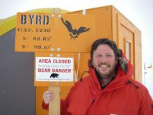
In early December 2009, after aircraft preparations were completed, the team traveled to Byrd Camp, a remote camp on the West Antarctic Ice Sheet, to conduct the aerial surveys. Each day (when weather permitted), the team took off, flew over area glaciers, and came back to camp. When they arrived back at camp, the team downloaded and processed the data that was collected by the instruments.
Although many of the areas that were surveyed were previously largely undiscovered, the survey work included flights over Thwaites Glacier (75.5°S 106.75°W). Part of the West Antarctic Ice Sheet, the Thwaites Glacier is one of the largest and most rapidly thinning glaciers in Antarctica.
At the core of CReSIS's work, the data collected during this project was integrated with other research efforts and data to create a 3-D visualization of the ice sheet to model and assess the potential impacts of ice sheets to future sea level rise.

