 Today we flew to the Penny Ice Cap on Baffin Island, Canada.
Did I mention we flew to Canada today? ‘C’mon, it’s Canada. We zip in, we pick ‘em up, we zip right out again. We’re not going to Moscow. It’s Canada. It’s like going to Wisconsin.’ If you are a fan of the movie Stripes then you’re laughing along with me.
 Willy was up early and eager to fly to Canada.
Turns out there is an interesting ‘little’ ice cap or small ice sheet over in Canada, just across the Davis Strait from Kangerlussuaq, called the Penny Ice Cap. The Penny Ice Cap is located on Baffin Island and is 6,000 square km or 2,300 square miles in area. It is up to 6,500 feet high and is part of the vast ice sheet left over from the last ice age. Scientists are interested in smaller ice caps versus large ice sheets as the rates of change could be different. Operation IceBridge will gather the data to help answer that figure those things out.
 Up on the Penny Ice Cap. Credit James Yungel, OIB.
I also had a chance to talk with Michael Studinger, who is a world renowned glaciologist, geophysicist, and expert on polar ice. He taught me a few things about glaciers and ice sheets and how they flow. And you should use the word ‘flow’, because ice, under tremendous pressure from the weight of lots of ice above, is not like the ice in your freezer. Under pressure, the ice becomes fluid. It flows. Glaciologists describe use pancake batter or play-dough as analogies.
 Ice under pressure flows like pancake batter.
Ice in Greenland can be broken down into two basic categories: the ice sheet and outlet glaciers. Greenland is interesting because the vast interior is a massive ice sheet left over from the last ice age. And the ice sheet in the interior flows out, is pushed out, through hundreds and hundreds of outlet glaciers. Operation IceBridge primarily targets glaciers with a width of 2,000 meters or more. There are 200 such glaciers in Greenland.
Michael explained the transition between ice sheet and outlet glacier is an interesting one because the velocity profile changes. It’s like this:
I asked about sub-glacial lakes – I had read about the large ones in Antarctica that scientists had drilled into. Michael said there were none in Greenland. He went on to explain why.
The mass of the ice sheet, it’s up to 2 miles thick in places, has depressed the earth’s surface below the ice. Most of the interior of Greenland is below sea level, as much as a thousand feet below sea level. It’s like a big bowl. You would think that geo-warming from underneath or surface melt-water that makes it down to the bottom of the glacier through moulins would form a big lake, but it doesn’t.
The reason is that … get ready for this … water below the Greenland ice sheet flows uphill! What? Yep, and it doesn’t violate any laws of physics either. Take a look at this simplified animation:
We talk about fields all the time in physics: gravitational, electric, and magnetic fields. For example, when you drop a rock, the rock ‘naturally’ moves to a lower gravitational potential in the gravitational field. Well, there’s also a hydrological field for water. The rule isn’t that water flows downhill; that’s not always true. The rule is that water ‘naturally’ flows to a lower hydrological potential. Water can flow uphill if it’s moving to a lower hydrological potential. Neat, huh?
Here are some pictures and, oh yes, another movie of today’s beautiful scenery.
 Elevation vesus longitude across the Penny Ice Cap.
 IceBridge flys crossing patterns over the Penny Ice Cap to generate images like this from the ATM data.
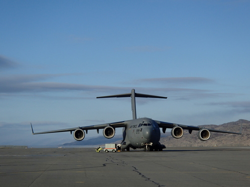
 It's not every morning you walk by a C-17 Globemaster on your way to work.
 The west coast of Greenalnd.
 The infinite varieties of sea ice.
 It looked like Yosemite Valley except burried in snow and ice.
 Baffin Island, Canada.
 Beautiful glacial valley on Baffin Island, Canada.
 One of the outlet glaciers of the Penny Ice Cap.
 The beautiful scenery of Baffin Island.
