No Flying Today
Sometimes the weather simply will not cooperate. You'd think that with most of an island the size of Greenland at our disposal that we would be able to find a route somewhere that could avoid any potential bad weather. And usually that is the case, but not today.
As I mentioned yesterday, everyone must proceed with the idea that there will be a science mission until we are specifically told otherwise. In today's case we got notice around 7 am, after all of the scientists had made it aboard. The reason for this late notice is simple: Our last weather briefing is at 6:30 am on the day of a given flight. If the conditions at that time look poor then the flight will be cancelled. Such was the case today.
So what does one do with a day off? People immediately filled the laundry facilities here at KISS with endless loads of dirty clothes. We also caught up on emails, or as one member of the team put it, "Endlessly deleting emails from the inbox." After lunch a few us hatched other plans.
Built in 2000 at the behest of Volkswagen, a 30 km dirt road extends east of town to the Russell Glacier and the edge of the ice cap. Evidently VW hired a car testing company to build the road first TO the ice cap before extending it for an addition 150 km ONTO the ice cap. This allowed them to test their cars in cold weather and low friction conditions over extended distances. This type of testing ceased in 2006 (presumably when they came to their senses) and the road has been turned over to the local town and tour companies. And they seem to hold an monopoly on the glacier access since you must unlock at gate to gain entry to the final few kilometers. (The ice cap portion of the road does not exist as melting and glacial dynamics quickly removed any evidence.)
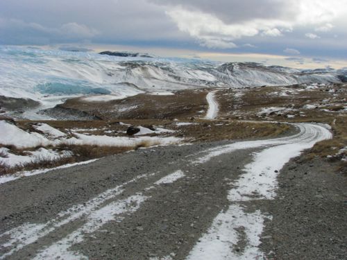 When I took this photo I was mentally cuing up David Byrne's song, "The Road to Nowhere."
For an Alaskan, driving to a glacier isn't that new. Exit, Worthington, Mendenhall, and Matanuska glaciers are all accessible by road and a short walk. The difference here is that this glacier is immense in size, and knowing that the ice extends for several hundreds of kilometers into the distance adds to its grandeur. The idea of driving up to the edge of one of the world's largest ice caps is really pretty cool. And having seen it from the air multiple times now I have a true sense of its overall magnitude - simply awesome. (We actually fly over this part of the ice cap on most days as part of our departure routine.)
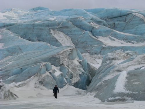 The slot canyon behind my colleague was beautiful if a bit scary to enter. The ice was very slick and the snow underfoot often gave way dropping you down a bit before it held. It gave the impression of a crevasse underfoot though there was none.
Walking around the toe of the glacier we encountered very unusual shapes that demonstrate the plasticity of ice. Just as a glacier can flow like a stream in slow motion, so too can ice contort under pressure.
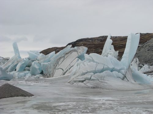 What do you believe caused this kind of ice eruption? Even as we walked around on the edge of the glacier we would hear the ice crack and groan and feel it shudder from time to time. Geology in action!
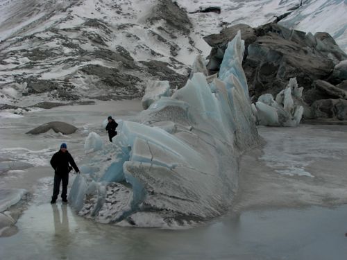 Here are some people in the photo for perspective.
Question of the day (not really a question today): Explain how you think the glacier created the formations shown in the pictures above. Does the evidence suggest the glacier is retreating, surging forward, or is it indeterminate? I shall not reveal the answer but since one of my colleagues on the trip had visited the glacier two years back he was able to describe to me how it looked then. Putting together the before and after picture I think I know how this occurred.
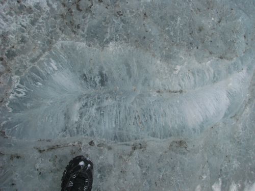 That's my foot shoved into the photo for some perspective. What might have caused this to form in the glacier ice? I have no idea...
Dusty and Flames joined us on the trip as well:
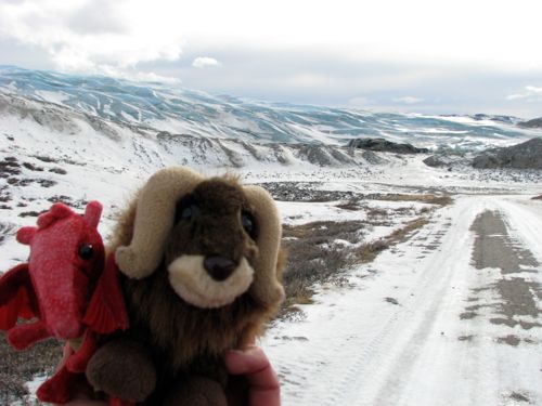 Dusty and Flames made it out to the ice cap with us today.
The drive to the glacier itself had a few surprises. First of all, just as we left the edge of town a sign provided us the ultimate in understatement: "Not a through road." We had a good chuckle at that. One would presume a road heading toward the second largest mass of ice in the world would not go through.
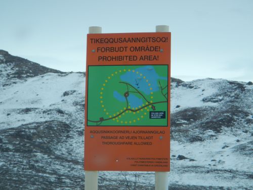 Tactful: the sign doesn't tell WHY you should stay on the road in this section, just that you should. The reason - unexploded ordnance.
A few minutes beyond town we came upon this sign asking us to stay on the road for the next several hundred meters. The reason: unexploded ordnance litter the ground on all sides of the road. One wonders if the road builders hired by VW new this at the time.
We also encountered what must be the world's most decrepit golf course. And once again, coming from Alaska - home of several gravel soccer fields - I've seen some some pretty sorry excuses for a golf course. The "course" is laid out over the floodplain of a river draining the ice cap. As such it floods every summer during the peak of the glacial melt - probably their token water hazard. This time of year the snow and ice are still frozen but the wind has driven glacial silt into half-meter tall hummocks that dot the course. The hole flags - which are the real thing - appear to have been stuck in the ground at random locations, suggesting that maybe they actually mark the location of unexploded ordnance. The "clubhouse" is a weather beaten double-wide trailer. Players are expected to take their grass with them: little swatches of astroturf from which you play your ball each shot.
Since the Master's golf tournament is currently underway it would great if CBS could, somewhere in their coverage, interject a short vignette on the difficult course here in Kangerlussuaq, Greenland. The world's best wouldn't stand a chance. Plus, their caddies might need to use a minesweeper.
 This looks like an album cover, doesn't it? Behind us is the wreckage from some kind of plane. We know nothing about it: when, who, what kind of plane, or the circumstances behind the accident. The wreckage suggests an unsurvivable accident, however.

Comments