Southern Tip
It snowed about 2 inches last night and was cloudy this morning, but the flight crew deemed the weather good enough for flying today. But as I would learn, the small amount of snow would slow us down tremendously.
As usual I arrived on board by 7:30 am, an hour earlier than we typically leave. So we had the usual one hour of down time where I moved in to my seat, hooked up my computer, schmoozed with the scientists, etc. Around 8:30 we started taxiing and I readied for takeoff. But we had simply taxied over to the de-icing facility and turned off the engines. The anti-ice crew spent about 20 minutes de-icing the plane with their pink, frothy solution.
 Getting the de-icing treatment.
The engines fired up once more and we began taxiing again only to end up right back where we had started! The engines spun to a stop yet again. This time we had to go out and carefully wipe the de-icing solution from all of the optical glass for our instruments - particularly the four cameras and the two lasers.
 Wiping off the de-icing fluid from the glass camera and laser ports. Most planes can skip this step.
I guess you could say that we had to wipe off "de ice."
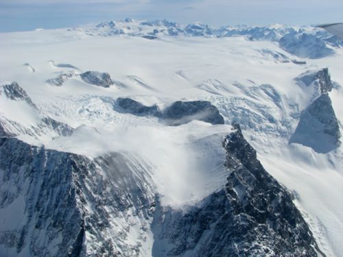
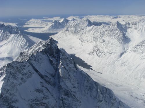
Our flight took us across southern Greenland to some spectacular coastline notable for the rugged peaks and frequent turbulence.
 The peaks of southern Greenland are quite sharp - this suggests that they were never under any ice at any time, otherwise they would be more rounded.
 I like this view of the edge of the ice cap. You can literally see how it "falls" into glaciers that roll down the valleys into the fjords.
 The mountains and fjords of southern Greenland.
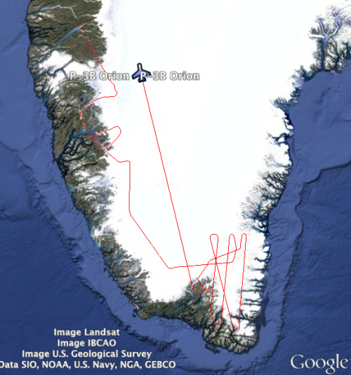
 You can see where we went today in this screen capture from a Google Earth overlay of our flight tracker.
On the whole our flight was relatively smooth but we hit one huge bump that dropped the plane notably and then brought it right back up. Instruments recorded -0.5 g acceleration on the way down and +2.0 g on the way back up. (Physics students: How much would you feel like you weigh under 2.0 g's of acceleration?) One sleeping scientist I witnessed went fully airborne during this event, as there are no seat belts for those napping on the engine covers. Most gear had already been secured but water bottles, laptops, and a few other items went all over the place.
As I understand it, all aircraft keep careful track of how many g's of turbulence they encounter. This data helps determine the maintenance schedule for certain parts like wing struts and engine mounts. More frequent, high-g bounces mean a shorter maintenance interval. Physics in action - pretty cool!
We've been having trouble with our video links lately but I'll try to insert a few than I have been saving. Hopefully they'll work!
First, here's a short clip of one of the Airborne Topographic Mapping (ATM) lasers firing on the tarmac. The wavelength is 532 nm so it appears green to our eye. A mirror rotates beneath the laser at about 20 Hz. Individual laser pulses (each lasting 5 ns) are shot at a rate of 3000 Hz. So if you divide the frequency of laser pulses by the mirror rotation rate you get the number of laser pulses per rotation = 150. And each laser pulse contains 200 micro Joules of energy.
http://youtu.be/g9Ieg4B16QE
AP Physics problem: Given 5 ns laser pulse, 532 nm wavelength, and 200 micro Joules of energy in the pulse - how many photons are in each pulse?
Physics I problem: If the laser is on for 5 ns at a time, 3000 times per second, for what fraction of second is the laser actually on?
Final question: How can the human eye actually see this (as you will in the video) if the laser is hardly on?
This final video comes from NASA's webpage. The data from the OIB radar that penetrates the ice all the way to the bedrock was instrumental in the recent discovery of the under-ice canyon in Greenland. (The NASA data wasn't the only data used to generate this model but it was a significant contribution.)
 Dusty and Flames take a nap with Eric, the DMS operator.
 A C-130 (front) and a C-17 cargo plane arrived in Kanger today. They both came from the US with equipment and personnel to support the Summit Station research facility on top of the ice sheet. The C-130 is equipped with skis and so will be the one actually taking people and gear up, landing on the ice runway at about 3300 meters in elevation.

Comments