The Expedition
The research team has arrived in Hobart, Tasmania! Over the next couple days, we’ll be boarding the ship and departing for the Antarctic expedition. Although not an official “Closer Look” topic, I figure I should go into a little more detail about the research we’ll be doing on the cruise. Today also presents the perfect opportunity for this, as the science team met up at the Institute for Marine and Antarctic Studies in Hobart, Tasmania to layout the research plans to all involved.
 The scientists, researchers and team members met up at IMAS to go over details of the expedition. Can you see our ship in the background? We board soon!
Here’s what we’ll be studying over the next two months.
Ice Stream Dynamics
The description of the expedition says “Antarctic Ice Stream Dynamics.” But what are Ice Stream Dynamics? And what do they have to do with the melting East Antarctic Ice Sheet (EAIS)? Let’s get a little background information first.
Ice sheets are huge areas of land ice that cover large parts of continents—like the Greenland Ice Sheet or the East Antarctic Ice sheet. Ice streams are big areas of ice sheets that move quickly compared to other ice, flowing toward the ocean. Dynamics, are how these ice streams flow and move.
 Left: Ice sheets in Antarctica, photo by USGS; Right: False color image showing how ice streams flow (darker color shows faster movement) photo by USGS.
As ice sheets flow they can move large amounts of sediments and create huge trenches in the land beneath them—like glacial valleys. Ice stream dynamics are important for us to understand because, as ice sheets melt, flowing into the ocean, they have can a direct impact sea level rise and coastal cities.
Recent studies show the ice sheet in East Antarctica is melting faster than previously thought, losing about 57 billion tonnes of ice per year. However, the majority of this ice loss is not at the surface in East Antarctica. Other studies suggest that the ice sheet may be melting from below, possibly due to warmer ocean water brought in through the underwater ridges created by ice streams.
On this expedition, the research team will be testing this hypothesis by mapping the topography of the land under the sea ice near multiple ice streams along the East Antarctic coast—looking for the possible ice stream ridges; collecting water temperature data around the ice streams to see if warmer water is present; and collecting mud core samples to determine the path of past ice streams. This will help us determine how ice stream dynamics are contributing to ice sheet loss and help scientists in future climate change predictions.
 The proposed track the ship will take over the course of the research expedition. The track is tentative and subject to change as the sea ice changes (which it already has!). Map by Dr. Frank Nitsche.
Check out another recent study that did something similar to what we’re doing here.
Mapping
The research team will also be mapping some previously unmapped areas of the East Antarctic continental shelf. Although explored, the East Antarctica coastline has been not very thoroughly mapped using multibeam bathymetry before, as some areas aren’t always accessible due to ice cover. In addition to helping us better understand the impacts of climate change and predict future sea level rise, we’ll also be contributing a wealth of data to the mapping of the Antarctic continental shelf.
Sea Ice Studies
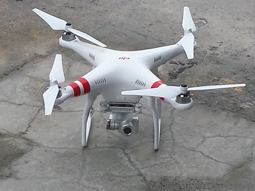
Joining us on the research vessel is a team of scientists from the University of Tasmania that will be studying the impacts of increased melt water on sea ice formation with unmanned aerial vehicles (aka drones) and underwater vehicles (ROVs!).
 An unmanned aerial vehicle, or drone, to be used on the expedition to study sea ice formation.

Comments