Going North
So, you may ask, what is the Arctic, where is the Arctic Circle, and how is it different from home?
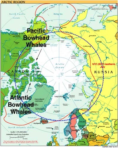
Just as the equator is an imaginary line, so is the Arctic Circle an imaginary line. It circles the Earth at about 66 degrees north latitude. It encircles an area where the sun shines for the entire 24-hour day on the summer solstice (about June 21) and not at all on the winter solstice (about December 21). Inside the circle, one can find the Arctic Ocean (much of which is frozen), a great many islands, including Greenland, as well as the northern parts of Canada, Alaska (USA), Russia, and the Scandinavian Peninsula (including parts of Norway, Sweden, and Finland). Greenland is, in fact, the world's largest island, and almost all of it is inside the Arctic Circle. It is a territory of Denmark, and 80% of it is covered by glaciers, that is, rivers of extremely slow-moving ice.
 The Arctic Circle is shown in blue. It includes parts of Canada, USA, Russia, Finland, Sweden, Norway, and Greenland (climatekids.nasa.gov).
I will be going to Kangerlussuaq which is on the southwestern side of the country just north of the Arctic Circle. We will camp on the tundra there, not on a glacier. Camping on a glacier would be really cold and uncomfortable! The tundra is a biome; biomes are regions of the world with similar climate, plants, and animals. Because tundra regions are very cold for much of the year, they have small plants and no trees. In arctic regions, the soil below a certain level is frozen all of the time, so it is called permafrost. This means that all active plant life -- stems, leaves, and especially roots -- uses just the top layer of soil that may be as thin as less than a meter (about a yard) up to four meters (similar to four yards). So when we study plants, we will be learning about a very different kind of ecosystem than the ones most of us are familiar with!
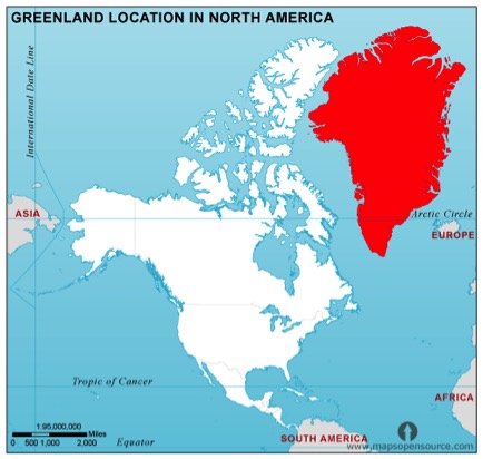
 This map shows Greenland (in red) relative to North America (white) (http://www.mapsopensource.com/greenland).

Comments