Resource Management in Alaska
Alaska is unique! Because it so much farther north than the Lower 48 states, it has different biomes and different resources. We PolarTREC teachers were lucky enough to visit the Permafrost Tunnel, and we also took a side trip to see the Trans Alaska oil pipeline.
Permafrost Tunnel
 Here I am entering the Permafrost Tunnel north of Fairbanks.
This dead-end tunnel was dug (using drills not shovels!) into a hillside in the 1960s by the U.S. Army Corps of Engineers. The main tunnel is 110m (about 360 feet) long. Today it is still a research site where scientists can study Alaska's frozen underground. Since summers are short and winters are long in the Arctic, most of the underground stays permanently frozen, and this is called permafrost. When you are in the permafrost tunnel, you are looking up and all around at the frozen underground, and you are walking through an environment that is more than 40,000 years old! Hanging above your head, you can see the roots of plants that died before the Ice Age. Sticking out of the walls you can see the bones of extinct animals like mammoths and steppe bison. The paleontologist who led our tour, Dr. Patrick Druckenmiller, knew every single one!
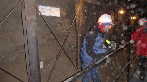 Dr. Druckenmiller showing PolarTREC teachers a mammoth bone stuck in the tunnel wall.
The dust you see in the picture is silt; it's not snow! Before this landscape was frozen, tens of thousands of years ago, it was a grassland where the mammoths and bison and other animals roamed. Fine soil (called silt) blew across the land and settled down in some areas, burying the plants and animals that died there, so that we could find them all these many years later. We kicked the silt up with our feet inside the tunnel.
 This is the ceiling of the Permafrost Tunnel; you can see ancient roots hanging down.
The Permafrost Tunnel is part of the Army's Cold Regions Research and Engineering Laboratory, so paleontologists aren't the only ones who study there. Geologists who study the Earth use it for understanding how the ground freezes and how it is thawing now that the world is getting warmer. When summer rains seep (percolate) into the ground, the water finds its way into any soft spots and freezes there. No one can see this happening above ground, but underground we can see what that looks like. Scientists have even found living bacteria frozen into these ice wedges, and the bacteria are 25,000 years old, so we know for sure that this ice has not thawed in that long! We can use what we learn to make models about how the permafrost will change in the coming years.
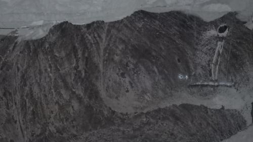 This is an ice wedge in the Permafrost Tunnel.
You can learn more about the Permafrost Tunnel and even take a virtual tour at http://permafrosttunnel.crrel.usace.army.mil/
Trans Alaska Pipeline System
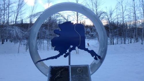 Here is a representation of the state of Alaska encircled by a section of the Alaska Pipeline.
The Trans Alaska Pipeline is a system that transfers petroleum from Alaska's North Slope all the way down to the port near Anchorage where it can be shipped further south for refining. The engineers that designed it had to remember a lot of different things when designing it. For example:
* It had to go up over mountains
* It had to go over permafrost soil where they couldn't dig a pathway
* It had to allow caribou and other animals to roam
* It had to have some space for thermal expansion and contraction (letting it expand and shrink a little as the temperature changes at different times of year)
* It had to be placed where it would not be damaged by avalanches
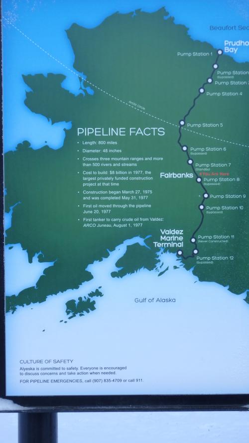 The pipeline traverses the state of Alaska from the North Slope south to Anchorage.
It covers 800 miles; 420 miles is above ground, and 380 miles is buried. It took two years to build from 1975-1977. It crosses three mountain ranges and crosses 500 rivers and streams, and it cost $8 billion in 1977. It currently takes more than two weeks for the oil to travel its entire length. You can tell from the picture that it is really big; it is four feet in diameter, and we could all stand under it.
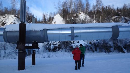 The pipeline carries thousands of gallons of oil across Alaska every day.

Comments