Scientists at KISS
Traversing the Ice Sheet
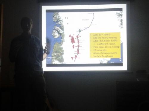
Such interesting people we have met! Dr. Erich Osterberg of Dartmouth College gave a talk on his recently concluded traverse across the ice sheet. He and his team of five traveled from Camp Raven to Summit, the highest point on the ice sheet, a distance of 800km (480 miles); this took them from southern to northern Greenland. The trip took them over a month (April 30-June 5), and they traveled using snow mobiles, dragging lots and lots of scientific equipment. Typically the temperature was -25 Celsius with winds of about 40 miles per hour (with a max of 62 in a snowstorm). They camped in tents each night with also a kitchen tent (where they used a propane stove to cook) and a science tent. They developed and tested ice-penetrating radar that they used to survey the entire traverse as well as seven east-west testing regions. They drilled seven ice cores (30m deep), dug 22 snow pits, made precise GPS measurements, and measured surface roughness and albedo.
Questions Students of mine: 1) Do you remember what albedo means? 2) Do you remember what material has high albedo?
The expedition itself amazes me. The hardship, the cold, the storms, the hard work: Wow! On top of that, however, is how cool the science is! We know for example that the Greenland ice sheet is losing 60 billion tons of water per year, even though snowfall has increased. The data they collected can be used to figure out what the ice layers look like inside (that's what the cores and pits are for), so they can identify layers of fresh snow, old snow, and ice. More about that below. They can also tell if the ice has a lower elevation (something that can be measured from a plane (like NASA's Operation IceBridge that PolarTREC teachers Kelly McCarthy and Maggie Kane are flying with) because there is less fresh snow, or it is more compact, or it is melting more than in the past (something cannot be determined from a plane). Also, we know that the ice is less reflective than it used to be, so chemical sampling should be able to show whether that is because there is more pollution in the new snow, whether it is rougher, or whether there is something else going on. The reason the research is so necessary is because climate models vary in the extremity of their predictions. For example, we know the ice is melting, but we don't know how fast it will melt in the future; therefore, we don't know how much more water will enter the ocean and raise sea level. Interestingly, a lot of the team's data support current models up to the present which show us that the baseline work seems to be very good. More data can help us fine-tune the models and make accurate predictions for the future. According to expedition member, Gabe Lewis, "Climate science with friends is really fun!" He recommends you look up their GreenTrACS blog.
 Osterberg's team's expedition
Freeze-Thaw Cycle
Dr. Mike McFerrin of the University of Colorado spoke about his ice sheet research as well. He studies how tightly the new snow in glaciers becomes compacted over time; remember that this is something that has to be studied on the ground not from the air. He was camped east of Kanger in 2012, the warmest year in Greenland to date (although 2016 may surpass it). While there, he observed vastly increased run-off, so much that the river into the fjord was increased to a raging torrent that carried away a truck. Question 3) Do you remember what run-off is, students? He has, therefore, begun to investigate what is happening in the top layers of the glacier. When new snow on the surface melts, much of it permeates deep into the glacier where it re-freezes. This means that there are layers of solid ice that form under the snow layers; these are called ice lenses. It seems that what is happening is that as the climate warms, melt water is sinking into the glaciers and creating ice lenses that extend over large areas. With impermeable ice inside, new melt water cannot permeate downwards but must run off onto the tundra. The flooding that occurred in 2012 will probably be repeated in subsequent years. So while the glaciers in Greenland are not receding, they are thinning and directing more of their snowmelt towards the ocean. Answer 1) Albedo is reflection of sunlight off of an Earth surface. 2) Ice and clouds have high albedo; this means they reflect a lot of sunlight. 3) Run-off is water that trickles (or pours in this case) over the ground and into water bodies.
Flag of the Day
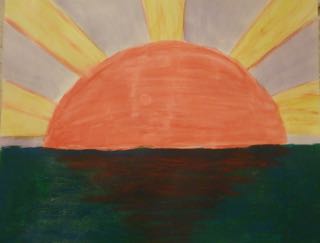
 Malaya's sunrise flag.

Comments