After spending quite a bit of time in the center of the Greenland ice sheet, I got the opportunity to go to the edge of it today. There were a few people from here at the science support building driving out there today and I was able to go with them. This was one of the local trips that I was hoping to find a way to do, so I was very excited and grateful when I was asked to go.
The road out to the ice sheet was a very rough 30 kilometer (about 20 mile) long dirt road. This road was completed in 2001 for a now defunct company called Nausta. Their intention was to create a car testing facility on and near the ice sheet where cars could be tested in freezing conditions. Kangerlussuaq was chosen for this project because it had a long runway (allowing planes carrying cars to fly in) and the ice was firm enough to drive on. After the road was completed, the project fell apart and they never actually tested cars there. But, the road offers access to the ice sheet. Another interesting fact is that this road is the longest road in all of Greenland. There are less than 200 kilometers (about 125 miles) of roads in all of Greenland.
The drive out to the edge of the ice sheet was beautiful. All along the route were ponds/lakes and the hills that make up the landscape in this part of Greenland. As we got further down the road, we could start to see the ice sheet in the distance. This was especially neat today as it was nearly 70 degrees Fahrenheit in Kangerlussuaq. As we drove down the road, the wind coming off the ice made it colder and colder.
 PolarTREC teacher Steve Kirsche with the Greenlandic landscape, including the edge of the ice sheet, in the background.
The first ice we got to was Russell Glacier. Here we saw the edge of the glacier and the meltwater that was running off it. We even saw a small portion of the glacier calve off while we were there. Sadly, I wasn't able to catch that with my camera because it happened so quickly.
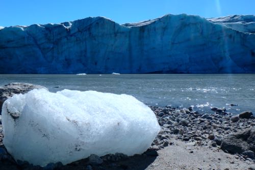 The edge of the Russell Glacier is where a great deal of melting is occurring this time of the year.
After that, we reached the end of the road where the edge of the ice sheet was located. The first thing that you notice here are that there are huge piles of sediment composed of dirt and small rocks. As the ice flows from the middle of the ice sheet to the edge, the bottom of the ice rubs against the bedrock underneath. The friction causes the bedrock to be slowly "scraped" away and pushed with the ice. When it reaches the edge, it is pushed into piles.
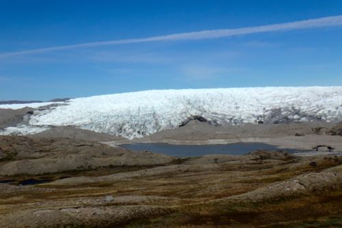 There are many piles of sediment at the edge of the ice sheet that have been pushed there by the ice.
Once we walked across the sediment piles, we got out on the ice itself. It was actually quite chilly there due to the wind created by the cold of the ice interacting with the warmth of the air. On the ice itself, there was an interesting phenomenon. Spots where dust was on the ice were darker than the surrounding ice. These areas absorb heat from the Sun whereas white ice reflects much of the Sun's energy. This leads to holes forming where the dust is. Over time, these can collect more dust and get deeper and deeper.
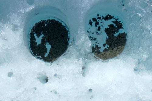 The albedo, or how well it reflects sunlight, of the ice is reduced by the dust. This causes it to absorb energy from the sun and causes these holes.
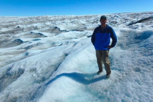 PolarTREC teacher Steve Kirsche stands on the edge of the Greenland ice sheet.
One last thing we saw near the side of the road was an old plane crash. Apparently, about 50 years ago, a group of planes were flying in Kangerlussuaq. When they arrived, the weather was so bad that they couldn't land. So, the pilots ejected and were rescued. But, their planes crashed. The wreckage we saw was one of these planes. The conditions here have helped maintain what is left of the plane over all of these years.
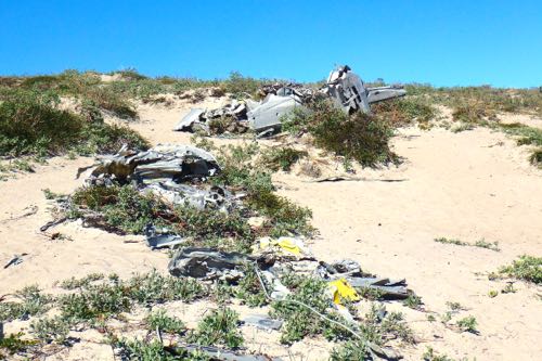 The remains of a plane crash can be found by the road to the ice sheet near Kangerlussuaq, Greenland.
Videos from Summit Station
Today's video from Summit Station is a walking tour of our drilling site. It shows you around the spot where we set up our camp for collecting the ice cores.


Comments
Add new comment