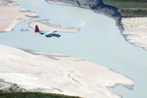
 Looking down from a nearby mountain, an LC-130 airplane can be seen coming in for a landing.
Sodrestrom Research Facility
Located on a hillside about 8 miles down the fjord is the Sodrestrom Research Facility. Here they have a number of instruments for studying the ionosphere and upper atmosphere. The name is left over from when Kangerlussuaq was the home of Sodrestrom Air Base which housed long range bombers during the cold war.
When we arrived at the facility, we were met by Eggert Gudmundsson, the site supervisor. He explained what the facility does and how it operates.
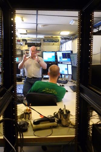 Eggert Gudmundsson explains what Sodrestrom Research Facility does.
The main instrument at the facility is an L-band radar that was moved here from Alaska. This radar is designed to study the ionosphere, the portion of Earth's atmosphere from about 60-600 kilometers high. This portion of the atmosphere is continually bombarded by electromagnetic (EM) radiation from the sun, causing the particles there to become charged. Due to the Earth's magnetic field, most harmful radiation from the sun is deflected away from the planet, helping protect human beings.
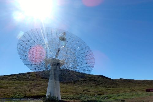 Located near Kangerlussuaq, Greenland, Sodrestrom Research Facility has an array of equipment for studying the upper atmosphere.
The facility uses the large dish antenna to send an EM wave up into the atmosphere. It then collects the signal that bounces back. The returned signal is changed based upon what particles the outgoing beam has hit. The computer attached to the antenna can then analyze the signal to determine what is happening up in the ionosphere.
Scientists from around the world use the data that is collected by the Sodrestrom Research Facility for their own experiments. It is very important that we understand the radiation sent from the Sun to protect astronauts in space, satellites, and even large Earth borne systems such as power grids. These can all be harmed by the sun's energy.
Kellyville
The area of Kangerlussuaq where the research facility is located is called Kellyville. There are a few homes and cottages here, but it primarily houses the research facility and a small port for boats. Occasionally, ships will anchor out and take small boats into Kellyville for further transport in Kangerlussuaq. Today, there was a group of Australian tourists who were being dropped off a ways away to hike back to Kangerlussuaq.
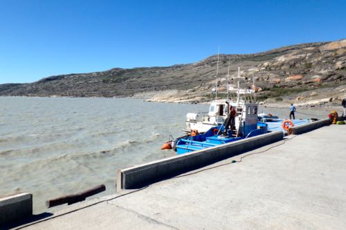 The pier at Kellyville provides access to to Kangerlussuaq for boat traffic.
Sand Everywhere!
An interesting part of Kangerlussuaq is the fact that there is very fine sand everywhere! The climate here is incredibly dry and the dust from the ice gets washed away from the glacier melt and blown by the wind. If you look in the picture of Kellyville above, you will notice that the water is quite brown as a result of the sand. On windy days like today, it can also look like there is a sandstorm.
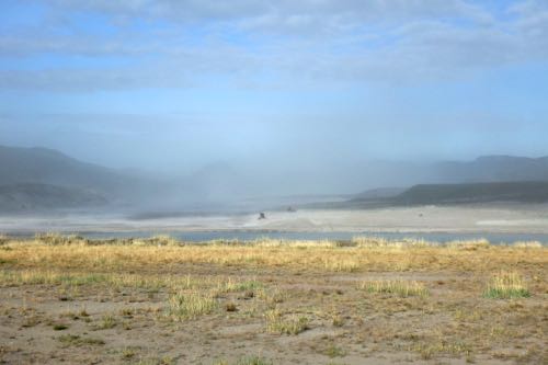 On windy days, the fine sand from the ice sheet gets blown around making it seem hazy.
Videos from Summit Station
Today I have two videos from Summit Station to share. These are the last two from Summit although I have another video from more of my expedition to share tomorrow.
The first video discusses the solstice and explains what a solstice is. It also explains the midnight Sun and shows a time-lapse of the sun's movement overnight:
The second video for today is a tour of Summit Station. It takes you around and explains a little bit about many of the buildings/places that can be found there:


Add new comment