"Archaeology is like a box of chocolates", according to BLM archaeologist Bill Hedman. Today we went out sampling that box to see just what kinds of chocolates we had in our big backyard. Helicopter pilot Stan Hermens provided the transport for an excellent day of archaeological exploration. We flew north and west along the Kukpuk River and some of its tributaries, then to the coast and the Chukchi Sea between Cape Thompson and Cape Hope. From there, we headed south following the coast towards Kivalina and then back east towards camp. By the end of the day we had investigated 4 sites and seen more wildlife than I have seen during my whole time in Alaska. Not only that, I didn't even have to put on my raingear!!
We were suited up and out of camp a little after 9AM. The BLM has some strict requirements for flying in helicopters. All BLM personnel (and volunteers--that's me) must wear flight suits or clothing made of Nomex, a fire-resistant fabric, as well as Nomex gloves. In addition you wear a helmet and don a snappy orange survival vest over your flight suit. The survival vest has all sorts of goodies in its multitudinous pockets; a small first aid kit, mosquito head net, mylar 'space' blanket, a couple of power bars for emergency food, a knife and fire starter, as well as other miscellaneous bits and bobs that would help you survive if you had to. The helicopter also carries survival equipment. To add to the aura of safety, the BLM requires AFF--automatic flight following. They are actually tracking the flight and are in satellite phone communication with us every half hour when we are in the air. Good safety practices in such remote country.
At each of the sites we visited, we would wander around a bit looking for chert flakes or any other sorts of artifacts. We would also dig a few test holes to see what the soil was like and what might lie under the surface. Some of the sites had quite a few large flakes lying on the ground, while others were much more sparse. The sites were chosen based on location; did they have a good view of the surrounding country or were they in an area was on major caribou paths. When we found artifacts (large flakes of chert), Bill used a GPS to mark the location. He also took a picture of each site from the ground, as well as an overhead shot from the helicopter.
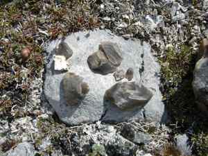
 These are some of the chert flakes that we found at one of the sites. The chert was almost transluscent.
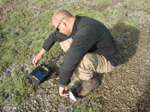
 Bill Hedman marks the site on a GPS mapping unit.
One of the sites we found consisted of a number of old tent rings--rings of rocks that had been used to weight down the walls of tents. The site was located at the apex of 3 valleys that were full of well-worn caribou paths. We identified 14 rings, as well as a number of holes that appeared to have been caches for food. We found a few flakes of chert, as well, but no points or other artifacts. To actually date these sites would require finding either stone tools with an identifiable style or bones and charcoal that could be dated using radiocarbon dating techniques. Bill felt that the site was at least a few hundred years old, if not older.
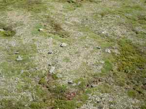
 If you look carefully you can see the circle of stones in this picture. This is the remains of a tent ring--stones that were used to weight down the edges of tent made of hides.
Best of all, was the wildlife viewing from up above. We saw numerous herds of caribou, with anywhere from 2 (is that a herd?) to 100 caribou in each and some males with enormous antlers. I lost track of the Grizzly Bears after the 8th was sighted. There were large lumps of brown on the tundra that were Musk Oxen. Golden Eagles soared out from their cliffside aeries. Best of all was watching a caribou running and realizing that it wasn't running from the helicopter noise, it was being chased by a wolf while another wolf waited on the hillside.
All in all, it was an amazing day. Apparently our big backyard is like a box of Godiva chocolates--exquisite.
 This is an aerial view of the Kukpuk River. It's a pretty nice backyard!
