Today instead of sampling rocks for dating with cosmogenic isotopes, we ventured to the bottom of the mountain to where the Beardmore Glacier meets the Ross Ice Shelf. Our destination was a small lake that receives water both from melt water from snow/ice fields on Mt. Hope and from the Ross Sea. Two years ago, when John was here last, he noticed that the lake was slightly brackish (salty) tasting and suspected that its volume might be influenced by the Ross Sea.
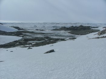 Looking down on the lake at the bottom of Mt. Hope next to the Ross Ice Shelf. We are taking samples from this lake to verify that it is connected to the Ross sea.
Yesterday morning, John took a time-lapse camera down to the edge of the lake and programmed it to take a picture every five minutes. He left the camera overnight to record the level of the water. He was hoping to see tidal influences. If the water level rose or fell dramatically, this would verify that the Ross Sea was moving into and out of the lake. After the camera took photos for 26 hours, we looked at the film (his camera automatically puts the individual images into a movie format). We were very excited to see that his theory was right! Right before our eyes, we watched the water come in, stay for quite a while, and then recede. Not only is the lake influenced by tides in the Ross Sea, but there is only one tide every day!
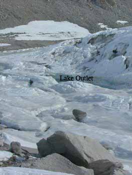 The far end of the lake near the Ross Ice Shelf. The deep cleft in the ice contains water. We suspect it is connect to the Ross Sea.
In addition to the photography, John took water samples from various places. He took one from the small melt water stream running down the hillside into the lake. One cam from near the center of the lake, and the other came from the far end of the lake where it disappears under the ice shelf. Perry also walked out to collect ice samples from the shattered and heaved ice blocks that form the beginning of the Ross Ice Shelf. This ice will be allowed to melt and then will be tested along with the water samples we collected. The samples collected today will be sent back to the University of Washington to be tested for ions which will hopefully confirm what the time-lapse video showed us. Freshwater has relatively few ions such as Ca+2, Na+, K+, Cl-, whereas sea water is very high in these ions. If the Ross Sea is influencing this lake, we should expect the test results to show ion concentrations somewhere in the middle range.
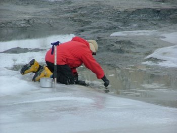 John is collecting samples of living algae using sterile forceps. He'll place these samples in bottles of lake water and send them back to the university for analysis and identification.
John and Perry took some core samples of sediments from the bottom of the lake (the tide was out while we were there, so they could walk towards the center). Once again, if the sea has a large influence on the lake, there should be some stratification (layering) of the sediments that make up the bottom of the lake. To take these cores, they had sections of two inch diameter PVC pipe. They pushed these as far down into the sediment that they could and then drew them back out. Each end of the pipe got a rubber stopper inserted into it which was then reinforced with duct tape. These will be sent back to the university where they will be sawed open and the sediments analyzed.
When people think of Antarctica's landscape, they think of ice and rock - shades of whites, blues, browns, and grays. One doesn't think of plants. However, there are some very determined plants that grow in Antarctica. On the Antarctic Peninsula, there are a variety of mosses that grow. In glacial lakes throughout the continent, there is abundant algae. Brenda Hall searches for remnants of algae that once inhabited ancient glacial lakes. In the lake today, we found algae. John sampled some of this to take back to other scientists in the United States. By knowing the chemistry of the water in which it lives and by identifying the species, some of the current and past history of the glaciation in this part of the Transantarctic Mountains can be determined. John and Perry also found dried algae about 20-30 m above the current surface of the lake. If these samples are identified as marine species (especially those dried samples above the current lake surface), it would indicate isostatic rebound is happening in the vicinity of the Beardmore Glacier. Isostatic rebound is where a continental plate rises after the weight of an overlying object/substance has been removed. Think of floating a block of wood in a tub of water. If you place a small metal object on it, it sits lower in the water. Once you remove the metal object, the piece of wood rises relative to the surface of the water. This is what will happen to the Antarctic continent when glaciers recede and their great weight is removed.
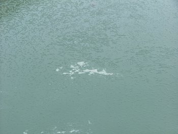 Algae floating in the lake at the bottom of Mt. Hope. It looks like brownish-green, leafy scum.
Scientific research in Antarctica is expensive and difficult. Once scientists get the opportunity to come here, they often collect samples for other researchers. These water and algae samples will be of great interest to Brenda. Since she wasn't able to come to Mount Hope with us, her research will benefit from John's hard work. The scientific community values communication. Without it, new discoveries would be a long time in coming.
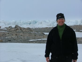 Here I am standing at the bottom of Mt. Hope where the Ross Ice Shelf begins. The huge, jumbled blocks of ice form similarly to the pressure ridges I saw where the sea ice and the Ross Ice Shelf converge by Scott Base.
