The simple matter of learning about the earth’s formation has caused a gargantuan sense of interest in our research group. Our hypothesis consists of a higher concentration down the valley because of the glacial discharge and common human waste. In this study, we predict that the sedimentation of the valley might have bigger grains or rocks and smaller grains as we descend towards the fjord. In this research, we used traditional field methods to collect samples of sediment/soils and rocks. By testing the sediment/soil samples, we find out that there is a higher concentration of the different chemical elements near populated areas. The landscapes around Kangerlussuaq have similar patterns but changes in the bedrock structure. As a group we think that the reason the landscape is consistent is because the glaciers have been the determining factor in the landscape weathering more so than differences in bedrock with climate. It could be interesting to see what could be the source or reason of the higher concentration as a future study.
Research questions
How has the rock changed in the past years?
How has the glacier affected the land and sediments?
Does the permafrost affect the sediments?
Group Members
Ole Olsvig (Greenland)
Hans Christian Sivertsen (Greenland)
Marie Jimenez Cobain (USA)
Tina Pedersen (Greenland)
Sylvia Kielsen (Greenland)
Hypothesis and predictions
We expect to find higher concentrations of chemicals as we increase distance from the glacier because more concentrated.
We expect to find layers in the soil and glacial deposits due to different glacial events and outwash events.
We expect the temperature changes associated with permafrost to change the distribution of soil sediments.
Methodology
Soil Sampling: Collecting hand-size samples from different depths using a hand soil corer.
Layer analysis: Photographing sediment horizon layers and visually designating layers (in conjunction with soil sample composition)
Soil testing: Chemically testing soil samples for pH, nitrates, nitrites, potassium, phosphorous, and carbon dioxide gas (from permafrost found)
Rock sampling: collecting float and erratics in till deposits, breaking fresh samples from bedrock, then identifying minerals and structures present to determine rock name
 Maria, Sylvia, and Tina collect moraine samples. Photo by Laura Lukes (2011)
 Hans Christian and Ole dig soil pits. Photo by Laura Lukes
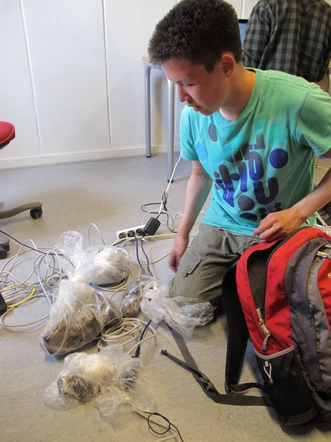
 Ole prepares permafrost samples for analysis. Photo by Laura Lukes (2011)
 Ole examining a rock sample under a microscope to identify minerals. Photo by Laura Lukes, 2011.
Photo and blog links
Hans Christian's awesome photography: http://www.flickr.com/photos/62372668@N05/sets/72157627007523423/

