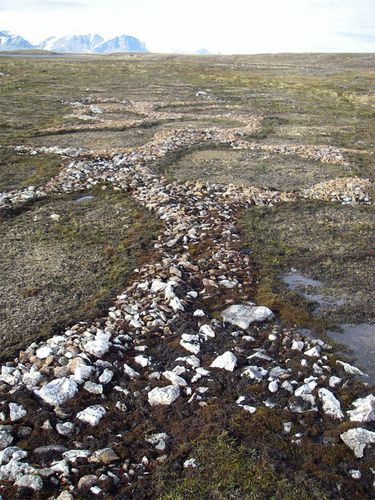
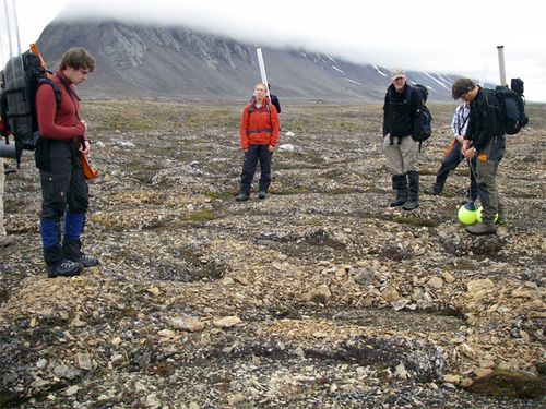
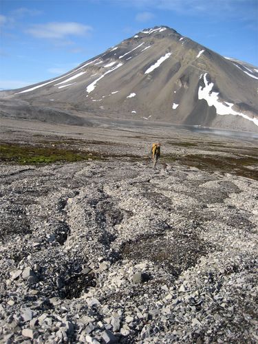
(Ole is Ole Humlum, a scientist from University of Oslo and UNIS who provided us with a lecture on the climate of Svalbard and joined us part of our stay in Kapp Linne while gathering data for a permafrost study.)On our first walk out to the Linne Valley we came across these odd shaped ground moraines and were in awe at the symmetry of their patterns. Being field geologists of course we questioned the origin of these strange phenomena only to left with more questions than answers since the size and shapes of these structures vary quite a bit around the tundra.
 Frost heaving causes these unusual features on the surface
These sorted circles are approximately 2 meters across and are raised anywhere from 10 to 30 centimeters above the ground. The rocks that make up the rings (or other shapes) tend to somewhat uniform in their size and shape. But what is the mechanism that creates these shapes? Two scientists, Mark Kessler and Bradley Werner successfully developed a computer model based on the properties of water, soil, and rocks in the Polar Regions. When water freezes it expands by close to 10%, and when it thaws it contracts again. This continual freezing and thawing is what creates those obnoxious potholes we find in the mid-latitudes, and what brings rock materials up from below the surface in a process known as frost heaving. This still doesn't give us the interesting shapes of the sorted polygons. So let's add another mechanism to the story.
 We hike past these each day, and they are as mystifying as they are beautiful
Freezing soils have the tendency of moving stones around at or near the surface as the soil particles move toward areas of high soil concentration and the stones move toward areas of high stone concentration. Continued frost heaving forces these clusters into the polygons and after a while the stone piles become high enough that they stones spill over the edges of the polygons further smoothing out the shapes. The two scientists ran their model based on this information and by varying the amounts of stones and the amount of freeze -thaw cycles. Their results showed that with hundreds of freeze-thaw cycles and higher quantities of stones in the soil (1,400 stones/sq meter) they produced sorted circles. In regions where there are numerous freeze-thaw cycles per year, the sorted circles are created quite rapidly - possibly just a few years. In places where there are fewer freeze-thaw cycles, the sorted circles take much longer to form. They also showed that sloping ground tends to produce elongated polygons like what we found around Lake Kongress. Knowledge of these sorted polygons has assisted planetary geologists decipher similar patterns found on the surface of Mars.
 When sorted circles are found on sloped ground, they to elongate.
As we make our daily trek across the tundra each day we use these polygons as our stepping stones to keep our feet dry from when walking across the soft marsh-like macadam. Although we are still in awe of these interesting rock formations, at this point we are simply thankful for their existence! Once we return to our homes and share our experiences with others, these sorted circles will again become special, and the sorted circle song will bring a smile to our faces.
Question of the day: At what temperature is water the densest?
Reference: Perkins, S. (2003), "Patterns from Nowhere: Natural forces bring order to untouched ground.” Science News, Vol. 163, No. 20, pg 314-316.

