So, my video of the karst springs did not work but fear not, it will be on soon. Sarah from PolarTREC headquarters was kind enough to remind me on proper protocol, as she's had to once or twice. I attribute the problem to a few minor errors like thinking "I don't need any directions on how to upload a video," it was 10:30 pm or so when I first tried, and an overindulgence in salami products (along with a product Mike refers to whimsically as 'shrimp whizz' that I continue to scarf without the least notion of its origin, flora or fauna).
High winds out of the northeast kept us from continuing our buoy/mooring hunting expeditions so instead we focused our efforts on the local cirques, stream discharge, and downloading data from instrumentation in the valley. White capped waves and being blown sideways are not conducive conditions to finding gear stashed 1.5 meters below an already turbid lake surface.
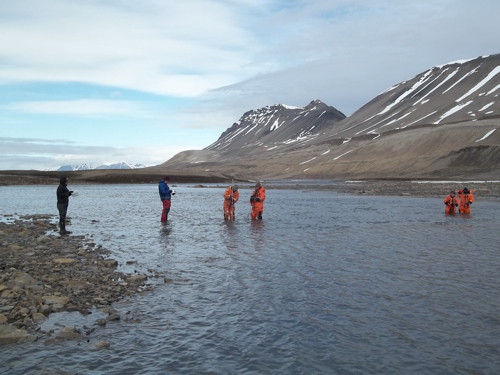 Students measuring the stream discharge along a cross section of the glacial meltwater stream entering Lake Linne.
Undaunted, the REU and AG212 students split into two groups (mixed of course, we are a unified bunch) and one followed Mike in search of quartzite striations/avalanches within a nearby cirque and the other with Steve and I to measure stream discharge on the Linneelva, which drains the glacier Linnebreen.
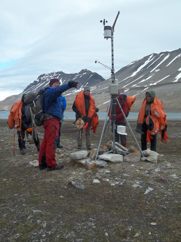 The group pauses along the way to the stream at our 'mothership' weather station.
Along the way to the stream we encountered one of the many instruments in the Linne valley though this one was the 'mothership' of sorts. It was (and still is) a weather station made by Onset Technologies with many different apparatus from their Hobo gear. This is simply a brand name for mobile equipment, not temperature probes that enjoy long train rides, apple pies cooling on window sills, and dream of the big rock candy mountain. This was simply a pit-stop along the way to the river though…
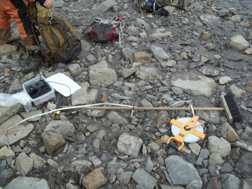 My patented 'broom gauge,' patent pending.
At the river, Steve and I worked through the objective of calculating an accurate stream discharge with the students and before no time they were in survival suits with gauge propellors turning to beat the band. In all reality, most of the students had encountered this exercise before so most of what Steve and I had to do was think up complicated questions, witty retorts, and make sure the gear worked. Along that same vein, I have to admit my short coming in leaving the wooden rod we used for one of the stream flow gauges at the northern boat launch, some distance away. Luckily there was a perfect sized broom at the southern cabin launch we use so I was able to fashion the meter onto it just fine. Plus, I figure its uses just expanded ten fold (and someone sweeping their floor in the near future is going to be extremely confused by the 10 cm increments written in sharpie on the handle of their broom…I only sweep in metric?).
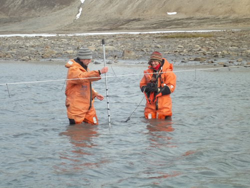 Lukas and Dagmar measuring Q (stream discharge) of the meltwater stream into Linne.
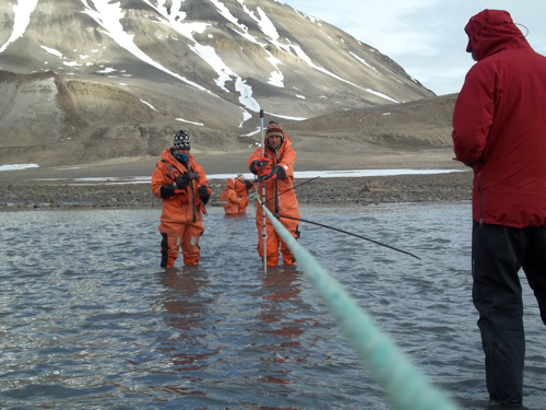 Looking down the tag-line at Hannah and Dion
Stream flow is extremely important to us as it is linked to many different parts of the Lake Linne system. First and foremost it is a major contributor to the sediment record we are looking to use for paleoclimate reconstruction but it also has many more attributes. It is the major drainage for meltwater coming off the glacier and thus tell when the ice is losing mass, a shaper of the proglacial fan that weaves up valley, and yeah we've got temperature probes in it too so we can figure out when to start expecting it to act as a major input to the system. When the temperature probe is flat lining zero celsius or below throughout the winter we know that the stream is locked up and when we see it rise we know things are moving along nicely. Slicker than snot on a banister as we say in Maine.
 Elin (with extremely heavy rock and stream temp. probe) and Mel making their way across the stream.
Throughout the measurements there were periods of down time so I was able to take a quick jaunt upstream and noticed that I hadn't been the only one. Can anyone guess who's paths crossed in the mud about 50 yards above us?
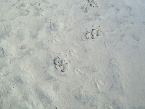 Paths cross in the mud alongside the meltwater stream.
Once groups switched and Dion, Hannah, John, Lauren, Louise, and Kayla finished their discharge calculations we had two more stops to make for the day before hiking to the dinner that we've taken to trying to predict each day (chicken still hasn't happened). First we stopped at the weather station and we had a bit of an issue with the electronics. It seemed that the desiccant used had taken all of the moisture it could so we were staring at dew covered, dead batteries. This stuff happens, especially when you can only access your equipment a few times a year in the most harsh conditions possible. Using a backup 9-volt battery we were able to get the data stored and planned on coming back to do a few repairs and get things running proper in the near future.
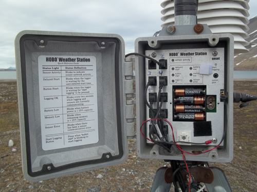 Inside the 'brain' of the weather station.
After that it was up to the time-lapse camera. If I for some reason forget to post pictures from the camera please do bug me as they are incredible (plus I get lonely when the only person emailing me is my mother…great to hear from you though ma!). The time lapse cameras, two actually, are located along a basaltic bedrock ridge on the east side of the Linne valley and each camera takes two pictures each day. One focusses on the southern part of the lake that the stream flows into (the PLUME CAM!) while the other looks down lake toward the outlet (the OTHER CAM!). The cameras have a small solar panel to help keep them going throughout the year…
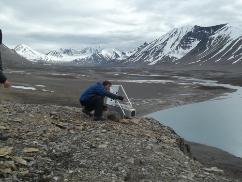 Plume Cam looking up and down valley
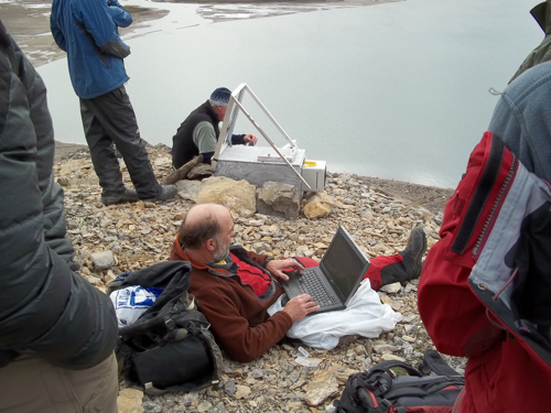 Mike and Steve downloading the time lapse camera above the Linne Valley.
Mike and Steve quickly got to work and after downloading the data, us all trundling some rocks down the cliff, and looking at large scale geomorphic features it was time for our wagons to make like a braided stream and meander back home (they never stop, again my apologies).
Svalbard Daily Tradition: Students continue to try and hide rocks in my bag each day. I thought I taught them their lessons earlier in the trip but am afraid they are slow learners in some departments. Suggestions are welcome...

