Glacier days mean going about everything the same as a typical field day only bigger: more breakfast, longer hiking, substantially larger lunch, and a longer day overall with departure and return at the 9's (am and pm, not 'dressed to'). That may seem like a lot of effort to look at some ice but even as we made our final steps in the evening I didn't see one person who thought it wasn't worth it…maybe we left them out there…?
The way to Linnebreen was fairly straight forward consisting of the hike to the boat park, boat shuttle to the south shore, and then a long, gradual uphill jaunt towards the margin. All told, we had shuttled everyone to the shore by 10:30 am and were on the Little Ice Age moraine by 12:30 pm to eat lunch. What followed was an afternoon of exploration into glacial landforms that were all under 100 years old (extremely recent on a geologist's timescale) and live-time glacial processes.
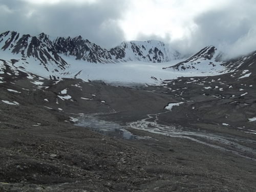 A view of Linnebreen from the Little Ice Age moraine. As you can see, we've had a lot of melting since its position in 1936...
As a bit of background information, Linnebreen is the glacier that sits in the higher country of the Linne Valley. Other than snowmelt and precipitation events it is the main source of water to Lake Linne. The glacier itself is easily recognizable this time of year by a lower altitude snout that is covered in sediment and melting snow/ice with continuous snow coverage at higher elevations. At those high elevation it bifurcates into two cirques that feed the lower main lobe.
Our current data and previous studies have allowed us to make a few assertions as to the state of Linnebreen. It is currently retreating with a seriously negative mass balance. That means the mass of the glacier is decreasing over time because the amount of ice lost during the summer months (ablation) is outpacing the amount of ice that is gained in the winter months (accumulation). On most glaciers one can actually see the physical difference in where the glacier is losing or gaining ice as zones of ablation versus accumulation. The accumulation zone is easily recognizable as the area in which you can see the snow at elevation and above that has lasted one full melt season (firn or corn snow). It is separated by something called an equilibrium line (or snow line) that which below lies the zone of ablation, marked by sediment and melting ice. Changes in the equilibrium line altitude (ELA) can often be used as a marker of whether the glacier is gaining or losing mass and how drastically.
The other pieces of information we know about Linnebreen are related to the remnant landforms of past glacial processes. The glacier occupies a region that is far smaller in size than the Linnebreen of 1936. We know this based on historical aerial photos showing the glacier's farther extent at the time. It is thought that this was the maximum extent of the ice resultant from the favorable ice making conditions of the Little Ice Age (LIA) which I've mentioned in the past. The LIA margin is easily recognizable by a large terminal moraine with successive moraines and margin-indicative landforms working progressively back toward the current margin. These include terminal and lateral moraines as well as relict meltwater channels that are no longer fed with glacial waters. Three paragraphs of science! UNCLE!
Ok, ok. Following lunch we serviced our glacier camera station and downloaded time-lapse photographs of the glacier system similar to our setup on the PlumeCam. These will show the melting of the glacier snout with the spring onset and the formation of meltwater streams.
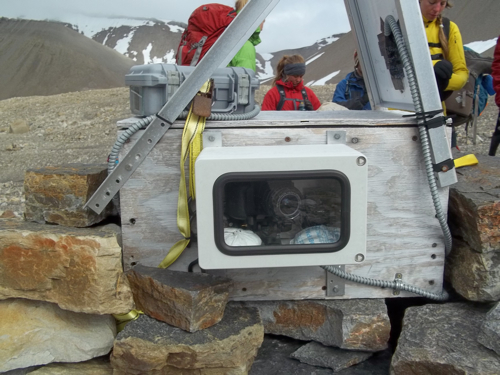 The glacier-cam located on the LIA moraine taking time-lapse photos throughout the year.
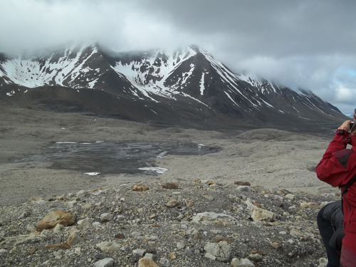 The view out in front of Linnebreen. Note meltwater fans and the rise up of the LIA moraine (the maximum extent of ice since 1936).
We then worked our way along the LIA moraine ridge which flanked the ice on glacier right. Our first encounter was a giant boulder that Steve explained to us was an excellent lichen growth station. Lichens are widely used as indicators of how recently an area was deglaciated as they grow quite slowly and for long periods of time in the most barren of areas. One must simply create a growth curve based on local lichen species in areas of known lichen age such as on buildings or gravestones. Then from the size of the largest lichens in proglacial areas, an age at which the lichen started being allowed to grow on uncovered rocks can be determined. This particular area was one of few that was actually documented by Al Werner (REU co-leader and Prof. from Mt. Holyoke) back in the 80's and can still be seen and analyzed today.
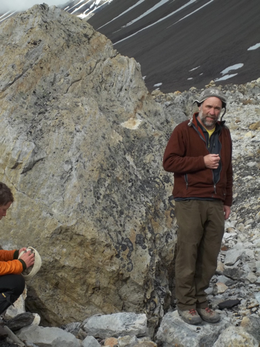 Steve explaining lichen growth as a tool for estimating the ages of exposed glacial boulders.
The next stop was an impressive outcropping of glacial ice that blew everyone away. What looked like a typical moraine ridge of consolidated sediment turned out to be an ablation-till-veneered ice landform with only about a half a meter of sediment blanketing its exterior. This changed a lot of our mindsets on the nature of ice-cored sediment deposits in the areas surrounding glacial margins. Just how much of what we've seen is actually sedimentary materials and how much is ice? Will the landforms we see today eventually melt out to be much more subtle geologic features? Man on man I hope you've got some fingernails left for the rest of this story…
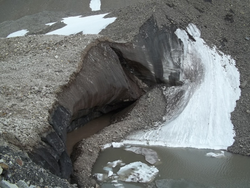 What looks like a giant till mound (moraine possibly) turns out to be ice cored to the nth degree. Note the folded ice bands (recumbent folds) on the right side of the exposed ice in view.
Venturing onward we dropped down from the glacier's last maximum advance to the true glacial margin. The sides of the glacier were flanked by lateral meltwater streams that took a bit of climbing to overcome but were generally benign during these cooler temperatures.
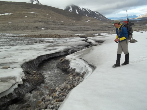 John next to a lateral meltwater stream by Linnebreen. John hopes to make the glacier one of the major facets of his senior thesis research.
On the glacier the main goal was to observe our first true glacial ice in the Linne valley and measure the distance of the glacial surface to ablation stake tops. These stakes are on the order of 6 meters long and drilled deep into the ice at varying points running from the snout up the center of the glacier to its height. By measuring these stakes we can get an idea of the timing and extent of the glacier's melt and ice-loss over the summer field season.
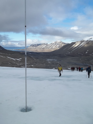 The group approaches an ablation stake with a view of the Linne valley in the background.
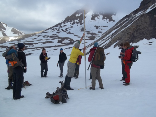 Measuring the height of the ice surface in comparison to that of the ablation stake...how much have we gained or lost?
On the ice surface proper there are other factors that are worth noting. In numerous spots there are rocks that have either been entrained in the ice due to flow or simply fallen onto the ice surface from nearby cliffs. These rocks act as thermal magnets on the surface of the ice due to their lower albedo. Albedo being the reflectivity of an object, these rocks absorb significant amounts of sunlight compared to the high reflectivity (high albedo) of the snow/ice around them. Accordingly they have a tendency to melt the snow/ice around them and contribute to increased supra-glacial melting.
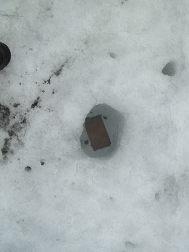 A rock acting as a thermal magnet on the glacier's surface. Notice the melting occurring around it and puddle...
In that same vein, the snow/ice surface in most places has many smaller black particles that could have any number of origins (soot from nearby coal burning, pollution from lower latitudes, volcanic origins even!). These particles too have their own effect on the albedo of the ice surface.
 Minuscule dark particles that dot the glacier's surface: coal, pollution, aeolian deposits, sprinkles?
By the time we finished our measurements, it was about 5 pm and if we wanted to make our dinner at 9 we needed to 'beat feet' back home. Many decided that food sounded better than changing so we kept our hiking boots on rather than the 'muck' alternatives and endured whatever stream crossing in the name of beef stew. With only a a brief stop to retrieve the sensors from another snow tree we cruised back to the boats and then the main station. A day spent on glacial ice is a good one in my book...
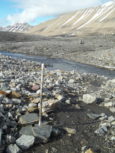 The 'snow tree' sitting below the LIA moraine of Linnebreen.
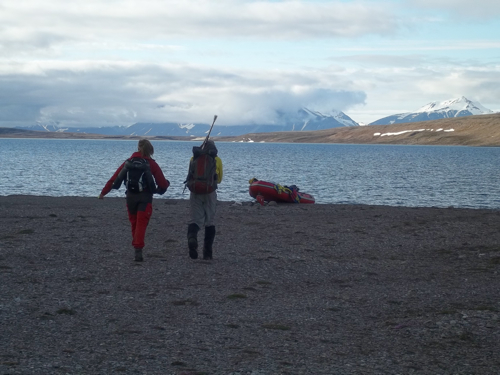 Homeward bound after a day on the glacier. Minus the matrimony I'd title this picture A Svalbard Honeymoon. Please, no offense Hannah or John...
Finally, to my English teacher/officionado friends who've pocked fun at my typos. I am trying to do good with my grammar but I admit to makign some mis-takes here and their. Please bare with me and I hope u can still have a excellent time reading the journals. Remember, I am a geologist at hart, not Dickens : ).

