Now that our training is over, Joni and I can finally help the team start the research. It feels good to get started!
Why we are here
This is the 12th year that the Texas A&M research group is monitoring sediment samples at McMurdo Station. The two people in charge of the research are Andrew Klein and Chuck Kennicutt. Chuck does a lot of work around the environmental protocols in Antarctica, but isn't with us on the ice this year. Every year, the A&M research team comes out to the same spots on the ice and on the ground and takes samples of the sediment. The research team then brings the samples back to Texas to analyze their chemical composition (whether there is petroleum or trace metals), the types of organisms living in the sediment, and to look for traces of pollutants in the organisms themselves.
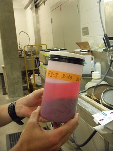 Terry Palmer shows a sediment sample of polychaete worms (died pink) from a prior year of collecting.
Getting Started
Although we are getting started with our research down here in Antarctica, a lot of the tasks required to make this research happen have already been done! Scientists can't just pick up and go to Antarctica to study something--first scientists need to do background research on what has already been done and then develop a unique or important research question that helps the scientific community and often society too. In order to go to Antarctica and conduct research, scientists also need to be funded, which means writing proposals and grants. Luckily my research team has done all those things and now it's time to collect data!
First Steps
Before collecting samples, a lot of things have to happen. First, our research team needs to find the correct sampling locations. The exact locations are found using GPS, which stands for Global Positioning System. GPS uses satellites orbiting the Earth to get accurate latitude and longitude measurements for a current location. When a GPS unit tries to find its position, it listens to the signals of satellites in its range and triangulates its position by determining the time difference between them. The more satellites in its range, the more precise its position.
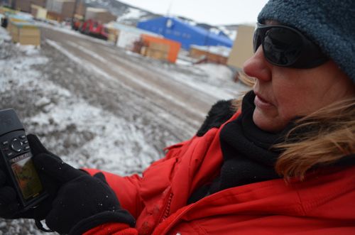 Joni Kincaid shows how to use GPS.
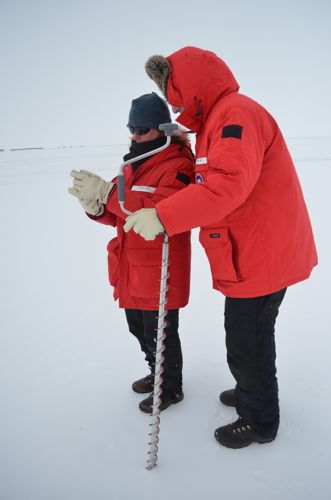 Andrew Klein and Joni Kincaid use the GPS to find the correct sampling site.
Flagging our Sites
Once we have found the locations that we want to sample sediment from, we have to flag the site. This means using an auger (a hand drill) to make a small hole in the ice and placing a flag in the hole so we can find it later. We drilled two sites that we will return to and drill large dive holes so divers can go down and collect the sediment on the sea floor. The map below shows all the sites we collect sea floor sediment from. Notice that each location has us collecting sediment at different depths. Divers have already collected sediment samples for the A and D sites marked on the map, but we have to collect samples for the E sites.
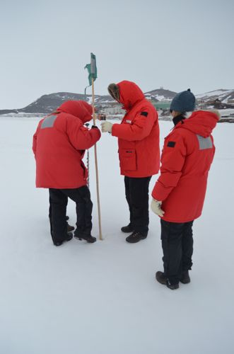 Michelle Brown, Steve Sweet and Andrew Klein place the flag in the hole while Joni Kincaid supervises.
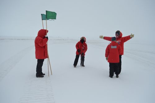 Michelle Brown drills a hole using an auger, while Steve Sweet holds the flags. Andrew Klein and Joni Kincaid discuss the site locations.
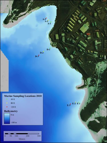 A map of the sampling sites show the three diving locations, A and D are the polluted sites and E is the control site.
Controls and Variables
Our research project is looking at locations that were once polluted. Sites A & D on the map represent these areas. Site A is in Winters Quarters Bay, which is where Robert Scott was interested in staying (see the Discovering Discovery Hut Journal to learn more about that!) There is a lot of pollution in the soil here because people at McMurdo used to dump equipment and other trash in the ice here. Site D is another polluted location where sewage and trash used to be dumped. Site E, however, is not known for having any pollution. We are collecting samples at Site E to see how it compares to the polluted sites. This is called our control site. We will be going to other control sites as well to make sure we can accurately interpret our data.
Test Dives
After we flagged the sites, we visited another dive hole so Terry could do a practice dive. Steve Rupp, who has been diving for years in Antarctica, went with Terry to help him practice. Terry and Steve were under water for about half an hour and saw all sorts of amazing things under the water. I can only imagine what it must be like! I will try to get Terry to take some pictures so I can share them. Steve did emerge with some "cockroaches of the sea" to give to another research team. They are not related to cockroaches, but are an isopod, which is a crustacean.
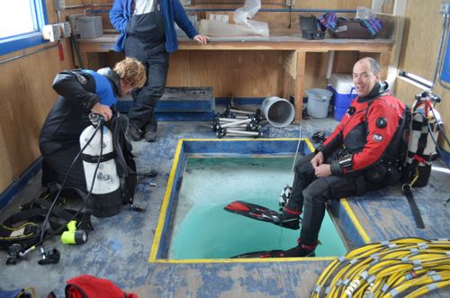 Steve Rupp (right) and Terry Palmer (left) get ready to do a practice dive under the sea ice.
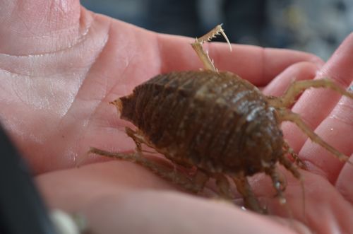 Steve Rupp collects Isopods (known as cockroaches as the sea) while in the dive hole.
Questions
Why do you think it's important to monitor the pollution in the soil and sediment? What do you think we're looking for?
Why is it important for the research team to go to the same sites as the years before?
Why do you think it is important to have controls in a science experiment?
Math Connection
If a GPS satellite is 11,500 miles above the Earth, and is orbiting the Earth at 9,000mph, how long will it take before it makes one complete loop? (The circumference of the Earth is 24,901 miles).
