Speed 3.8 knots (kts) Course 7.2° Location Beaufort Sea 73.76°N, 145.31° W with CCG Cutter Louis S. St. Laurent Depth 3716 meters
SPECIAL FEATURE DISCUSSION:
(see previous journal for the questions.)
The Law of Superposition applies to sediment layers and states that younger layers are deposited above older layers. The gas hydrate isn't a sediment layer, though, and may have formed under previously deposited sediments. If the gas hydrate could be shown to cross layers then cross-cutting relationships could be used to get a relative age.
TODAY'S JOURNAL:
One component of our expedition is a team of ice observers and analysts from the National Ice Center (NIC), an agency funded by NOAA, The US Coast Guard, and the Navy. Pablo Clemente-Colon (from NOAA) and Josh Miller (from the Coast Guard) are aboard the Healy, and Caryn Panowicz shuttled over to the Louis. In exchange, Erin Clark of the Canadian Ice Service came over to the Healy to complete the ice team. Every day the team gets satellite imagery and drift buoy data to help forecast ice conditions and movement, particularly along our intended track lines. The amount of ice we encounter affects our speed so knowing what to expect ahead of time really helps out with planning travel times over the various legs of our cruise.
Yesterday Pablo and Josh unpacked two buoys to cast overboard. Buoys are floating markers that come in a multitude of shapes and sizes. There are scores of buoy types. For example, some are simply visual markers such as those used to mark navigation channels or hazards, some have lights, foghorns or bells on them to act as warnings in shallow water when fog or darkness obscures vision, and some have sophisticated electronics built in to report weather conditions. Many are moored (anchored) to the bottom to act as fixed markers and some are free-floating to drift in the ocean. The buoys we deployed carried instruments to measure sea-level air pressure and sea surface temperature. They are drifting buoys, with 15-meter deep drogues (underwater fabric sails) that keep them moving with the surface current rather than with the wind. They report their position back to a satellite along with their meteorological data as part of the International Arctic Buoy Program (IABP), a collection of similar instruments drifting in the Arctic Ocean.
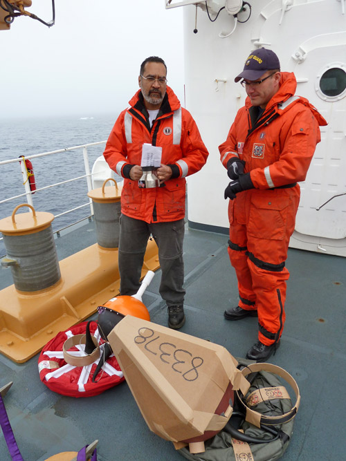 Pablo & Josh readying two drift buoys for deployment in the Beaufort Sea. Each measures sea level air pressure and surface temperature and their positions are satellite-tracked. These were deployed together to evaluate their functioning compared to each other.
 One of the drift buoys has this label with instructions on what to do if it is found.
These buoys can be tracked on our map server, where they appear as little triangles. The solid triangle is the most recent position and the outlined triangles are each previous day's position. By doing a little measuring and calculating, the speed of the current (if in open water) or drifting ice (if it is caught in the ice pack) can be determined.
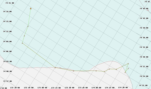 One layer available to us on the Healy map server shows active IABP buoys. The solid triangle is the most recent position and each outlined triangle is the previous day's location.
Standard buoys made for typical ocean conditions often don't do too well in the Arctic, and these two are new versions of models that have been upgraded in the hopes of better performance in the unique conditions up here. For example, the expected 1-2 year operational life of these buoys has more typically been around 6 months in the Arctic. The cold conditions are hard on batteries, buoys can be crushed by ice, and sometimes buoys are even chewed up by polar bears. The team decided to deploy these two new models together so their performance could be compared side-by-side. Since all of the electronics are sealed inside to protect them from salt water, the switch to turn them on is activated by removing a magnet from the outside of the buoy. Then they are ready to go and tossed overboard. Bands holding the drogue bundle dissolve in seawater, dropping fabric coils down 15 meters into the water column. One buoy also is packed with a protective cardboard cone around the pressure sensor which will also disintegrate in seawater after deployment.
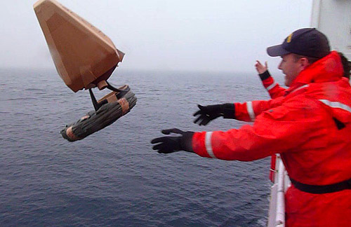 A drift buoy is deployed in the Beaufort Sea off the USCG Cutter Healy.
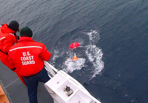 Another drift buoy model is deployed for performance comparisons in the Beaufort Sea off the USCG Cutter Healy.
http://
SPECIAL FEATURE:
Here's a screen shot of an IABP track on the Healy's map server. Using the measuring tool we can see that it traveled 34.4 nautical miles in the last 5 days. What is the buoy's average drift speed over that time period?
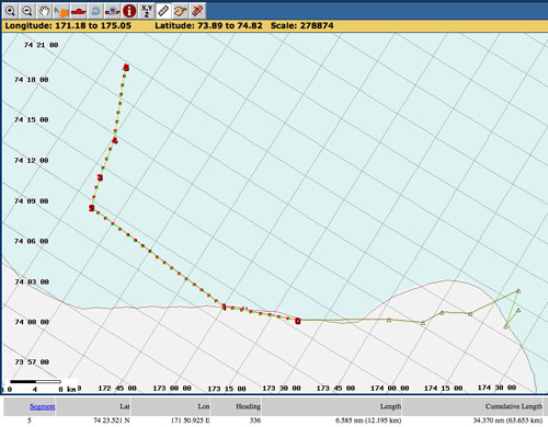 An IABP buoy track on the Healy map server, with the last 5 day's movement measured as 34.4 nautical miles.
The track shows that the buoy covered its biggest single-day distance of the past week 4 days ago, traveling nearly 14.8 nautical miles in a day. What was its average speed over that time period?
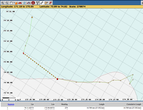 An IABP buoy track on the Healy map server, with one day's movement measured as 14.8 nautical miles.
That's all for now! Best- Bill

