Speed 6.9 knots (kts) Course 214° Location Beaufort Sea approx. 180 nm northeast of Barrow AK Depth 3705
SPECIAL FEATURE DISCUSSION:
(see previous journal for the questions.)
The IABP buoy went 34.4 nautical miles (nm) in 5 days. So by taking 34.4 / 5, we have an average drift speed of 6.88 nm per day. By dividing that by 24 we get an average drift speed of about 0.29 nm per hour.
On the 'speedy' day the buoy went 14.8 miles in a day. 14.8 / 24 =drift speed of about 0.62 nm per hour.
TODAY'S JOURNAL:
I'm at one of my favorite spots on the ship, up on the bridge in a comfortable chair with a sweeping view of the Arctic Ocean. From 70 feet above sea level I can see a lot of territory when the fog clears enough as it is currently doing. Right now I'd estimate the sea is about 1/4 covered with drifting ice and the rest is exceedingly deep clear blue water. It's a fairly quiet Sunday morning and the hectic pace on the ship has backed off a notch or two.
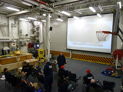
On Saturday nights there are some special events to have a little fun. A different department cooks dinner each Saturday night to give the galley crew a break & last night we were treated to burgers and gourmet fixings by the ship's deck division. There is bingo after that in the mess deck (the ship's equivalent to a cafeteria) and at 20:00 hours (8 pm in landlubber terms) a movie is shown on the big screen in the helicopter hangar. Since the hangar heaters are really loud they are turned off and everyone bundles up in winter clothes to watch the movie from camping chairs.
 On Saturday nights a movie is shown on the big screen in the Healy's helicopter hangar.
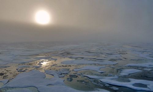
 After the movie let out the low-angle sun filtered by fog produced some neat lighting effects on the ice.
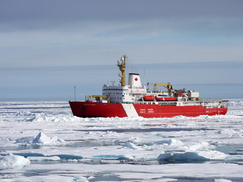
We're now heading southwest, aiming generally towards Barrow, Alaska on this leg of the cruise. Keeping a mile astern is the Canadian Coast Guard Cutter Louis S. St. Laurent, running a continuous seismic profile of the sea floor. The Louis generates seismic wave pulses by releasing compressed air into the water. As the waves penetrate into the sea floor, successive layers reflect some of the energy back to the surface. We open a lane in the ice for the Louis to tow its seismic streamer, the long array of hydrophones that record reflected seismic waves from beneath the sea floor. Sophisticated computers sort out all of the recorded data to produce profiles of seabed geology.
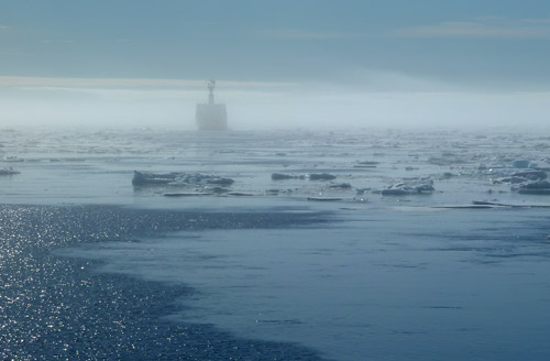
 Even though it follows just a mile behind us, we often can't see the Louis at all through the fog. When visible it is often just an outline in the haze, kind of like a ghost ship.
 The fog cleared for a little while as we made a sweeping turn onto a new track line, giving me my first clear look at the Louis of the trip. Since we were turning it was also the best look we've had at the whole length of the Louis, not just its bow pointed at us.
Meanwhile, we run a continuous swath of multibeam sonar that charts detailed 3D bathymetry (sea floor features) as we go. Right now we are in water about 3700 meters deep and our multibeam swath is about 11,000 meters wide (11 km or about 6 nautical miles.) We also run our subbottom profiler sonar nonstop.
The day's plan is to pull away from the Louis as the ice thins, speeding up to pick up a replacement crew member and engine parts for them off of Barrow (the Louis aims to stay at a speed of about 4 knots regardless of ice conditions for the best seismic recordings.) Then we'll turn back north on a new track to again lead the Louis through ice.
SPECIAL FEATURE:
What is the difference between a statute mile and a nautical mile?
What are two meanings of the word knot related to ship-board operations?
That's all for now! Best- Bill

