Speed 0 knots (kts) (Stopped for core sampling and CTD cast) Course N/A Location Southeast Canada Basin, West of Prince Patrick Island 76.53° N, 128.62° W Depth 2061 meters
SPECIAL FEATURE DISCUSSION:
(see previous journal for the questions.)
Here's a sea floor profile heading east from the Canada Basin, up the Banks Rise, Banks Slope, and Banks Shelf, and onto Banks Island.
 Sea floor profile west of Banks Island, Canada generated by Healy's map server.
While there is significant vertical exaggeration (if drawn to scale, the sea floor wouldn't rise nearly that steeply), you can see the differences in the relative steepness of a rise (which begins the transition upward from the abyssal plain), a slope (the steep transition from deep to shallow water) and a shelf (shallow, gently sloping water adjacent to land.)
TODAY'S JOURNAL:
So how do you think you did on the photo matching challenge from yesterday? Here are the names of these objects and what they are for:
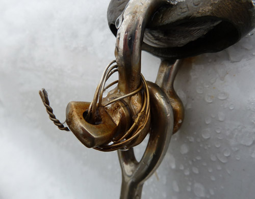 Mousing: The wire keeping this shackle pin from loosening and falling out is called mousing.
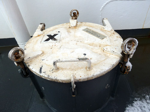 Dog: Each of the three threaded toggles used to lock down this scuttle is called a dog.
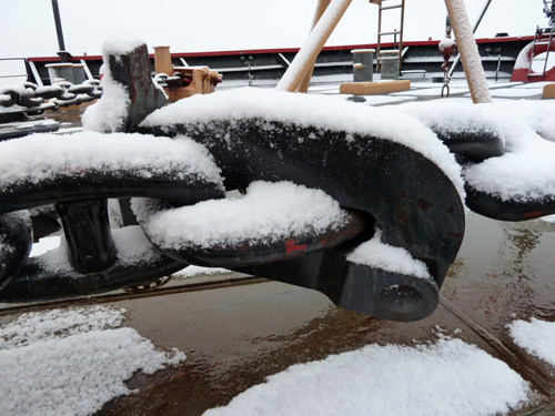 Pelican Hook: This massive pelican hook clamps onto the anchor chain to hold it tightly in case the windlass slips. Each anchor chain has two pelican hooks weighing over 100 lbs. each securing them to the deck.
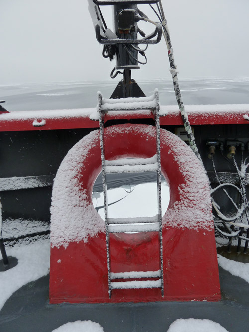 Bull Nose: The large hole for passing lines through on the bow is the bull nose.
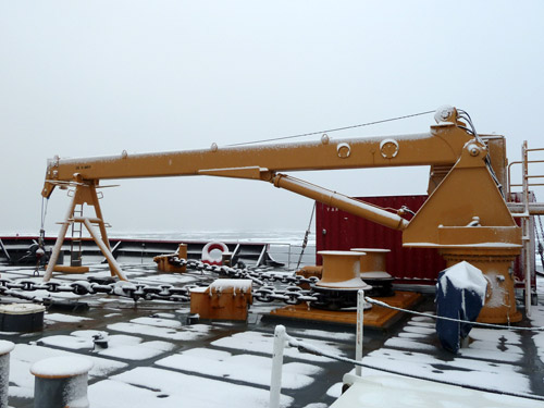 Crane: Not just a long-legged bird, a crane is also used for heavy lifting on a ship or on land.
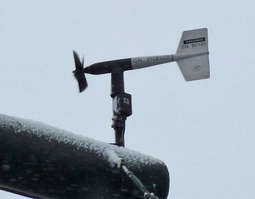 Windbird: This device measures wind speed and direction. While meteorologists may call it an anemometer (the propeller part measuring wind speed) and wind vane (the fin that points it into the wind to indicate direction), sailors call it a windbird.
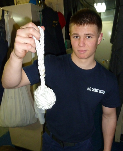 Monkey's Fist: SN Evan Burgeson shows me a monkey's fist, the round knot on the end of this line. It can be tied around a ball or heavy weight to help with throwing a line, or just used as a decorative knot.
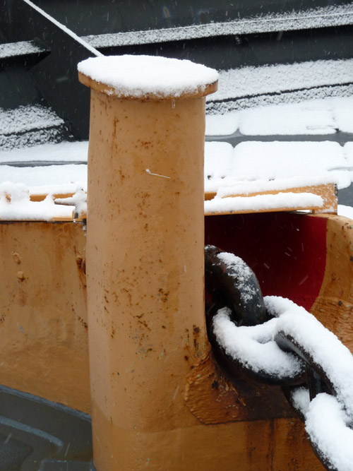 Elephant's Foot: The yellow pillar alongside the anchor chain where it drops through the bow is known as an elephant's foot.
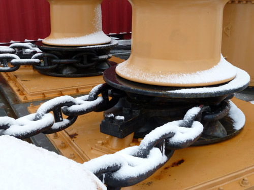 Wildcat: The black winding gear on the windlass that pays out or retrieves the anchor chain is a wildcat.
How did you do?
Yesterday was a great day for marine mammal sightings! I saw two polar bears, two ringed seals, and a bearded seal. I found one of the polar bears by scanning the horizon & was lucky to see it amble out from behind some distant jumbled ice blocks. It never was very close to the boat but I found it very satisfying to detect one for myself. The bearded seal was a new species for me. They are the largest 'ice seal', averaging around 500 lbs. They look a little silly with a big body but disproportionately small head. That gives them a recognizable profile even when they are extremely distant- Justin, one of our marine mammal observers, identified it over a kilometer away by recognizing its unique shape. It was lounging out on the ice but when we were about 250 meters away the seal slipped into its hole through the ice and into the sea.
Now we are working our way back north, roughly along the 2500-meter contour line in the eastern Canada Basin. We are about 90 nautical miles west of Prince Patrick Island (the westernmost island north of Banks Island) This has gotten us back into extensive sea ice again. We separated from the Louis for a few days do to medical issues that required them to drop off a couple of folks shoreside in Tutoyaktuk, Canada. They are safely ashore now and we should meet up with the Louis this evening. While we wait for them the plan is to take core and water samples before embarking on a few more days of seismic profiling. Then it will be time to pack up gear as we begin to wrap up the expedition.
 We had a brilliant view as the sun briefly climbed above a cloud bank this morning. The ice is solid with melt ponds on the surface and fresh snow that fell overnight. The sight didn't last long as fog returned later in the morning.
SPECIAL FEATURE:
Water in the Arctic Ocean slowly rotates clockwise, roughly around the North Pole. This is known as the Beaufort gyre, which takes around 4 years to complete one circuit. Why is the pack ice generally thickest in the Eastern Canada Basin near Greenland and the Queen Elizabeth Islands? (Use your Arctic Region Map to picture this.)
That's all for now! Best- Bill

