But First, Science in the Morning...
Because science can wait for no one, but the United States Post Office makes everyone wait; Elliot and I took soil samples today while waiting for our infamous last package. So out to the field we go, with serrated blade in hand. Elliot removed soil samples approximately 14 cm deep in 3 of the depression areas and soil samples approximately 12 cm deep in 3 of the higher areas. The soil samples were incredibly interesting because it wasn't like soil much at all - it was more like an accumulation of compacted dead plant material that wasn't fully decomposed yet.
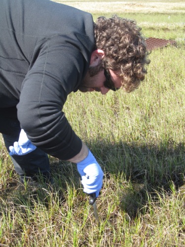 Elliot cuts out a 14 cm deep soil sample. He'll do this in 6 places - 3 in the depressions and 3 in higher, drier areas.
It turns out, it sounds a lot like the soil at Toolik! I participated in Nick LaFave's PolarConnect PD for Teachers and I learned that his team also took soil samples using a very similar method. You can read his journals here. http://www.polartrec.com/expeditions/predatory-spiders-in-the-arctic-food-web
Another "cool" thing that happened, literally, was that Elliot hit permafrost with his knife in one of the higher areas, which is why those samples are less deep. So of course, I had to put my hand in there too. It was oddly exciting to feel the suddenly very solid, thick permafrost.
Now About that Whale Graveyard...
In the afternoon, we took the ATVs to Point Barrow the original site of the northern most US village! It is absolutely the MOST northern point of the entire USA! "You can't get any more north than this!" proclaimed Elliot.
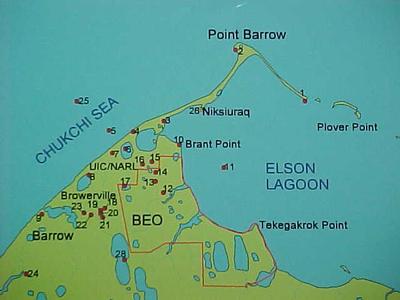 This map indicates the locations of the city of Barrow, the BEO, and Point Barrow. Source: TEA
Point Barrow is quickly eroding away due to rising ocean levels as a result of climate change. In fact, there is a huge archeology project underway as a large research group excavates the old village and collects and catalogs artifacts and relocates incredibly old native gravesites.
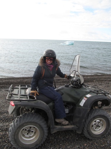 Point Barrow is the original site of the northern most village of the Inupia Eskimos. It reallys helps to have an ATV to get way out here.
Point Barrow is best accessible via ATV. So after a min lesson on driving one, since I had never been on one before, and a few words of stern caution from Elliot, (as he checks the shotgun on the back of his ATV) about leaving immediately if we see polar bears, we were finally on our way.
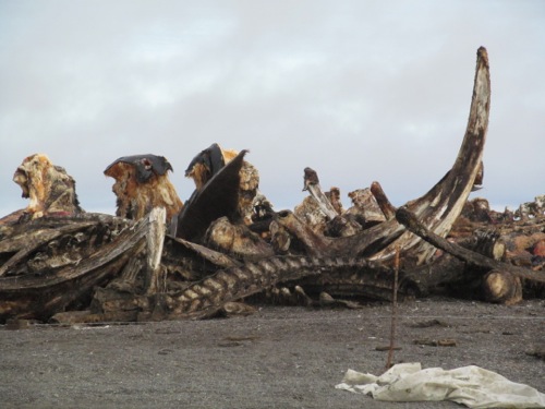 The whale graveyard was so cool! The bones are so massive!
Point Barrow was really cool! I had a great time. It's crazy because you are actually between two different seas - the Chuchi Sea and the Beaufort Sea. After my initial hesitation, the ATV was really fun. The best part of Point Barrow was the whale graveyard - the place where locals haul the remains of the whale after a hunt. It keeps animals, who like to eat the remains, safely away from the town. It was unbelievable how large the bones were! It was like looking at dinosaurs.
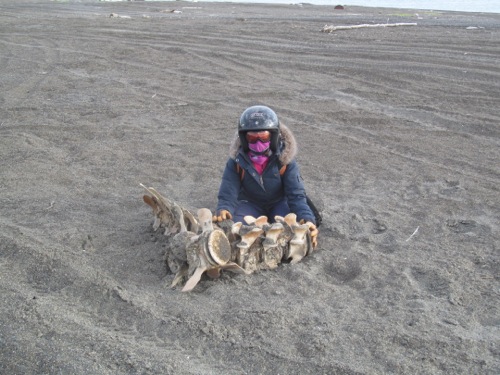 I got to touch this piece of vertebrae that was just laying on the sand far from the whale graveyard. Totally awesome!
