First Day in Camp
Getting Set-Up
Today was our first full day at Toolik. It is the first day for Byron and Sarah to be in the lab, so they spent the day orienting to the space and project, getting their equipment set up, and hashing out details for sampling and data collection.
The Dalton
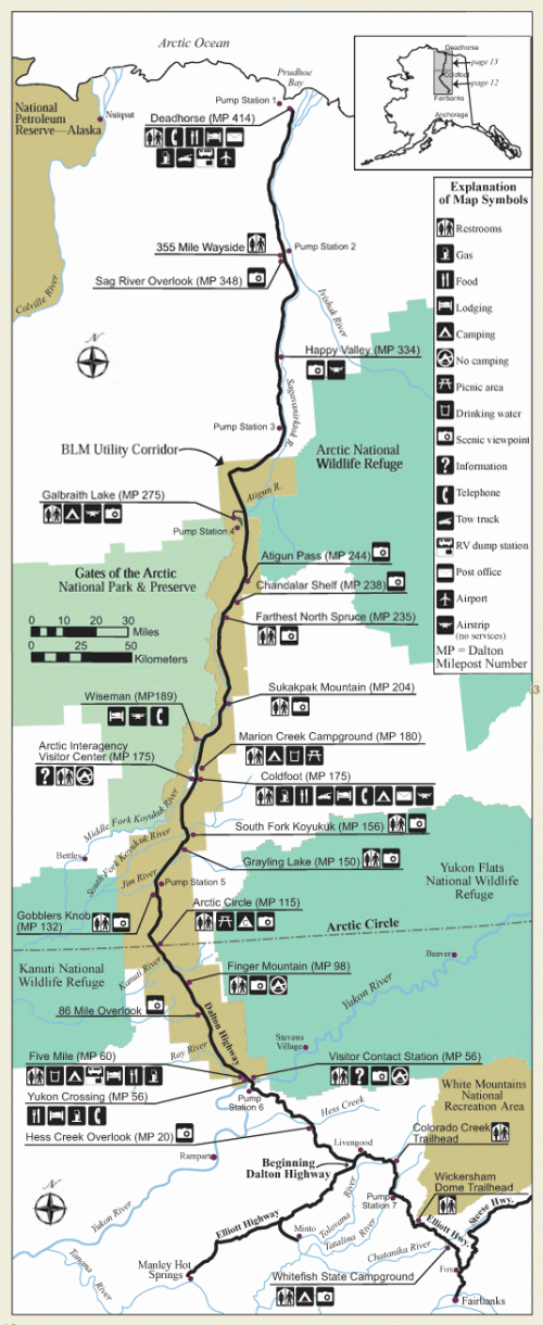 Map showing the Dalton Highway and major features along the route. Toolik is located between Pump Station 3 and Pump Station 4 right at the big eastward turn in the road. Map courtesy of US Bureau of Land Management
I thought I would take this opportunity to share with you a video of our drive up the Dalton yesterday. We had a camera mounted on our dash board that took a picture every five seconds as we drove along. I have sped up the footage, but it give a pretty good idea of what the drive was like. There are long sections of dirt that can get pretty rough- though they do their best to maintain them- but there have also paved a number of stretches of the road.
9.5 hours compressed into about 9.25 minutes
Some History
This road is quite an amazing engineering feat, there is a lot of factors that had to be considered. Building a road-even a dirt one- is so much more than just removing vegetation! It is often called the Haul Road, but it was officially renamed in 1981 after James B. Dalton, an expert arctic engineer who was involved in early oil exploration efforts.
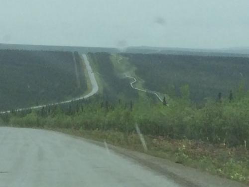 Here's a stretch of the Dalton, you can see the highway stays close to the pipeline (and I have no clue qhy it zig-zags!)
The fact that we were able to drive to our field site is pretty unique for most of the PolarTREC expeditions. We owe that to the Dalton Highway- or the Haul Road as any local will call it- or the Ice Road as some of you may have seen on some reality tv shows.
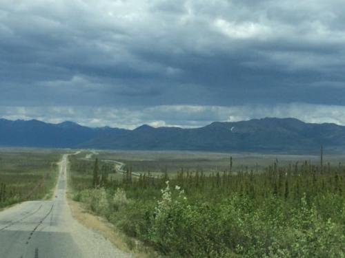 The Dalton Highway approaching the south side of the Brooks Range.
This road was built in 1974 to support the building of the trans-Alaskan Pipeline. It spans 358 miles (415 if you include Livengood Road which connects that Dalton to Fairbanks), across nearly 1/3 of Alaska, crossing the highest mountain pass in Alaska, and through other difficult terrain and very remote areas. There are only three small towns along its entire length! Incredibly, it was built in just 5 months- a single summer! Money was no object, work continued for 24 hours a day in 12 hour shifts, for 154 days until it was completed.
 View from the back
Why was this road so critical? Well, it was built to facilitate the construction of the Alaskan-Pipeline. This pipeline is key in transporting oil from the oil fields of Prudhoe Bay to Valdez. Once it reaches Valdez is can be put into oil tankers and brought down the coast to the continental United States for refining.
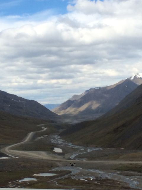 The view looking down the valley on the north side of the Brooks Range after coming over Atigun Pass
Due to the intimate relationship between the road and the pipeline they travel nearly parallel to each other for the full distance. By the end of this expedition I will have traveled the full length of the road, and driven to the furthest north in North America one can.
Species Journal
Today was a day around camp, and there aren't too many animals that like to wander this close to humans. However, I did spy an arctic ground squirrel or two poking around! Photos to come later as I get better at chasing them.
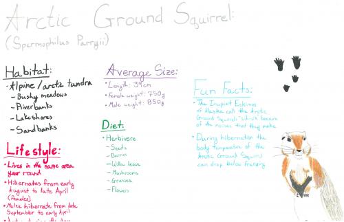 Alanna Croak's species journal of the arctic ground squirrel!
Be sure to check out the Team Squirrel PolarTREC journal. They have been spending lots of time with the squirrels here at Toolik!


Comments