We've now drilled over 50 holes in Lake Joyce! Everyday, we load up the drill sled and the science sled and go... somewhere. We usually have an idea of where we're headed, but without Sasha, we'd surely end up in the wrong place.
One of Sasha's main jobs is to refine the map of Lake Joyce. This lake hasn't been studied enough to have a really good idea of what the shape of the bottom of the lake is like. (The study of underwater topography is called bathymetry.)
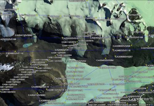
Sasha started out with old maps and photographs of what this area looked like long ago. This includes both a hand-drawn map that someone made back in 1973 and an aerial photograph from 1961, taken when the lake level was much lower than it is now.
 Flight lines showing where photos from the past had been taken of this area- we used specific photos from this set. Courtesy of Polar Geospatial Center at University of Minnesota.
 The 1973 hand-drawn map, Created by Dr.C.H.Hendy, University of Waikato Antarctic Expedition.
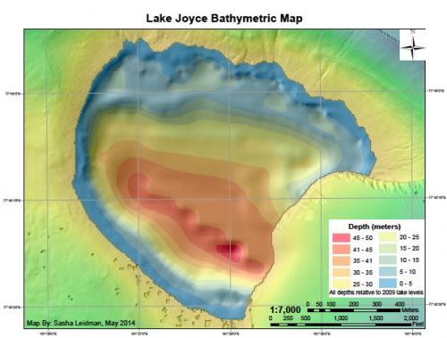
Using this information and a computer program called ArcGIS, he made a new model of the lake's bathymetry that he uses that to determine where we should put our drill holes.
 Sasha's first map, created with data from previous images. Courtesy of Sasha Leidman.
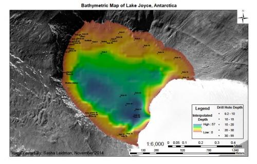
Using his GPS unit, Sasha guides us to our future drill holes. His GPS is accurate to within 6 feet! Once we drill, we measure the depth of the lake. Sasha enters that data into his computer model to generate a more current and accurate map of the lake bottom.
 Sasha's improved map, showing our drill holes. Can you tell the differences between this and the first one? Courtesy of Sasha Leidman.
There are still questions we don't know, and we won't be able to drill enough holes in the lake in one season to be able to answer. For instance, we've drilled in what we think is the deepest region of the lake, but how do we know if a spot 5 meters from that isn't the deepest unless we drill there too? Or 10 meters away? And what is the shape of the lake right next to the glacier? Although we won't be able to figure out every detail of the lake bathymetry, the model for the lake that Sasha ends up with will be much better than what we started with.
Immediately, Sasha's work allows for the us to place the sediment traps in the right locations, at the right depths. Additonally, this new map is a tool that other researchers can use in the future. Perhaps next year, or 50 years from now, someone will use Sasha's map to investigate the rising levels of the lake, or study the interactions between the glacier and the lake. It will be a tool for everyone!

