After the last year and a half, remote learning has consumed students and teachers alike. Today's class will be extra special remote, since I'm not teaching live and I'm in the Arctic while preparing. So, pretend you're here on the ship as I describe a bit of Arctic geography to you. Bundle up, because Winter is Here!
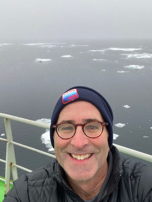
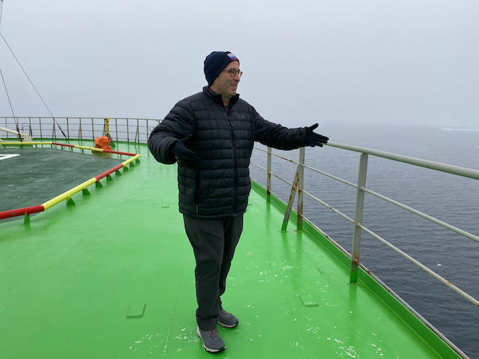 Standing on the bow of the ship giving a truly remote lesson about the Arctic.
The polar regions are one of the most difficult regions to show on maps because we are used to looking at continents from "the side," and thus the geography gets very distorted. When I initially showed my students the map of the expedition, they were very confused how "south" could be up, down, left, and right on the map. That is because we were looking at the globe "from the top."
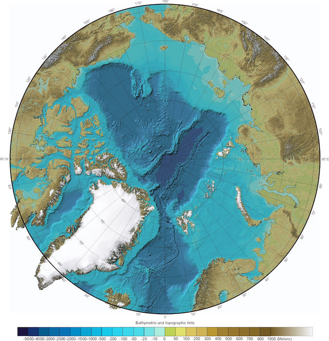 Map of the Arctic looking "down" on the North Pole. Image courtesy of IBCAO (International Bathymetric Chart of the Arctic Ocean).
The Arctic Ocean floor is divided into 2 main basins (very deep areas), separated by a higher ridge of undersea mountains (the Lomonosov Ridge). The Amerasian Basin borders Canada, Alaska, and eastern Russia and is divided by another undersea ridge into the Makarov and Canada Basins. The Eurasian Basin is bordered by Greenland, Iceland, Norway, and Russia. This basin is further divided by a series of ridges into the Nansen and Amundsen basins. This latter area contains the North Pole and the deepest point in the Arctic Ocean - about 5500 m (18,210 ft). This basin is where the NABOS (Nansen and Amundsen Basins Observational System) expedition starts and ends, research will be conducted in the Makarov basin too.
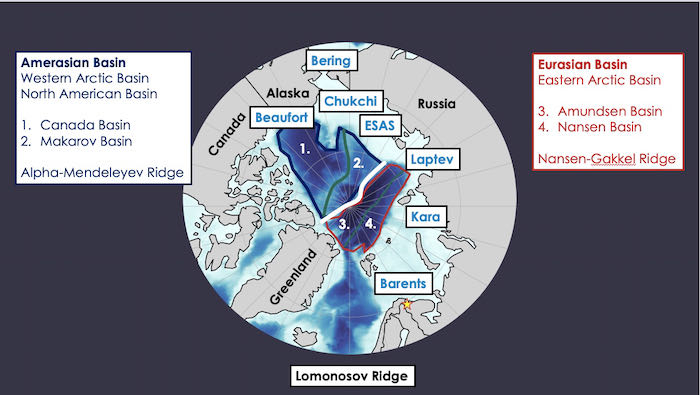 The geography of the Arctic Basins (Image courtesy of Laura Whitmore, UAF).
The edges of the Arctic Ocean are subdivided into various seas. When we left Kirkenes, we were in the Barents Sea. As we sail east to the north of Siberia, we will pass through the Kara, Laptev, and East Siberian Seas - I can't tell the difference. Some seawater comes into from the Pacific Ocean through the Bering Strait between Alaska and Russia. The majority of water comes into and leaves the Arctic Ocean through the Fram Strait between Greenland and Norway. Freshwater enters the ocean from rivers running off each of the continents. This has a significant impact. 10% of total global discharge from rivers enters the Arctic Ocean.
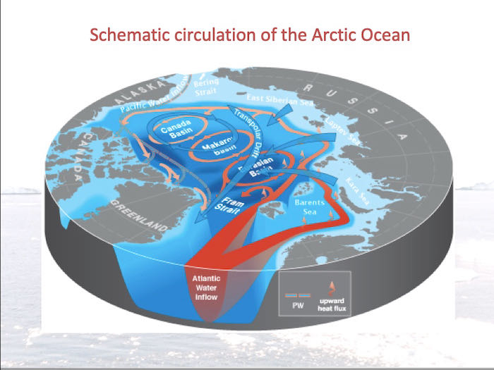 Circulation of water through the Arctic Ocean (Image courtesy of Igor Polyakov, UAF).
To understand the interaction between all of these water currents, as well as the effect of the ice, is why we are here. Don't worry, there will not be a quiz on this - yet!
 Calm seas. More ice. No polar bears...yet.

Add new comment