Schedule Updates
The time is near, everyone! In T-Minus ten days I will be on a 6 hour flight via military rotator to Thule Air Force Base to begin my first leg of the Operation IceBridge Arctic expedition. A bit has changed since my last post in terms of schedule so I will give you a quick update so we're back on the same page: Rather than beginning my portion of the expedition in Kanger, flying some land ice missions and heading to Thule until the end of the OIB spring campaign, maintenance and testing delays have pushed things forward a bit. I will now be joining the team first in Thule as they wrap up their sea ice missions and then fly with them to Kanger to complete a series of land ice flights.
The careful planning, thorough testing, and emphasis on science objectives through these pre-field months makes it clear that the work done by Operation IceBridge is an enormous priority in understanding our changing Earth. That observation was reinforced this morning when I woke up to an article describing new information about changes in the Earth's spin axis and its relationship to the melting ice sheets of Greenland and Antarctica. You can find that article here Changes in Land Water Storage and Melting Ice Sheets Drive Polar Motion It is a true reminder that the continuous stream of data and imagery provided by OIB year after year is crucial to understanding the health of our planet and the impacts of the changing poles.
Speaking of 'careful planning,' let's chat about what it takes to prepare for an OIB airborne campaign.
COLLABORATION
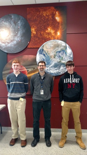
I first met the team in January at NASA's Goddard Space Flight Research Center during the PARCA/OIB meetings. (Acronym Soup: PARCA is the Program for Arctic Regional Climate Assessment and OIB is of course Operation IceBridge). I had the opportunity to bring along two students and parents who will share their experience at Goddard in an upcoming post. The meeting was a clear indicator that collaboration among many researchers is crucial to understanding what is happening at the poles. At the PARCA meeting, polar researchers from all over the globe shared their research and formed collaborations, everyone with the same goal in mind: To construct a clear model of the changing ice sheets in the Arctic and in Antarctica.
 Lourdes students Charles Keer and Ryan Mirarchi meet Jefferson Beck of OIB at Goddard Space Flight Center.
At the OIB meeting, team members nailed down timelines and agreed on the science priorities the OIB campaign flights will focus on. In addition to the science objectives determined by the OIB scientists, collaborators working on the Ice Sat II Satellite (to be launched in 2017) had objectives in mind that influenced the flights the campaign should take. Also, instrument teams presented information about the types and accuracy of data collected with their particular instrument (everything from the Airborne Topographic Mapper LIDAR system to a new instrument using infrared technology).
 NASA team members from Operation IceBridge and Ice Sat II meet in January to plan the next year of science flights that will be part of the Operation IceBridge Campaign
In this year's spring campaign, NASA is partnering with NOAA in order to use one of NOAA's research hurricane hunters for the IceBridge missions. Collaboration between these agencies was an important part of putting this year's science campaign in motion.
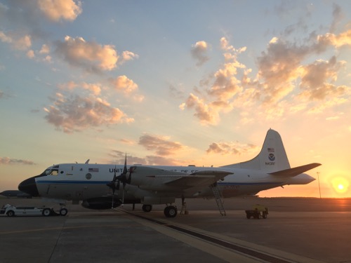
 The NASA OIB team and NOAA crew spent weeks testing the airborne laboratory to be flown over the Greenland Ice Sheet. It was captured in front of a Florida sunset between tests here.
INSTRUMENTS AND TESTING
Once science objectives were finalized and collaborations in place, the next step was refitting the NOAA P3 hurricane hunter (who goes by Miss Piggy) with IceBridge instruments, including an Airborne Topographic Mapper (a LIDAR system), Kansas Radar Suite, and Digital Mapping System (DMS). The NASA team headed from their home at Goddard to MacDill Air Force Base in Tampa FL, where Miss Piggy was waiting. Soon, with the instruments in place, extensive testing by NOAA and NASA crew was underway. There is a very thorough and descriptive article in the Tampa Tribune which is linked below to describe what happens during a test flight. Scientists and crew want to ensure that in every potential condition the instruments will remain stable and collect accurate data, so pilots simulate extreme turbulence, steep drops, and rolls. If something isn't at 100%, crew will focus on that particular piece until it is perfect.
Check out this detailed article about the testing required here: Aircraft at MacDill Helps Track Earth's Shrinking Ice a World Away
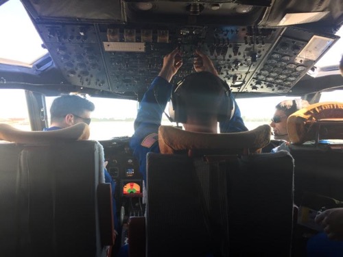
 The NOAA crew prepares for flight in the Operation IceBridge P3 during testing in Tampa, Fl at MacDill AFB
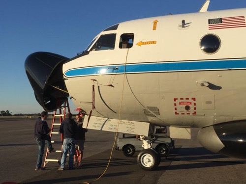
 Crew members make instrument adjustments to the NOAA P3 during testing at MacDill Air Force Base
TRANSPORT
With testing and maintenance complete, the next step is getting the team and crew to the Arctic Circle. After filling out quite a bit of documentation, and completing a comprehensive NOAA Aviation Safety and Survival training, Ice Bridge members, Goddard Scientists, NOAA crew, and that one PolarTREC teacher will be shipped to Greenland either by hitching a ride on Miss Piggy or via military rotator out of BWI. Finally, with team in place we will start completing 8-9 hour science missions over the Arctic Ocean and Northern Greenland. Phew, here we go!
http://
Stay tuned, folks. The adventure has just begun, but the science never stops.
QUESTION(S) OF THE DAY (Comment your Answers in the Ask the Team Section)
Find the time of sunrise and sunset for Thule, Greenland over the next ten days. How many minutes of daylight is Thule gaining on average over that time?
Answer the same question, except this time for Kangerlussuaq, Greenland.
Now answer the same question for YOUR location.
What did you notice about amount of light gained from Thule compared to Kanger? What about from Thule to your home? Give us your thoughts on why those numbers are different.


Comments