We have experienced the arctic, its beauty, its chill, the culture and history surrounding it. We have learned about the data collected by Operation IceBridge, visited the ground station, examined the idea behind differential GPS correction. We've learned about the big ideas behind sea ice studies from two of Goddard's dedicated sea ice scientists, and heard about the importance of climate research and the place for airborne science from Astronaut Piers Sellers.
Finally, it is time to get on an Operation IceBridge Science Flight! The first part of preparing for a science flight is gathering all scientists, instrument teams, pilots, crew members, outreach visitors, etc. for a meeting to discuss flight options for the next day's mission.
Pre-flight MeetingAt 5:30 everyone involved in the OIB mission gathered in a meeting space on the 2nd floor of the North Star Inn. Nathan Kurtz, Project Science Director began the meeting by filling everyone in on the purpose of OIB. The NOAA flight crew is new to the OIB campaign (as you know, the majority of their science flights are into hurricanes to study storm systems). For that reason the science team provided a thorough overview of how OIB came to be, what it's current goals are, and how they choose priority flights. A quick recap based on Nathan's talk is listed below:
- IceSat was collecting measurements on ice sheet topography until 2009, but ice measurements via airborne methods and field research have been going on since the 1970s.
- Operation IceBridge began collecting airborne data in 2009 and will continue to do so until another satellite IceSat II is launched.
- Operation IceBridge collects data using LiDAR, Radar, and other remote sensing methods to construct a map of the land and sea ice over the Arctic and in Antarctica each year.
- The importance of this data is attributed to the net ice loss observed in the ice sheets each year.
- Flight plans are developed based on scientific priority (quickly changing glaciers, thinning sea ice regions, dynamic ice shelves, etc.) but also must be subject to changin weather conditions.
- The sea ice flights are early mission priority so measurements can be collected before maximum summer melting occurs.
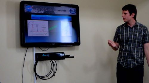
Nathan gave an overview of each of the instruments and the teams behind them. We'll be profiling each of these instruments and teams as the expedition continues!
 Nathan Kurtz provides a mission overview during our first pre-flight meeting of the week.
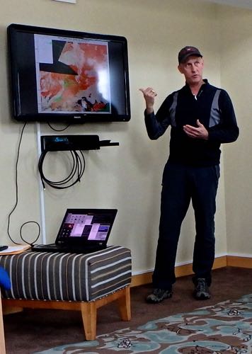
When Nathan's portion of the talk ended, John Sonntag, flight navigator provided an overview of flight planning and weather. Weather plays a huge role in determining what flight path will be flown each day. In the pre-flight meetings the night before a mission, one to three top plans will be selected. That could change by the next morning when final decision are made at 6:30 a.m. Thule time because the arctic weather patterns are so dynamic. John and his team use a combination of satellite data, infrared imagery, and various models of weather patterns to make the decision. Currently the top flight prioritized for tomorrow is called the Eastern North Pole Transect, a priority sea ice flight that will take us over the north pole. If the weather changes, we will either fly a different sea ice route, or a land ice route.
 John Sonntag provides a thorough overview of the weather component behind flight planning
Tomorrow morning there will be a weather brief at 6:30 a.m. I will be plane-side at 7 a.m. for a safety briefing, crew will be plane-side at 7:15 a.m. and we should be on our way just before 8:00 a.m. The tower at Thule Air base closes at 4 p.m. so we must leave on time in order to complete our 8 hour flight path. Here we go, everyone!
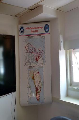
 The bold red lines are the highest priority flight plans over sea ice (top) and land ice (bottom).
Mission Tools Suite for Education
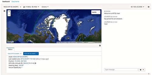
You and your classes can chat with us while we are in the air! If you are interested in using Mission Tools Suite for Education to connect to us during flights, send an email to kmccarthy [at] polartrec.com We have capability for a text-based chat while in flight, but you can also track the plane and view photos or preliminary data images in the meantime. Below is a screenshot of the window when the flight tracker is up.
 Mission Tools Suite for Education allows classrooms to interact with the team in flight.

Comments