Walakpa Archeological Salvage Project
As a researcher in Barrow, one of the main things that is stressed is the importance of giving back to the community. One such project is that of Walakpa Archeological Project, which hopes to salvage as much of the cultural and paleoecological information off the coast of Walakpa.
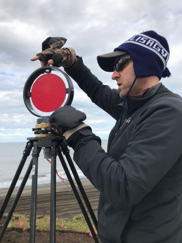
 Ryan Cody sets up the reflectors for the LIDAR.
Interestingly enough, all the efforts are done on a volunteer basis. Most of the archeologists working are students, members of the community, and researchers willing to help.
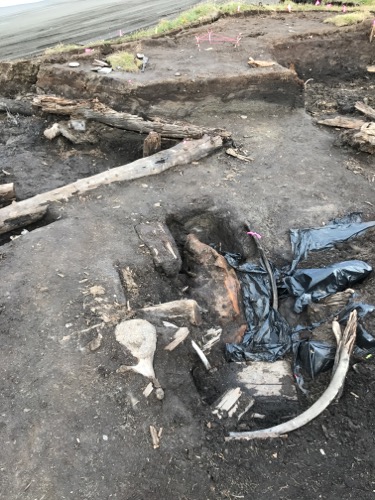
 A preserved seal at Walakpa.
With the increase of coastal erosion, this site is literally on the edge of the beach. In the event of a surge, the site can be potentially lost. Two of the members of Systems Ecology Lab from UTEP, Ryan Cody and Stephen Escarzaga, are tasked with created a 3D image using of the dig site, using LIDAR. Light Detection and Ranging (LIDAR) is a type of remote sensing that uses laser and satellites to create an image of the selected area. Loaded with the heaviest scanner (I carried it on my back), to create the 3D image, five tripods and software, it takes the team almost three hours to collect the data from the site. The dig site smells of melting tundra/permafrost, like the Permafrost Tunnel in Fairbanks, Alaska. It doesn't help that mosquitos are out. Setting up the equipment takes about 45 minutes, making sure that the tripods are level and that there is no interference between the reflectors. The reflectors bounce signals from each other to create a 3D image of the site. A camera is mounted on top of the scanner that will take a panoramic picture of the site.
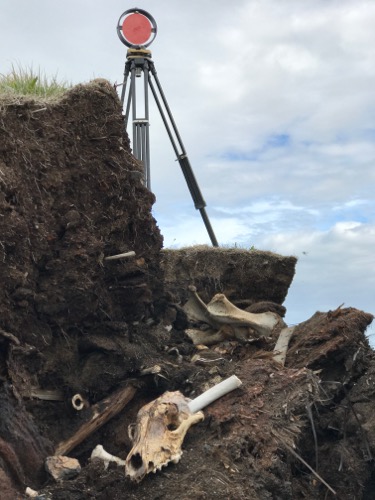
 The remains of a caribou collected at the Walakpa site.
A Trimble GPS is used to collect site points that will help in the creation of the image. Just in the area that we sampled over 20 million points were collected!


Add new comment