After learning that Professor Steffen and his team will be stuck on the ice sheet for at least one more day, I decided that I would at least try to show everyone why we are here, which is to study the ice sheet. So, I grabbed a bike and stopped by the Kangerlussuaq Museum to get some information. Wow, what a cool place! It was like stepping back into the past. The building used to be the Danish Hotel and then a military facility used by the United States Base Commander until 1992.
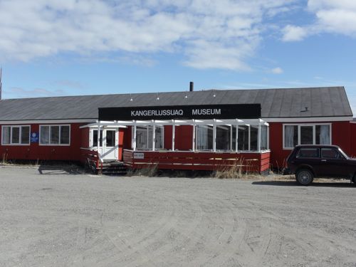 Kangerlussuaq Museum - a great place to see the history of Kangerlussuaq. Only cost 35 Danish Kroner to explore the virtual trip back in time!
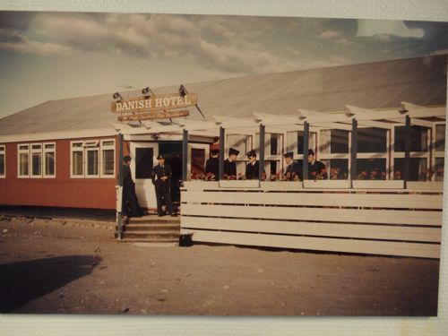 Original Danish Hotel - Converted to military command center then currently to Kangerlussuaq Museum.
Erling Jensen, the museum curator, was kind enough to share his memory of Kangerlussuaq in the sixties. He said that Kangerlussuaq was very different than it is today. “The place was full of military personnel and it was fun to go to the club.”
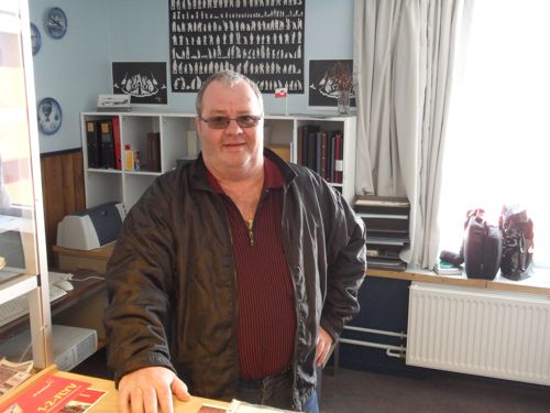 Erling Jensen - He is the current museum curator. He has worked in Kangerlussuaq since the 60's. He has many stories to share about the trials and tribulations of Kangerlussuaq. If you ever visit Kanger, be sure to find him. He also rents a cabin on the fiord.
After sharing his wonderful stories when he was a young man in Kangerlussuaq, he gave me some suggestions as to where to visit while I was here. I said I wanted to see the ice sheet and he recommended I go to the top of Black Ridge, a huge granitic mound carved by the retreating ice sheet. I immediately rode to the top of the ridge, through sections of loess and gravel, which were difficult to climb due to lack of traction. I suffered for about 45 minutes of significant climbing and then I got to see a very special view of the valley below.
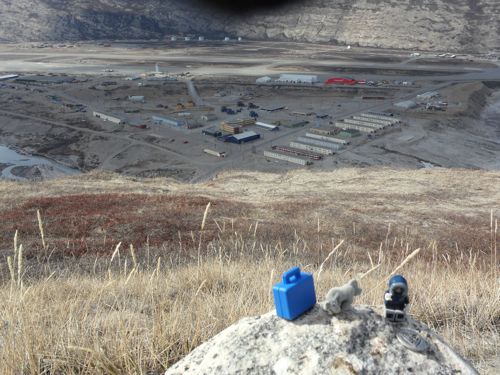 View of Kangerlussuaq from Black Ridge with my families trinkets. I wanted to bring something to remind me of my family back in Pennsylvania, so I had each of them pick something special that I could take with me on each adventure. Riley (8) picked her favorite horse, Torin (6) picked an arctic lego man, Becket (2) picked a lego suitcase and Mimi (spouse) picked a special coin.
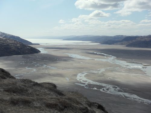 View of fiord from Black Ridge
After taking in the beautiful view, I turned around and saw an even higher observation point about a mile away, facing the direction of the ice sheet. So of course I decided to suffer some more and climb (I enjoy suffering, it’s getting to the destination that makes it worth it, and you get to enjoy the downhill!). After about a 30-minute climb I was at the top of the mountain. Wow, there it was, the edge of the Greenland ice sheet. I could actually see the steep face of the ice sheet from here.
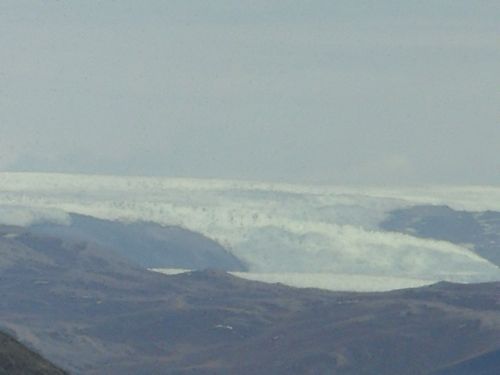 Greenland ice sheet, or at least the edge!
Once I had enough pictures of the ice sheet, I decided to investigate the local geology to look for glacial features. I immediately noticed the shiny rock exposed next to a radio tower. Upon further observation, I identified striations on a granite outcrop. Striations are multiple scratches or minute lines, generally parallel but occasionally cross-cutting, inscribed on a rock surface by a geologic agent. Common indicators of (at least the latest) direction of glacier flow. Looking at the striations, the parallel nature of the surrounding ridges and valleys, and the location of the ice sheet, I could pretty much infer that a receding glacial body caused the striations.
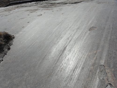 Striations on granite. Top of Black Ridge in Kangerlussuaq. Multiple scratches or minute lines, generally parallel but occasionally cross-cutting, inscribed on a rock surface by a geologic agent. Common indicators of (at least the latest) direction of glacier flow.
On another outcrop, I noticed a Chattermark: A small, curved scar made by vibratory chipping of a bedrock surface by rock fragments carried in the base of a glacier. Each mark is roughly transverse to the direction of flow, and either convex ("lunate") or concave ("crescentic") toward the direction from which the ice moved (American Geological Institute’s Glossary of Geology). Which type of chattemark is displayed below?
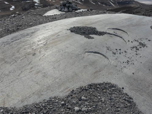
What a successful trip! I got to see the ice sheet and several geological features caused by glaciers. Now the fun part, the descent! It took me a little under 15 minutes to descend compared to the 90 minute climb. I had to stop for this picture of a musk-ox crossing. Although I did not see a musk-ox, I did eat one for dinner, musk-ox pad thai, yum!
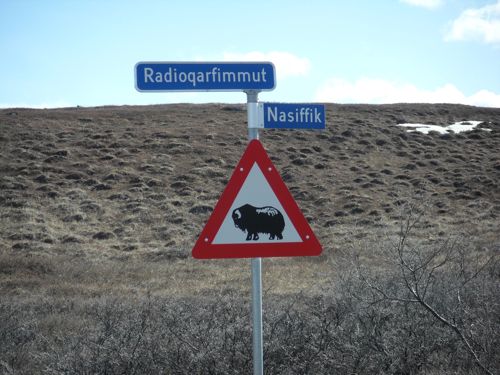 Muskoxen road sign on Black Ridge access road, Kangerlussuaq.
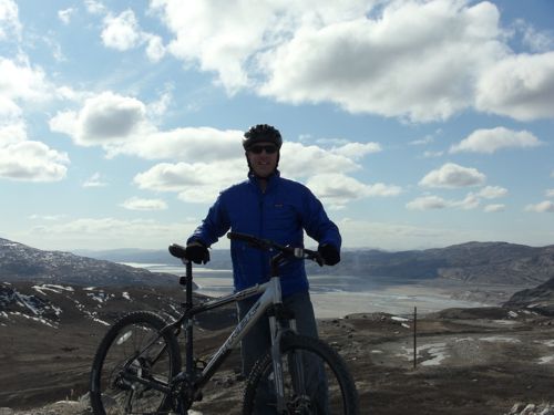 View from Black Ridge access road on bike.
.
Stay tuned for tomorrow’s flight status!

