Last night, Koni called the local car rental agency and arranged to have a car delivered to us at 9am; we are going to the ice sheet! After a quick breakfast, we jumped in the red Toyota diesel pickup, and started the 1.5-hour drive to the edge of the ice sheet. More commonly referred to as the Russell glacier, it actually flows from the edge of the Greenland ice sheet.
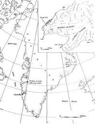 Map showing location of Russell Glacier
The drive was quite spectacular. First, we drove past the most northern golf course in the world and then the remnants of a plane crash.
 Site of military plane wreckage. Rumor has it that the planes that wrecked here were put down on purpose due to poor landing conditions. The pilots were told to eject from the planes and crash them into the hill side.
There are several ways to get to the glacier. Some people, walk or ride a bike, others rent a car. Most people pay for the tour in town and ride in a big vehicle called a Unimog. To walk would take at least two days, riding a bike takes an entire day and driving a car takes 6 to 8 hours to see everything.
It was exciting to see the terminal moraines as we drove closer and closer to the edge of the ice sheet. A terminal moraine, also called end moraine, is a moraine that forms at the end of the glacier called the snout. Terminal moraines mark the maximum advance of the glacier. An end moraine is at the present boundary of the glacier. Terminal moraines are one of the most prominent types of moraines in the Arctic.
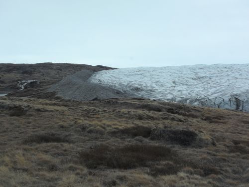 Terminal moraine
Each turn brought new and exciting features. The next big feature we stopped to look at was a huge waterfall. This waterfall is slowly etching its way into the metamorphosed gneiss rock.
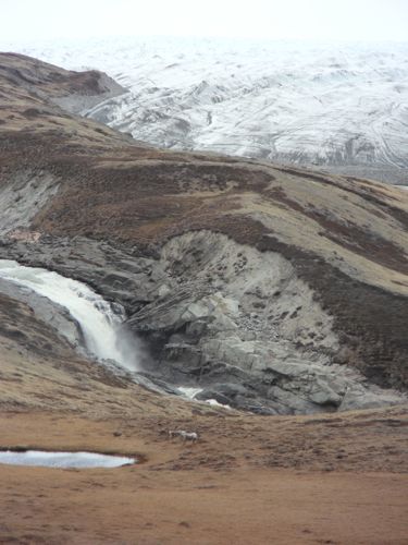 Large waterfall on the way to the ice sheet
After a few more miles we were at the end of the road. The road was actually built by Volkswagen about a decade ago so they could drive some of their vehicles onto the ice sheet for a test track. You can still walk on to the ice sheet, but unfortunately, you can no longer drive a vehicle due to the deteriorating conditions.
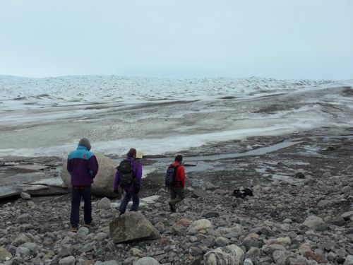 Steffen group walking to ice sheet
On our way back to the truck, we ran into a group of people snowmobiling and carrying equipment. At first we thought they were scientist, but we eventually found out that they were filming a new documentary on climate change. Greenland has become the hotbed for climate related films and meetings recently.
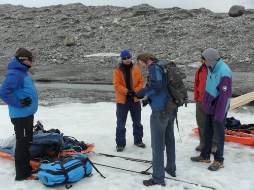 European film team working on climate documentary
Once we were back in the truck, we decided it was time to head to Russell glacier. On the way we stopped and took in more of the beautiful Greenland scenery.
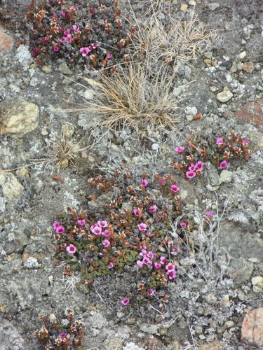 Arctic flowers
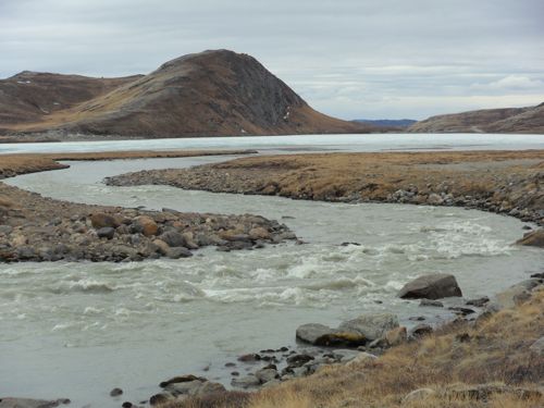 Meandering glacial melt stream
The next big stop required a short hike. We wanted to investigate the large waterfall we observed earlier, so we parked the truck on the side of the road and hiked about 20 minutes to the waterfall. It was much more impressive up close. You could hear the water pounding the rock below as it churns and erodes its way down the valley towards Kangerlussuaq.
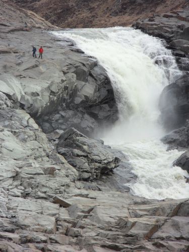 Large glacial melt waterfall
Al of the hiking required us to stop and take a short break behind some rocks. The wind was quite strong and very cold coming off of the glacier. I would estimate the temperatures were 10 degrees colder at the ice sheet.
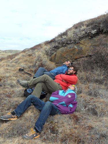 Lunch break and time to take in all mother nature has to offer!
After a short break, we drove to the next parking area and started the 45-minute hike to Russell glacier. Russell glacier is located 25 km (16 mi) east of Kangerlussuaq. It is active, advancing 25 m (82 ft) every year, and due to easy approach it remains a popular tourist target.
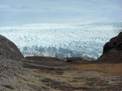 Russell glacier from nearby valley
 Hike to Russell glacier
Once we got closer, the size and power of the ice and water was overwhelming. You could hear the water rushing into and under the front of the ice sheet. Low, thunderous cracking noises would ripple through the air as the ice edged forward. We sat and watched, at the main observing area to see if a piece would fall off, but no luck.
 Looking down on Unimog and Russell glacier
We waited a few minutes and then decided to hike up towards the other end of the glacier. As we did we were amazed at the interesting rock outcrops. The large, banded metamorphic rocks were exposed and slightly polished for any lucky observer who happened to walk this way.
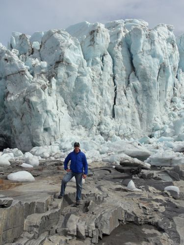 Russell Glacier - 20 to 40 meters high
As we approached the end of the glacier, we discovered multiple tunnels eroded into the glacier. There was a massive waterfall in one of the tunnels, and several places where water would flow out from the bottom of the glacier only to disappear back under the glacier a few hundred feet away.
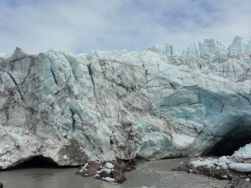 Face of Russell glacier with tunnels
As we were taking some pictures of the group, a large chunk of the glacier broke free, startling everyone. We waited patiently for more activity and after a few minutes, we were presented with another larger chunk of ice falling from the ceiling of a large arch.
Video of chunk
While it would have been nice to sit there and watch the glacier succumb to gravity and erosion, we had to get back due to the deteriorating weather conditions. The hike took another 45 minutes, but as soon as we got back to the truck, the rain started. Perfect timing!
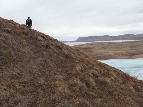 Hiking back from Russell glacier
The ride back to Kangerlussuaq was a quite one. Nikko and Simon dozed off, Koni drove the truck and I just tried to take in the scenery, because this may be my last time to visit such a wonderful place.

