Science Update
The science team has been working non-stop for the past few days. Between wrapping up the first incubation experiment, moving ahead with the next two incubation experiments, setting up individual experiments and station sampling along the Palmer LTER, every member of the science team has been working long hours. Today, we didn't start sampling until after breakfast. This gave most a chance to sleep a bit and to head to the bridge to check out some of the amazing scenery (see below). After spending a few days offshore in the Drake Passage, we were happy to move closer to land.
Ice From Above
Rain early in the evening followed by snow overnight created a coating of ice on most of the decks of the RVIB Palmer. The exception, however, is the main deck. This deck is heated to allow for safe operations on deck. Other locations of the ship that are coated in ice require care when walking or even standing. One major safety concern is ice falling from above. With sunny conditions throughout the morning and afternoon, many people headed to the decks for pictures. You must always look up to be sure you are in a safe location. During CTD deployments, you are sometimes required to stand in a particular spot. In these situations, hard hats are an important piece of on-deck safety equipment.
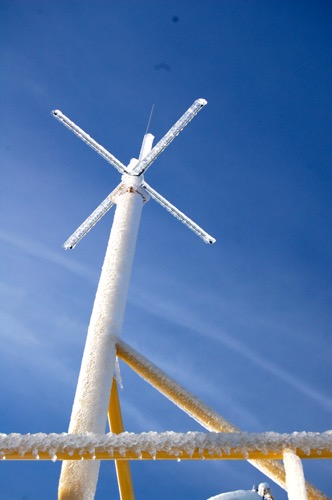
 Ice coats the railings, antennas and other equipment outside the bridge of the RVIB Palmer. These ice pieces would fall approximately 80 feet before they hit the water.
 A night of rain and snow left an inch or two of slush on the bow of the ship. After the sun broke through the clouds, most of the snow disappeared.
 Cara Pekarcik dresses in deck safety gear for CTD deployments. This gear includes a bright orange 'float coat', steel-toed rubber boots and a hard hat. Sunglasses were also important on this sunny day.
Gerlache Strait and Wilhelmina Bay
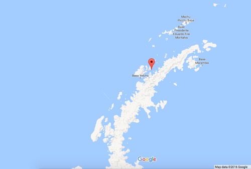
After sampling a Palmer LTER station in the southern Drake Passage, we left the Drake Passage and headed toward sampling stations in more protected regions closer to land. Overnight, we entered the Gerlache Strait, a well-known body of water separating the Palmer Archipelago from the continental Western Antarctic Peninsula.
 Gerlache Strait is shown on the map with the red marker. This strait separates the Palmer Archipelago from the continental portion of the Western Antarctic Peninsula. Brabant Island is directly underneath the red marker. Map data ©2016 Google
The Gerlache Strait was first explored between January and February 1898 during an expedition led by Lt. Adrien de Gerlache. Gerlache originally named the body of water Belgica after the expedition ship, but the name was later changed to honor the leader. This area is known for its beauty and for numerous wildlife sightings.
 The Gerlache Strait is known for beautiful scenery. This area is often filled with ice, as seen in this photo. For scale, the 'flag' is approximately 70ft off the waterline.
After sampling off the coast of Brabant Island (just under the red marker on the map), we continued to travel in a southwesterly direction to a narrow section of the strait. We turned to port and entered Wilhelmina Bay. I have one word for this location - BREATHTAKING! Wilhelmina Bay was named by Gerlache after the Queen of the Netherlands. It is a large bay surrounded by tall peaks and filled with ice. For many, this was our first opportunity to see the peninsula. This peninsula, while only a small portion of the continent, represents the entire land mass of Antarctica. We are looking at the tip of the 14.0 million square kilometer (5.4 million square mile) coldest continent on Earth. I don't know if I can speak for everyone aboard, but it is a special moment for me - a realization of a dream. I wake up every day and can't believe that I am here. I have one word for this entire experience - AMAZING!
 Snow and ice covered land masses dominate the landscape of Emma Island. This island is located at the mouth of Wilhelmina Bay.
 A view of Wilhelmina Bay from the 05 deck or bridge deck, looking aft (towards the back of the ship).
After another set of CTD casts to sample the Palmer LTER station in Wilhelmina Bay, we will head back to the Gerlache for the night and continue to navigate the Gerlache Strait to other sampling stations.


Comments