I awoke to a changed sea this morning!
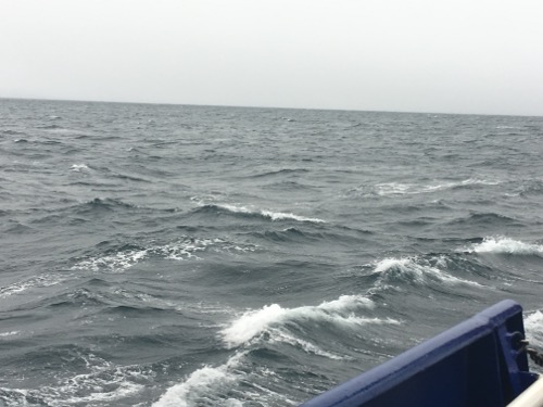 Waves off the aft-portion of the starboard side. R/V Sikuliaq. September 6, 2017. Photo by Lisa Seff.
I could feel the ship rolling and pitching a little more than it had been the past few days but it was hearing Dr. Mike Lowe say, "I'm hunting for more strapping" that caught my attention! When a storm event is headed your way it's time to add strapping and tie down anything and everything that might get damaged, or might do damage during rough seas! And the right time to tie things down is before the ship really starts to rock and roll!
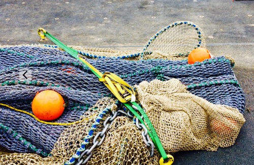 Mid-Water Trawl net strapped down to the deck during rough seas. Onboard the R/V Sikuliaq. September 2017. Photo by Lisa Seff.
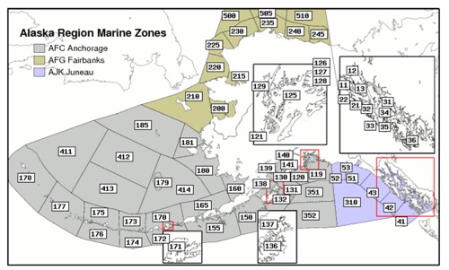 The R/V Sikuliaq is in Marine Zone 240 on the chart for Marine weather forecast! September 6, 2017. Photo by Lisa Seff.
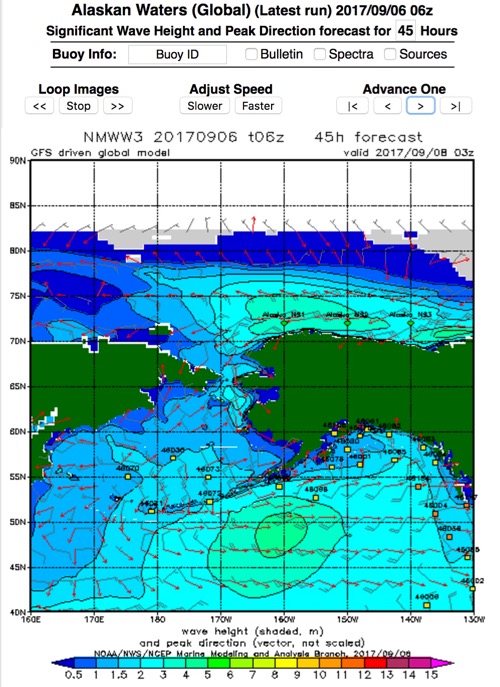 NOAA Wave Watch III Significant Wave Height. How high will our waves be? September 6, 2017. Photo by Lisa Seff
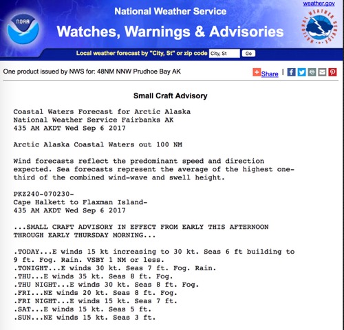 NOAA Watches, Warnings and Advisories! September 6, 2017. Photo by Lisa Seff
Compare and Contrast!
While we're up here preparing for heavy weather, I know that friends and family in Florida are preparing for a possible direct hit from Irma, a Category 5 Hurricane. Compare and contrast our weather data with Hurricane Irma data.
Notice any similarities? Any differences? Let me know in the "Ask the Team" area of the journal!
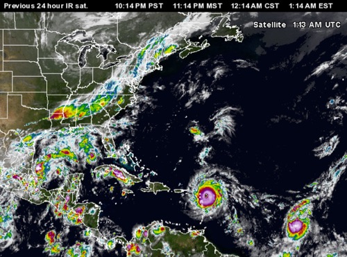 Hurricane Irma. Satellite view of the Eastern United States. September 6, 2017. Screen shot by Lisa Seff from the website:https://www.wunderground.com/hurricane/atlantic/2017/hurricane-irma?map=sat
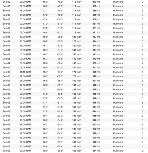 Screen shot of Hurricane Irma data from www.wunderground.com website. Screenshot September 6, 2017 by Lisa Seff.
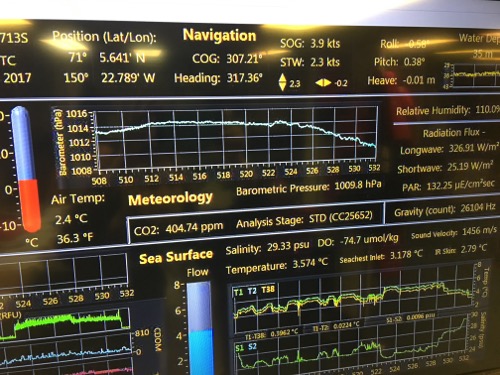 R/V Sikuliaq Underway Data Display of the barometric air pressure. September 6, 2017. Photo by Lisa Seff.
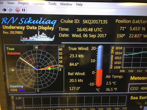 R/V Sikuliaq Underway Data Display of wind speed and temperature. September 6, 2017. Photo by Lisa Seff.
Other questions for you!
What makes a storm earn the classification of a hurricane? Can a hurricane occur in the Arctic? Why or why not? Do a little research and let me know what you figure out!
Links!
NOAA Marine Forecast: Go to the following link, click on the Alaska Marine Zone #240 and you'll be taken to our forecast area http://www.weather.gov/afc/marine
NOAA Wave Watch III Significant Wave Height: Have fun playing around with this site too! http://polar.ncep.noaa.gov/waves/viewer.shtml?-multi_1- latest-alaska-hs
Wunderground Hurricane & Tropical Cyclone Information:https://www.wunderground.com/hurricane


Comments
Add new comment