Cruise Day 2
Speed 12 knots (kts)
Course 308° (NW)
Location Southern Bering Sea, approx. 55 nm SE of Pribliof Islands, 56.40° N, 171.25° W
Depth 145 m
GO DEEPER DISCUSSION: (see previous journal for the questions.)
Each Niskin bottle on the 36-bottle CTC holds 10 liters of water. A liter of seawater with average salinity weighs about 1.035 kg (1035 grams.) You may recall that pure water, with a density of exactly 1 g/ml, would weigh 1000 grams or 1 kilogram per liter. But when salt dissolves in water it causes the density to rise. In average seawater, there are about 35 grams of salts dissolved in every liter of water, thus the weight of about 1035 grams per liter (1000 grams from water and 35 grams from salts.)
So, we take 1.035 kg/liter x 10 liters x 36 bottles to get about 372.6 kilograms of water. To figure out how many pounds this is, we multiply: ~2.2 lbs/kg x 372.6 kg = about 820 lbs. This is nearly equal to the empty weight of the CTD, so when it comes aboard full of water it weighs about twice as much as it did when it went overboard.
TODAY'S JOURNAL:
Yesterday we departed Dutch Harbor right on time, sailing out through soaring sea cliffs on either side of the harbor. Once out to sea we turned northwest, roughly paralleling the continental slope that underlies much of the Bering Sea. Once out in the open ocean we had briefs from the Captain and many department heads on how shipboard life works, safety guidelines, a lifeboat drill, etc.
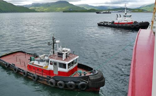 Two tugboats arrived to pull the Healy away from the dock once we unmoored and then turned the bow in the proper direction for us to steam out of harbor under our own power.
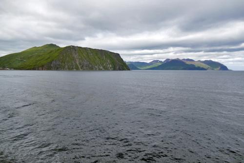 A last look back at the steeply rising slopes of Unalaska Island as we sail into the Bering Sea.
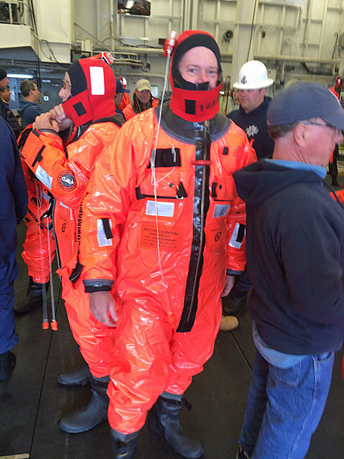 Survival Suit / After finding our group assigned to a particular life boat, we all tried on survival suits. These are a bit updated from the older “Gumby” suits but still kind of a pain to pull on. However, that would be well worth it if they were ever needed!
After dinner we paused for a quick CTD cast. There were a few goals to meet on this cast. First, the cast was made with the GEOTRACES CTD carousel. This carousel will be retrieving water samples to be analyzed for very minute amounts of trace metals such as iron and zinc, so contamination of any kind would present a problem. We are already on a roughly 16,000-ton piece of iron (in the form of a steel icebreaker), but once the CTD gets sufficiently below the surface we shouldn’t be getting any metal contamination from the ship. Our “regular” CTDs can be a source of stray iron from the steel frame of the rosette, the cable raising and lowering the device, and any other hardware such as hose clamps etc. So to keep the trace metal samples clean, the GEOTRACES CTD frame is made of coated aluminum, no steel hardware is used in any of the fittings, and the winch cable is made of a non-metallic fiber called Vectran (similar to Kevlar) with a polyurethane coating. The cable has 4 insulated copper strands running down the middle to carry signals to and from the CTD carousel, such as receiving salinity and temperature data from the water column and sending the signals to trigger bottles closed when desired. Finally, the bottles are triggered as the CTD is rising up into pristine water, so even if there was a small amount of contamination coming from the rosette (say, a bit of aluminum), the top of the bottle would be rising into clean water as it was sampled to avoid any cleanliness problems. This CTD is deployed off the back of the ship using the stern A-frame crane, while our other CTD rosettes go off the starboard side (right side facing forward) via a little garage-like staging bay and the starboard A-frame crane.
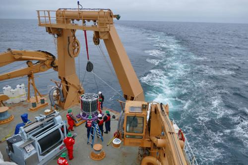 The GEOTRACES CTD being set up on the fantail deck.
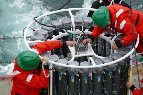 Members of the science team set triggers for each bottle. When the message is sent down the conducting cable, a hook will let go of the loop of line to trigger the end caps closed.
The first GEOTRACES CTD cast had a few goals:
- First, to test the systems involved and get the crew of scientists and Coast Guard personal involved familiar with their roles and the sequence of events. For example, the special winch gave its operator a little difficulty so today they are fine-tuning the mechanism that wasn’t working well.
- Second, to rinse and condition the sampling bottles. No analysis will be done on this water, but additional cleanliness was gained by letting fresh seawater rinse the bottles and then sit in the containers for a day or so before draining them.
 The GEOTRACES CTC being set up on the fantail deck.
This morning I got to do some birdwatching, hunting for seabirds that thrive in the cold, rich Bering Sea. There were lots of Northern Fulmars and Fork-tailed Storm-Petrels around the ship for the hour or so I scanned the waves. I saw two Black-footed Albatrosses, several Short-tailed Shearwaters, occasional Tufted Puffins, and a pair of Least Auklets. A group of three Ruddy Turnstones circled the ship several times, and one landed on the bow to take a break for a while before resuming its migration. Most exciting for me, though, was a Red-legged Kittiwake. It was the first time I have ever seen that species, a so-called life-bird or “lifer.” Two Humpback Whales were spotted ahead of the ship, and the crew slightly adjusted course to give them plenty of sea room as we passed by. We also passed several fishing vessels far on the horizon (or beyond on radar), plying the Bering Sea for seafood.
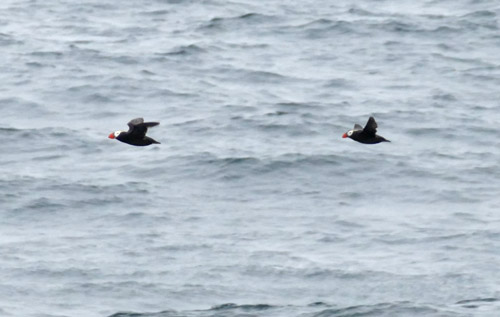 A pair of Tufted Puffins zipping by ahead of USCGC Healy in the Bering Sea.
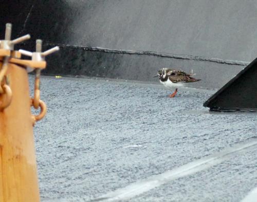 A migrating Ruddy Turnstone took a break from crossing the Bering Sea by resting on the bow of Healy.
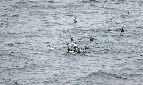 Several types of seabirds found something in the water to squabble over. Here we see Northern Fulmars (some are brown and some white, mostly in the bunched-up group), Short-tailed Shearwaters (the two nearly black birds, both with wings up), Fork-tailed Storm-Petrels (the 4 small gray birds across the top), Red-legged Kittiwakes (small white bird with dark-looking wings on left & bird showing coral-red legs coming in to land in the tight group) & a Black Kittiwake (gull-like white bird with raised wings showing black wingtips in-between the Red-legged Kittiwakes.)
Tomorrow there is another rinse station scheduled using different CTDs, testing some pumps, and working out the details on the various methods of analysis in preparation for the first full sampling station which will follow shortly later in the week.
 The science team meets to plan the next few science stations in our meeting room / lounge space on the second deck.
GO DEEPER!
One of the things I love about Healy is the accessibility of a map server. Lots of great real-time data is available on the server, such as the bathymetry we are sailing over. Check out the screen grab below- what major oceanographic sea-floor features can you see on the map? (The red dot is our current position, the dark red line is the course we’ve traveled so far, and the little ship outline shape indicates the direction we are traveling.)
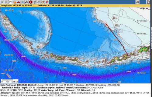 Screen Shot from Map Server of our Departure Track.
Aloft Con web cam updated every hour
Healy Track
That's all for now. Best- Bill

