In the past few weeks I have had the opportunity to work with amazing researchers and familiarize myself with all of the projects that they are involved with here in the arctic region of Northern Alaska. As I learn what the research entails, I have become astounded by how technology helps drive science further. Many of the instrumentation that is being used; such as drones, Lidar, GPS tracking are essential to gathering accurate data out in the field.
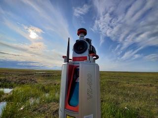
 Lidar VZ400 being used to conduct a terrestrial scan in Atqasuk, Alaska.
Light Detection and Ranging (Lidar) is used just like radar and sonar with the exception that is uses light waves; not radio waves or sound waves. For more information click here A Lidar scanner will send various points of light in the forms of lasers to various scanning locations. From there, these lasers will bounce back to the scanner, thus developing a 3D scan of the area for researchers to process in the lab via their computer applications. With this new form of technology, scientists are able to capture 3D images of areas in different parts of the world.
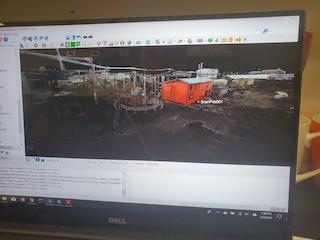
 A 3D Lidar Scan of Utqiagvik, Alaska being analyzed through a computer.
The International Tundra Experiment (ITEX) is a collaboration of various research institutions that are examining the effects of global warming in the arctic regions. I have had the chance to participate with The University of Texas at El Paso’s Systems Ecology Lab with gathering data using Lidar during this arctic field season. Lidar is especially useful in looking at areas that are experiencing coastal erosion and the changes of topography in landscapes affected by climate change.
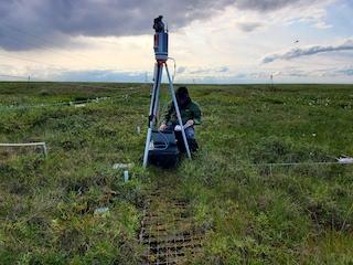
 GPS Technician, Ryan Cody, conducts a Lidar scan of Atqasuk, Alaska.
The research team has been conducting Terrestrial Lidar scanning in Northern Alaska since 2010. Since then, the Lidar scanning locations have grown to include 3 main locations with various scans at each of these places. The main locations include: Utqiagvik, Toolik Field Station & Atqasuk. With this new form of technology scientists can gather data with much more precision and accuracy.
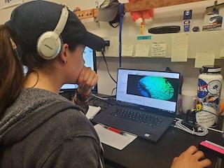
 Doctoral student, Tabatha Fuson, analyzes Lidar scans on the computer.
Lidar is essential when looking at the effects of warming in the arctic region. One main issue that is being monitored is the effects that permafrost thaw is having in the coastal regions where erosion is occurring at rapid rates. In addition, the tundra’s land surface is lowering from year to year. These acts are having vast impacts on the communities with the destruction of their homes and roads along the coasts. There are also changes in vegetation, due to excess drainage of water into the ocean. Lidar is one contributing form of technology that is providing scientists with data to support these impactful findings.


Comments
Add new comment