I've told you that we are at WAIS Divide, and a little bit about what life is like here, but I haven't told you much about what WAIS Divide is, why it's significant, and why we are doing our research here.
So this next series of posts will be your basic primer on the science of WAIS Divide.
All about the WAIS (not the treble)!
Part 1: What's in a Name?
 The logo for WAIS Divide.
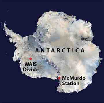
WAIS stands for the West Antarctic Ice Sheet. This is fairly straightforward. Antarctica is composed of a West and an East side, with the Transantarctic Mountains cutting right through it.
 We are currently right in the middle of West Antarctica.
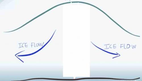
What many people don't realize is that an ice sheet is not static; rather, it is a dynamic body of water that exists largely in a frozen state. Just because it's frozen does not mean that it just sits there. Ice sheets, like glaciers, move slowly over time. Similar to streams and rivers, ice sheets generally flow downhill and toward open water.
 As this diagram shows, ice flows from high to low, and from the center of a land mass out toward open water. Image credit: Erin Pettit.
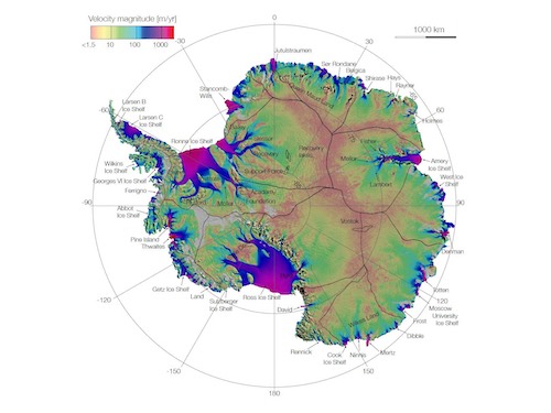
So the "Divide" part of WAIS Divide's name comes from the fact that we sit at the point where the flow of ice beneath us divides into two separate directions, and flows towards two distinct bodies of water. To the west is the Ross Sea and to the east is the Amundsen Sea.
 This diagram shows the movement of ice all over Antarctica. Ice at WAIS Divide flows either towards the Pine Island and Thwaites Glaciers and out to the Amundsen Sea, or toward the Ross Ice Shelf and out into the Ross Sea.
To be continued...

