....is this your first visit to my journal? Start on Day 1! Don't worry, we'll wait till you get back
Yesterday Dr. Jennifer Watts, one of the two main scientists I will be working with, arrived so we could head 60 miles south by a small prop plane (seating 6 + 2 pilots) to Atqasuk, an Inupiat village of around 250 residents.
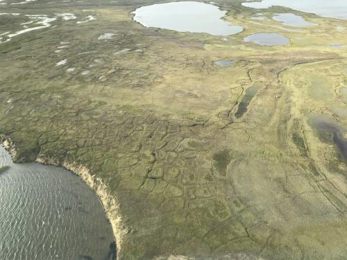 Views from the plane – notice the polygon shapes with lowered centers caused by permafrost thaw.
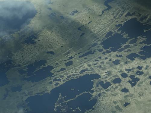 Here you can see thawing permafrost polygons combining to form larger bodies of water.
We landed on a dirt runway and the fun began. We went to get the truck left for us – but couldn't find the keys – and waived down a ride from the last car before it pulled away – the walk into the village would have been a little less than a mile.
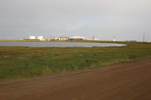 View of the village of Atqasuk from the landing strip.
When we reached the Science house, our key didn't work. It was pretty cold out, but thankfully we got a hold of another researcher who told us the trick – wiggling up and down with lots of force. We got in. Our luck started to turn around when we got a warm welcome at our first stop of the day, the Meade River school. This school serves ~40-60 students grades pre K-12. The building and facilities are large, new, and very well taken care of.
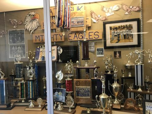 Students at the Meade River School are very proud of their basketball team – hoping for some science trophies next year!
Despite the small number of students, there seem to be a fair number of teachers at the school (5-10?). Our mission was to find some missing data monitoring materials from a citizen science project that Dr. Watts had begun to partner on with the school. This hunt began with the principal. The principal was warm, welcoming, and enthusiastic about having a group of scientists show up to the school unexpectedly – this was especially impressive since it was her second day on the job! She introduced us to a few teachers and we were eventually able to find the box and a CO2 monitor. The cool thing about the hunt for the materials was it helped us meet different teachers in the building and start to broach the idea of future collaborations and projects. One teacher, Rod, who has been at the school for many years immediately came up with the idea to use the C02 monitor for an independent study/credit recovery for upper-grade level students. I was really excited about this idea because it had all the makings of a successful project – active, inquiry-based, student-centered, etc. He was thinking of having students go around to different parts of the village and gather data throughout the semester to formulate a hypothesis on why readings may be similar or different. We left the meter with him; I can't wait to hear how the project goes!
We also got to meet with and observe the class of a new teacher, Steve, who focuses on the high school students. One (of the many) classes he teaches is North Slope Science. This class could potentially use the monitoring stations Dr. Watts has set up for a citizen science project. This is the class we got to observe and Dr. Watts gave an impromptu (and interactive) lesson on what the stations are trying to measure and why.
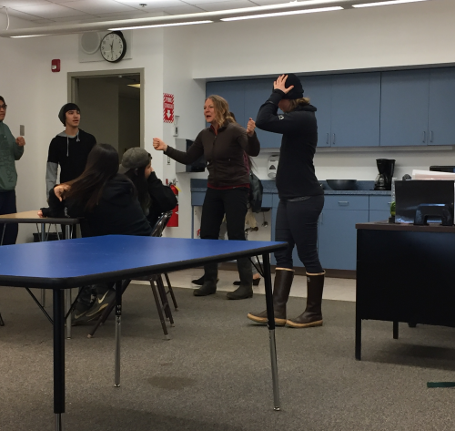 Dr. Watts did a good job getting the students involved in the lesson plan.
Down by the river Dr. Watts has set up a tower that is monitoring air temperature, soil moisture and temperature, and a trail camera. This camera takes a photo everyday at 1pm. All of this equipment was installed last summer with help of local school children. We checked the station and pulled the data it has collected over the last year. Hopefully this will be something students can be trained to do and monitor in the future.
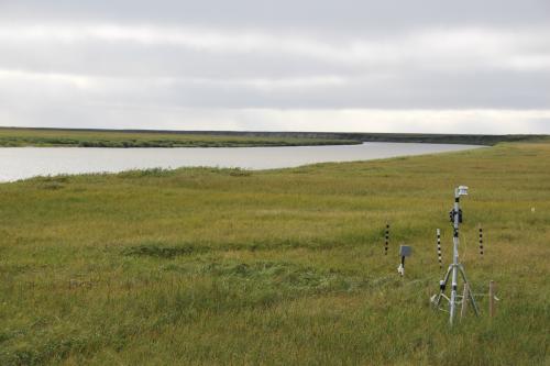 Monitoring station down by the river.
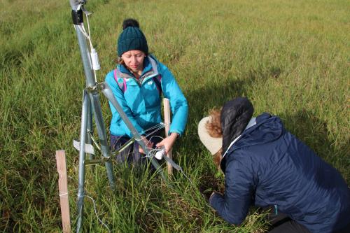 Getting data off the monitoring station.
Below is a a video of the photos taken over the last year. These photos, through visual analysis, can be used to observe several important happenings: when the river freezes and thaws, snow levels (striped sticks give depth reference points), and greening/browning of the vegetation. I think this type of data is especially useful when engaging students. Watch and see what a year is like in Atqasuk:
Did you see anything that surprised you? What day does the river thaw? What day does the vegetation green after the winter? How deep is the snow? How often is it sunny? (note: some photos are missing because the camera got covered with dirt)
Through visiting the school and brainstorming with Dr. Watts, there are so many possibilities and collaborations for citizen science projects with this school in the future: * What if we got the students in Steve's North Slope Science class "talking" with my students through flipgrid videos?
What if we got the school a tablet to help students with collecting data from the tower?
What if we built a monitoring station similar to the one in Atqasuk in Weston?
What if the students in both communities started comparing data and observations?
What if we got the students in Atqasuk GIS training?
While we will start small, there are lots of possibilities – so ARCUS, NSF, National Geographic, and WEEFC – get ready for some proposals coming your way!
While we had hoped to spend the night in Atqasuk, we heard over the radio that all planes might be canceled for the next day, and we had one more opportunity to catch a flight out. In addition to that, after using an ATV (my first ever!) to go back and get the truck once we found the keys, we found out the truck was running on empty – and it had been used by other research teams throughout the day – meaning it (maybe) had one trip left. We made it to the landing strip and waited in the cold for a couple hours hoping for a plane. Given Dr. Watts' commitment to working with the community, she had the number of the airline gate agent – and we were able to get some updates. The plane arrived a little after 6pm and we made it back to Utqiagvik to catch our flights the next day. Up next – Fairbanks adventures!
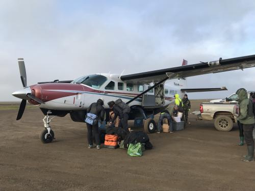 Boarding the last plane out - for maybe a couple of days!
Further Reading
Want to know more? Check out Alaska Dispatch News' article on a citizen science initiative focused on foraging and berries.
Today's 360 Image
Spin around to see how close the monitoring station is to the school (blue building).


Comments
Add new comment