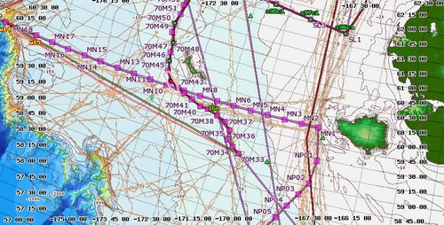
Yesterday, science was once again underway. The weather has been difficult to deal with to say the least. We were working stations on the 70M line. There is a short weather window predicted of conditions favorable for conducting science operations and of that we are taking full advantage. St. Matthew Island is close enough to seek refuge if the weather conditions deteriorate.
 Healy headed to the 70 meter line with St. Matthew close to offer refuge!
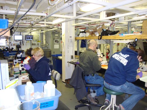
As we processed samples from the net tows, every microscope was occupied! Dr. Campbell “picked” krill for Kristina to process for CHN analysis. Donna “picked” Pseudocalanus for Celia to process for CHN analysis.
 Every microscope was working to process the sample!
A little excitement yesterday, as Krista was watching the map server, TWO ships appeared in our proximity! This is the FIRST time since we left Seward Harbor that we have seen any other ships! I dashed off to the Bridge to find out who these ships were and what they were doing. The two ships were Beauty Bay and Valiant. They are fishing vessels. Too bad they were too far off to see – only visible on the radar screen and map server!
 The FIRST time we have encountered OTHER ships!!
The Bering Sea was named after Vitus Bering, a Dutch navigator in Russian service. In 1728, he was the first European to systematically explore the region sailing from the Pacific Ocean to to the Arctic Ocean. Many scientists believe that during the last ice age, the sea level was low enough that humans could walk across the "Bering land Bridge" - now seen as the Bering Strait. Some even believe this may have been the first point of entry for humans into the Americas.
The Bering Sea is world known for it's enormously productive and profitable fisheries. What makes the Bering region so biologically rich? The first driver of primary productivity is the Bering Sea shelf break. This is an area where nutrient upwelling provides for constant phytoplankton production. The second driver in primary productivity is seasonal sea ice. Sea ice melting in the spring drops the salinity of the surface waters which cause stratification and in turn increased phytoplankton production and algal blooms.
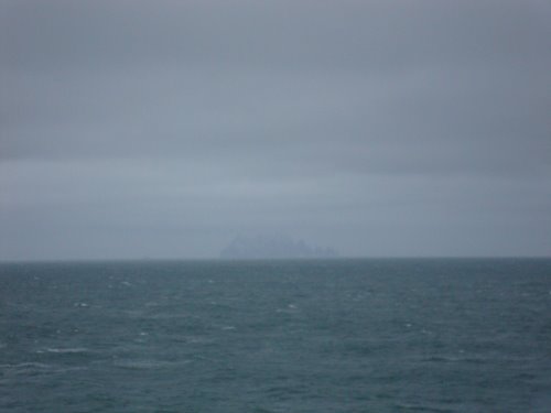
 Can you see St. Matthew Island?
According to the NOAA's Bering Climate and Ecosystem Status report, the climate of the Bering Sea region has changed twice over the past 50 years. The region has experienced an increased temperature shift in the late 1970's and again in the 2000's. It is feared these changes may continue as a result of a lack of sea ice. A lack of sea ice, decreases the albedo of the ocean's surface that causes it to absorb more of the sun's energy. This will in turn, increase the water temperature which will lead to a continued lack of sea ice which will perpetuate the cycle.
To read more about the status of the Bering Sea, check out http://www.beringclimate.noaa.gov/bering_status_overview.html
New vocabulary
albedo-Albedo is the fraction of solar energy (shortwave radiation) reflected from the Earth back into space. It is a measure of the reflectivity of the earth's surface. Ice, especially with snow on top of it, has a high albedo: most sunlight hitting the surface bounces back towards space. Water is much more absorbent and less reflective. So, if there is a lot of water, more solar radiation is absorbed by the ocean than when ice dominates.
Question of the Day
Find another interesting fact about the Bering Sea. Cite your resource.
Stay tuned as we continue our exciting voyage on the USCG Cutter Healy. Until then...
“Live as if you were to die tomorrow. Learn as if you were to live forever” - Mohandas Gandhi

