**Its all about the water.............. **
Ocean water is like a sandwich. It is stratified-- full of horizontal layers some of which do, and others which do not, mix well with the layers near-by. These layers are determined by the density of the water. The primary factors affecting ocean water density are its salinity (how much salt is in the water) and temperature. However, in the Arctic the water temperature is fairly constant at just above freezing, so water density is determined primarily by salinity. The biggest sources of fresh water are rivers, rain and snow and ice melting. Scientists sample water at specific depths, which represent these different layers, then measure a variety of factors in each sample. In this way, scientists "cut through the sandwich" exposing each layer, making a vertical picture of the ocean. The more factors tested, the more detailed and informative this picture is.
We collect a lot of water. What is done with all this H2O? Here are a few of the processes......
Rick Nelson and Nes Sutherland test the water for chlorofluorocarbons (CFCs). Although CFCs are no longer used on the North American continent, their progress through the Earth's water system is still being tracked. Monitoring where the CFCs flow is a good marker for where ocean waters flow.
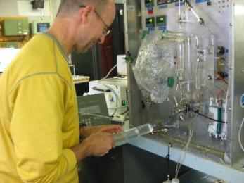 Rick Nelson loads a sample on the the gas chromatograph for CFC analysis. The sample has to be analyzed right away to minimize air contamination.
Linda White measures the nutrient content of the water. Just like you might test your garden soil for NPK, nitrogen, phosphate and potassium, Linda tests the water for NPS, nitrates, phosphates and silicates (a critical nutrient for ocean life). Scientists use nutrient signatures to identify the source of water.
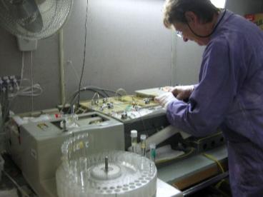 Linda, an 7-year veteran of LSSL science cruises, runs the auto-analyser to measure nutruient concentrations. Note her awesome purple tie-dye lab coat.
Melissa Hennekes measures ammonium, another water source marker. Ammonium is an especially good "winter water marker" because as ice forms the salt in the water is left behind, making the surface water saltier and thus more dense. This more dense water sinks, and can be identified as a specific water layer, especially along the continental shelf.
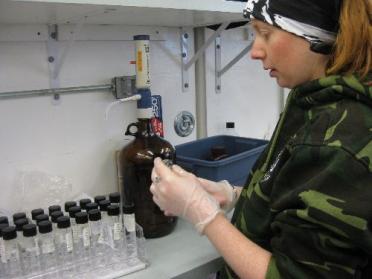 Melissa prepares her samples for nitrogen measurement.
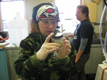 Melissa realy likes ocean critters and has found a surprise in one of the bongo net collection bottles.
Hugh Maclean measures the oxygen content of water. Remember: cold water holds more dissolved gas than warm water, so these Arctic waters can have a lot of oxygen! Of course, oxygen is necessary for life so low amounts indicate not many living things. This oxygen gets into ocean water primarily by the water interacting with the air at the surface. Ice floating on the water blocks this interaction. Thus the oxygen concentration can tell you about how much a specific layer with the surface or how much life that layer can support.
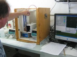 Hugh Mclean measures the dissolved oxygen content on the *Winkler*
Chad Cuss measures the amount of organic matter -- the dissolved "detritus" -- in the layers. Knowing how much of this material is available for biological and physical processes at each layer of the "sandwich" helps to complete the ocean current picture.
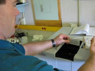 Chad Cuss checks for CDOM *colored dissolved organic matter* in the sea water.
Collecting this water is a 24/7 operation. When we get to the location of interest, the scientists go to work. Of course, being in the Arctic in summer means there is always light; still, it is a bit surreal. It is also hard, cold work. To get an idea of what water sampling is like, get a bowl of ice water and the parts to a small plastic toy such as a Lego guy, the more small parts the better. The water temperature should be just above freezing, about 2 degrees C. Put lab gloves on your hands (so that you don't contaminate the water). These gloves act in a mysterious "cold amplification" way. I am not sure how that works....Now put your hands into the water and start to build the Lego guy. This is water sampling: manipulating plastic parts in cold, cold water.
Of course, it is also fun:
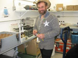 Mike, the Sample Sherrif. He is more important than the Sample Cop.
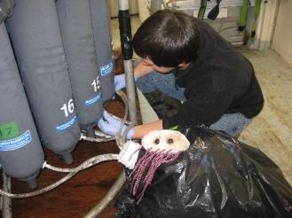 Kenny and *Eli* collect ocean water for chlorophyll analysis.
On another interesting note: We are heading south, yet we are seeing more ice? How can this be? I asked Alice Orlich from University of Fairbanks about this. One explanation could be that as we get closer to land (Alaska), we are seeing chunks of land fast ice, ice that has formed attached to land. During summer, this ice melts and breaks off and floats around in the sea. Support for this idea can be seen in the ice.
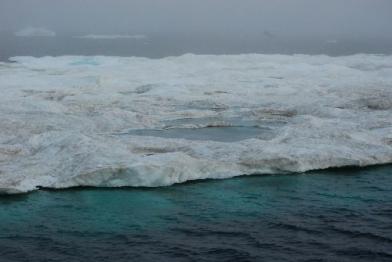 We are sailing south, yet seeing more ice. One theory is that we are seeing chuncks of land fast ice that has broken free and is being blown by the wind. Note the dirt. It may have come on the ice from the land via wind and errosion. Photo courtsey of Brian Hunt.
The dirt in the ice is from shore, brought on to the ice by wind and erosion.
The sun is out, so I leave you with warm thoughts!
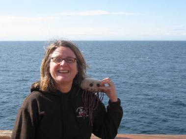 Eli and I take in some rays on the heli deck
So long, for now, from the Louis

