Back in the Air
We flew a fantastic mission to the East Coast of Greenland today. That area has some of the most scenic coastline you'll ever see - ice or no ice. And some of the most predicable turbulence. We had modest turbulence for much of our time over there, enough to spill coffee creamer all over the back of the plane and temporarily knock offline one of our ATM's (lasers).
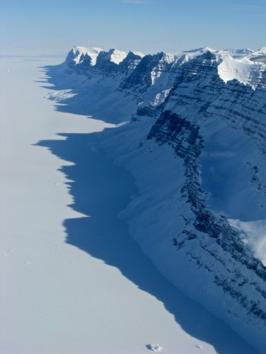
 The transition from sea to mountains is often abrupt on the east coast. This row of mountains looked like a saw blade extending into the distance.
Flying along the coast we saw lots of polar bear tracks again. Our pilot actually spotted one but nobody else was quick enough to set eyes on it much less snap a photo. Too bad! I sat atop the engine covers looking out the window, following polar bear tracks as we flew along and hoping to spot an actual bear. But it was not to be. At one point, the set of tracks I was following left the sea ice, headed up and over a mountain I'd guess to be about 1500' tall, and then came right back down. Maybe it wanted to get a good view of all the seal breathing holes in the area? Who knows, but surely it couldn't have expected to find food up there.
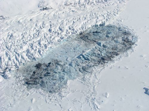
 Who says glaciers can't fall apart in winter. I'm not sure what happened here but it appears that an iceberg broke off from this glacier and simply disintegrated.
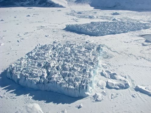
 Sometimes icebergs simply look like small glaciers themselves. These two icebergs have retained their integrity despite the heavy crevassing present. Once the sea ice melts they will fall apart quickly. The closer one is roughly 100' high by 1000' long.
The mountains in this part of Greenland seem to go on forever in carbon copy fashion - they all look so similar to one another, layered with sedimentary deposits stacked several rows high. Tucked into one corner here is Greenland's highest mountain, Gunnbjørn Fjeld, at 12,139 feet. We flew right past it.
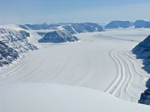
 I took this photo because I like how even with the new snow you could see the lateral moraine deposits from tributary glaciers (the snow covered ridges). The white thing at the bottom is not part of the plane but a snow covered mountain we are skimming over.
NASA Videos Worth Watching
This year NASA's OIB team has been travelling with a professional photographer/videographer who has been working alongside everyone else to produce short clips about what we're doing here. And I am going to shamelessly exploit this opportunity.
All of the videos below are courtesy of NASA and have been shot, edited, and produced by Michael Starobin. Besides doing a fantastic job on these videos - way better than anything I could produce - Michael partnered with me to make yesterday's apple crisps. We work well together. Without further ado...
This first video provides a brief glimpse of what a typical day looks like for our team. I've given a more detailed, hour by hour description here. But his video provides a better idea of how the parts fit together.
http://youtu.be/TpeKyWQaxQA
This next video details the Airborne Topographic Mapper - our green laser. We actually have two of these on board, one narrow angle and one wide angle. Michael interviews Jim Yungel, the most senior scientist on the team. Jim has been running lasers since before some of the team's scientists were born.
http://
Finally, this last video titled "Over Ice" discusses the P3 in a bit more detail. Again, I have done some of that already here, but Michael has nice interviews with both one of our pilots and some of our engineers/ground crew.
http://
The weather doesn't look good for flying tomorrow. We'll see...


Comments