Last Flight
Clouds continued to sock in most of Greenland this morning so none of those routes were available. Our only other alternative was a low priority mission that over Baffin Island, Canada. It costs a lot of money to fly any mission but with the number of weather delays we have had thus far it also becomes costly to do nothing. So the decision was made: off to Canada.
Flying over Canada requires that we inform them ahead of time that we are coming. There are two reasons for this: One is that we fly very low and the other is that we are shining a laser on the ground the entire time. Our pilots dutifully called and emailed the proper authorities last night telling them that we likely would be flying over there today. (They could not be more sure than that because no flight plan is locked in until we consider the morning weather briefing.)
Side note: The relationship the OIB crew has with the Kager weather people is unique. John Sonntag (our meteorologist/navigator) and Michael Studinger (the project leader) visit the "met" office twice a day - just before and after we fly. Because of this we can give the Kanger weather forecasters real-world feedback about the accuracy of their prediction each day. Every evening we can tell them how the morning forecast panned out and give them specific details about what we encountered in various regions. In this way they learn to better interpret their computer models and hence increase their forecast accuracy. This symbiosis has generated a tight connection between the OIB crew and the "met office" workers. Four officials take turns staffing the office in pairs, 24/7. They literally work half their lives. To show our thanks the OIB team tries to take each one of them on a flight while based in Kanger.
The target today was the Penny Ice Cap, a small ice field located in the southern half of Baffin Island. Upon arrival I could more fully appreciate exactly how small it was - we could fly across it in about 12 minutes or so. The center of the icecap is still over one kilometer deep according to our MCoRDS radar. But the western and southern margins contain considerable meltwater lakes, and moraine deposits suggesting a fading ice cap. The other sides of the ice cap spill out into valley glaciers that wind through towering rock walls. To the north these glaciers end in the ocean while the eastern glacier terminals are landlocked. Mountaineers have taken note of the sheer walls that rim the ice cap and travel here each summer looking for new routes up these incredible mountains.
The flight began with an hour long flight at altitude over Davis Strait, the body of water between Greenland and the Canadian Archipelago. As we headed west the clouds parted revealing tight clusters of pan ice below.
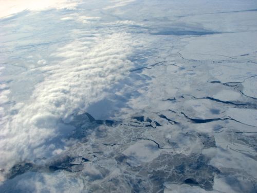 As we flew west across Davis Strait, the clouds gave way to a view of the sea ice. This photo catches the last edge of the clouds.
Polar bears may have been cruising the ice looking for seals but we were far too high to look for them. Even at low altitude it is difficult to spot them in this kind of ice - the seams where the pans have collided and stuck together are almost impossible to distinguish from a wandering polar bear track. You'd just have to be lucky. I was also looking for any kind of whale - narwhals would have worked - but saw none.
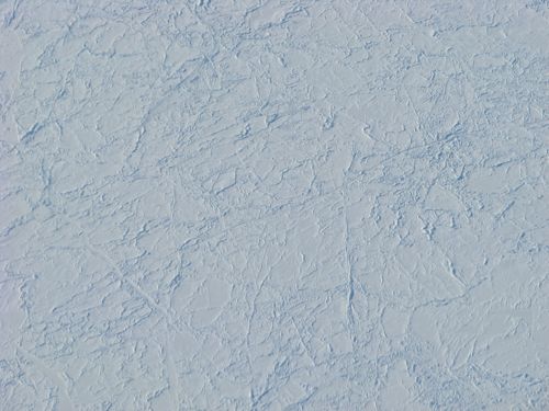 A close up of pan ice. You can imagine how difficult it would be to find a trail of polar bear footprints in this.
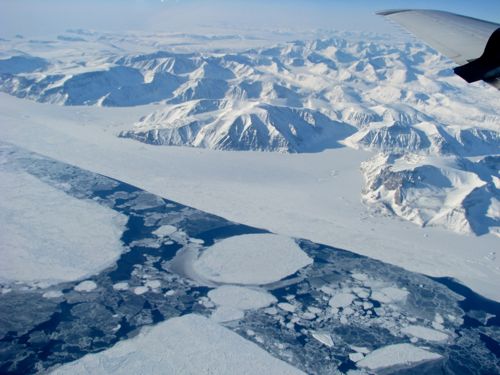 Fast ice is the ice that sticks to the edge of the land. This is the ice that Greenlanders use to travel and hunt upon. Fast ice along the coast of Greenland has been smaller in extent in recent years, affecting travel and hunting. Melting fast ice has even cancelled annual sled dog races in northern Greenland.
Despite a reputation for turbulence we found very calm air over the area - John and the Kanger "met" officials predicted as much. The Penny Ice Cap route is among the most sinuous routes we fly - a pilot's delight.
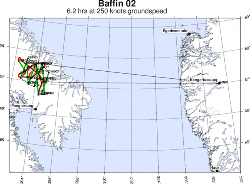 Out route for today. You can see how it weaves and winds throughout one specific region of Baffin Island.
Here are a few photos showing what the more scenic regions of the ice cap looked like. I understand why mountaineers climb here.
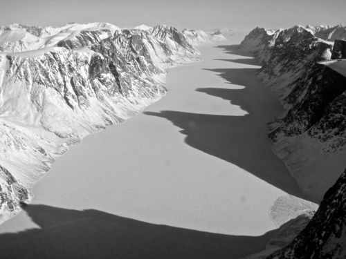 I love the line up of shadows down this fjord.
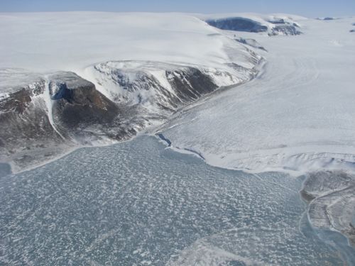 This is what the edge of the Penny Ice Cap looks like on the west side. There are no grand fjords or tidewater glaciers here. The ice simply thins until it disappears, often into a melt pond.
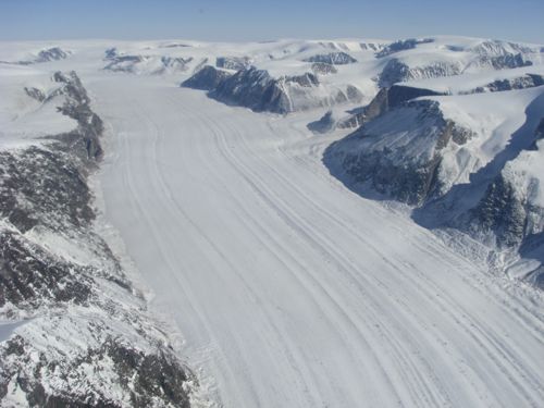 An entire set of lateral moraines is visible in this classic valley glacier. You can also see a couple of tributary glaciers joining the main flow in the background.
This was a gorgeous flight and a wonderful way to go out. It has been a privilege to get to know the OIB crew and how the operation functions. In time I will post a longer reflection regarding my experience here in Greenland. But for now I have packing to do and a very busy travel schedule ahead.


Comments