Cruise Day 44
Speed 7 knots (kts)
Course 246° (WSW)
Location N. Canada Basin, ~600 nm north of Barrow, Alaska
Depth 3848 m
GO DEEPER DISCUSSION: (see previous journal for the questions.)
The answer to Sunday’s riddle: The sailors are facing each other from opposite sides of the ship.
TODAY’S JOURNAL:
Our drive south continues, with only a couple of short breaks for repeat hydrography stations on the way to our next super station at ~80° N. At our current speed that arrival appears to be just after midnight tonight, but ice conditions will dictate that. Generally the ice has been pretty yielding, with large areas of thin, lightly snow-covered ice that appear to have been open water late in the summer. We are getting larger chunks of darkness now at night as the equinox approaches, and while it hasn’t slowed us much, the ship will slow or stop for the combination of thick ice in the dark.
As most of the gear was getting packed up and hoisted back aboard at the last ice station, a peculiar-looking long instrument made of PVC pipe was lowered overboard. It turned out to be another type of buoy that the Healy had ferried up into the Arctic ice for deployment. The instrument is called an autonomous ice mass balance buoy. Most of its long body (nearly 20 feet overall) is submerged by lowering the device through a hole drilled in the ice. It will freeze into the pack ice, sending back data for about a year via Iridium satellite to the Cold Regions Research and Engineering Laboratory (CRREL).
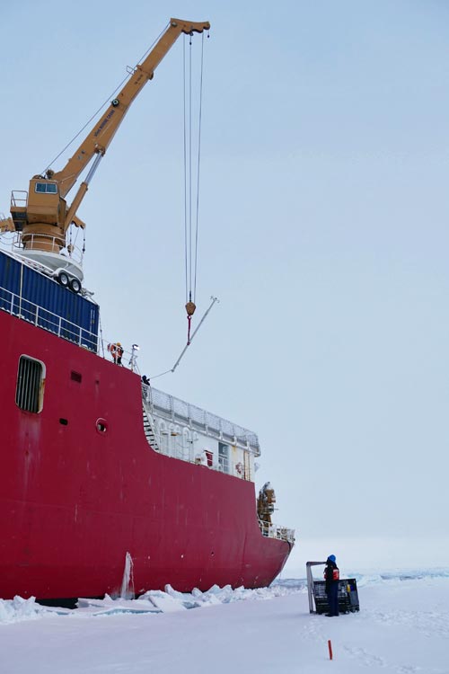 The ice mass balance buoy is lowered to the ice by crane to be deployed through a hole drilled in the ice pack.
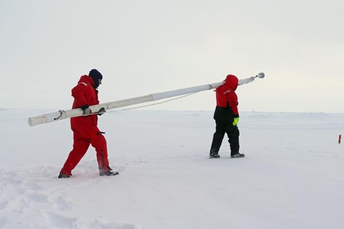 Paul Aguilar and Mark Stephens haul out the ice mass balance buoy to a hole they drilled for placement in the Arctic ice pack.
Direct measurement of Arctic ice is very important now, with a dramatic decrease in both the overall coverage and total volume of Arctic sea ice in the last few decades. Jackie Richter-Menge and Bruce Elder of CRREL summarize the buoy’s purpose:
They are instrumented to measure changes in the thickness of the ice cover, and the snow that lies on top of it, through the annual cycle of ice growth and melt. An important and unique characteristic of the IMBs is their ability to determine whether the thermodynamically-driven changes in the ice cover are occurring at the top or bottom surface. This knowledge helps us better understand the reasons for the change and, hence, improve models being developed to forecast future change. The CRREL IMB program has been supported by NSF and NOAA and relies heavily on the collaboration of many researchers and logistic teams working in the Arctic.
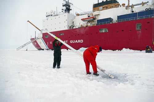 Paul Aguilar and Mark Stephens prepare to ease the ice mass balance buoy into the hole they drilled through the ice.
To accomplish this, the buoy records air temperature and pressure, changes in snow accumulation and/or melt with an acoustic sounder (which also measures ice surface melt), and growth or melt in ice bottom with sonar range-finder. A temperature profile every 10 cm from the air, through the ice, and into the water column can calculate heat flux through the ice and give further evidence for ice growth or melt. The buoy senses water pressure to determine if it melts out of the ice in the summer, and has a tilt sensor to determine if the buoy is upright and if not, help adjust the surface and under-ice sounder values or detect if the buoy is stuck in a pressure ridge. The buoy’s position, determined by GPS, can be tracked over time to track the direction and speed of ice drift.
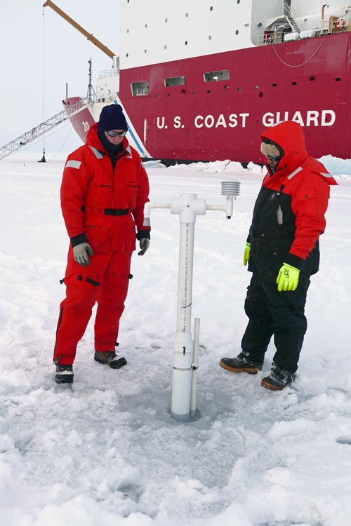 Paul Aguilar and Mark Stephens inspecting the installed ice mass balance buoy, most of which extends into the ocean underneath the ice.
There is a web site to find out more about this program, and to track data from buoys in operation at http://imb.erdc.dren.mil. The buoy we deployed is one of three going in this fall, and data from it should be available in a few weeks once it is added to the active data page. Look for buoy 2015I to make its appearance down the line if you want to follow it in its Arctic journey!
Thanks, Jackie & Bruce, for the information!
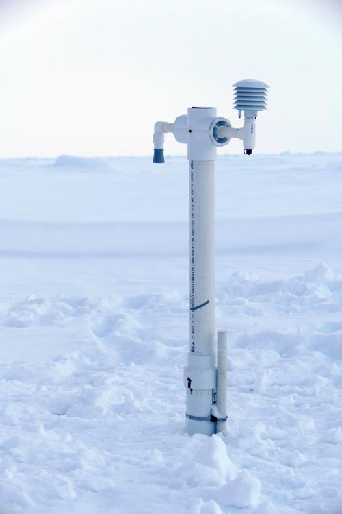 Left in the ice, the ice mass balance buoy will freeze in, measure important parameters, and report back home by satellite for about a year if all goes to plan. I wonder what an Arctic explorer or a polar bear would think if they happened upon this strange-looking installation protruding from the ice?
GO DEEPER!
A recent press release announced: According to a NASA analysis of satellite data, the 2015 Arctic sea ice minimum extent is the fourth lowest on record since observations from space began.
It will take a lot more study and analysis to determine an estimate of the ice volume present this past summer in the Arctic – why is that?
Aloft Con web cam updated every hour
Healy Track
That's all for now. Best- Bill


Comments