Moving Targets
Just as a warning, I like maps. A LOT. When my team mentioned that they were plotting the Automatic Weather Station (AWS) on the moving ice sheet, I thought to myself "That sounds FUN!" Prepare yourself for a land navigation geek out session! Let's see if you agree with me.
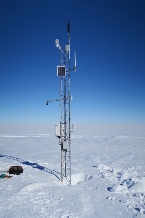 This is the Gill AWS after servicing November 29th, 2017 Photo Credit AMRC.
There are more than 100 Automatic Weather Stations distributed all over the continent of Antarctica. A few of them are on solid ground or rock. Those AWS include Cape Bird, White Island, Marble Point, Minna Bluff, Thurston Island, Evans Knoll, and Bear Peninsula, and they don't experience any movement since they are on solid ground. Most of the Automatic Weather Stations are on ice. The problem with the AWS being placed on ice is that ice moves. That means that most of the AWS are NOT where they were last seen. They don’t have onboard GPS locators so they are moving targets! We better get out a map!
Why is that a problem? AWS need to be serviced, repaired and extended (they get buried in snow) periodically. So, we need to calculate where we expect them to be to provide the pilots with accurate Longitude and Latitude coordinates to find the AWS. Some are relatively stationary and are hardly moving at all, but some of them are in faster moving areas than others. AWS on the Ross Ice Shelf (or any ice shelf) move a lot faster than those AWS on the ice over land. I analyzed the movement of a variety of our AWS, which are listed below. These were calculated by using GPS coordinates every couple of years and averaging the distance per year.
I’ll use the AWS named 'Gill' as an example. I'll write a journal on how AWS get their names in the near future. Gill, by the way, is named for an Antarctic LC-130 pilot! Gill is about 232 miles (by Twin Otter airplane) from McMurdo Station.
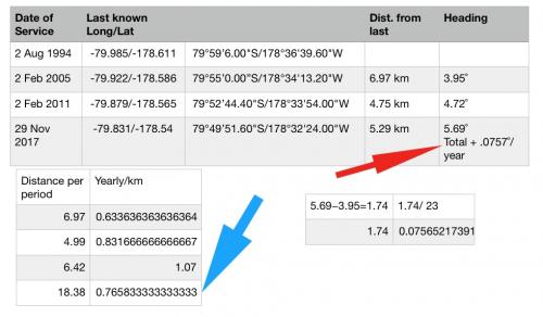 This shows the math involved in tracking the movement of Gill AWS.
The tables above show the last known positive locations of Gill AWS. So, without getting too far into the weeds with the math… If we figure out how far Gill moved over the periods between getting the last known positive locations and divide each distance by the number of years (or months to be more accurate) we SHOULD get an average yearly distance that the ice sheet has drifted on which Gill sits. But we aren’t done yet because it isn’t traveling in a straight line! Isn't this getting EXCITING? The ice sheet is drifting off to the East at +.0767˚ per year. FUN!
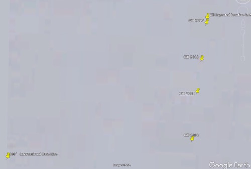 This shows the movement of the Gill AWS from 1994 to 2017 and the expected location for 2018.
So, where should Gill be if we need to tell a helicopter pilot where to find it?
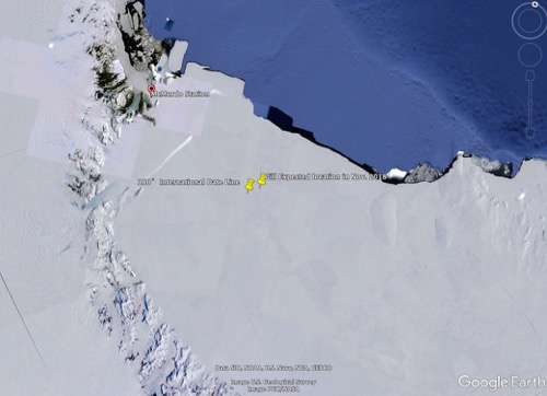 This shows the Ross Ice Shelf, and the locations of McMurdo Station and Gill AWS.
Well, it SHOULD be .77km further north and .075˚ east of the last known positive location. Or, more precisely: 79°49’27.24”S, 178°32’10.83"W. Easy right?
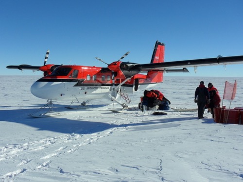 This is a Twin Otter, the type of airplane that would be used to get to Gill. Photo credit Tim Spuck ARCUS.
Here are the drift rates for a few other AWS – Provided to me by Carol Costanza (who provided much of the info for this journal).
Elaine: Movement 0.31 km/yr
Gill: Movement 0.77 km/yr
Lettau: Movement 0.35 km/yr
Marilyn: Movement 0.58 km/yr
Schwerdtfeger: Movement 0.54 km/yr
Vito: Movement 0.91 km/yr


Comments
Add new comment