Helicopter yesterday, fixed-wing Twin Otter today!
Click the Media tab to see a video of today's adventure.
We flew to an Automatic Weather Station called 'Sabrina.' There are several really cool things about going to Sabrina. Sabrina is in the Western Hemisphere! McMurdo Station (where we are currently stationed, is in the Eastern Hemisphere, so going to Sabrina made me feel just a little bit closer to home...being in the same hemisphere and all!
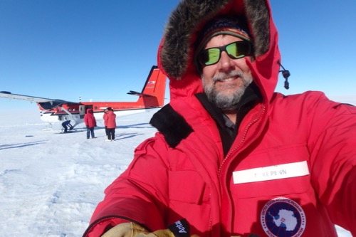 Our "Twin Otter" stopped at "South by 200" fuel cache to refuel before continuing south the Sabrina AWS.
There were four of us in this trip. Dave Mikolajczky, Elina Valkonen and me from our team. We also had a great "Boondoggler" named Dan Garcia. Dan is here as a Crane Operator who is originally from California but now lives in Canada. Coincidentally, both of our pilots ( Lindsay and Mark) were from Canada.
"South by 200"
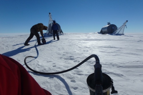 "South by 200" is a fuel cache about half way between McMurdo Station and South Pole that is roughly on a 200˚ heading from McMurdo Station.
Another thing that was interesting was that we had to fly so far, 510 miles (one way), that we had to land at a fuel cache to refuel! Even the fuel cache had a cool name – 'South by 200.' Our plane was equipped with skis, so we landed on the ice and taxied to within about 50 feet of two big fuel tanks. (Those fuel tanks had been prepositioned there by a 'Traverse.' A traverse is a caravan of bulldozers that drags supplies and equipment (that are too big to be transported by airplane) on "magic carpets" (specially made sleds) to very remote locations. We refueled our plane and were on our way within about 40 minutes.
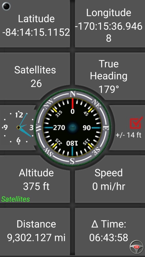 The actual location of Sabrina was pretty close to where we expected it to be! The negative signs in the latitude and longitude indicate the southern and western hemispheres, the eastern and northern hemispheres are indicated by positive numbers in the DD system. The 9,302 miles indicated on the GPS screen is from where I last used the GPS back in Pennsylvania!
The coordinates for Sabrina were predicted to be at 84˚ 14' 49" S Latitude and 170˚ 04" 05" W Longitude and turned out to be pretty close to that. I think it is impressive that they found a tiny nine-foot tall tower poking up from the endless ice shelf. The pilots just had to get down close to the ice and circle a time or two to find it.
 This is the team near the Sabrina AWS before the tower and instruments were raised.
Raising the tower
Maintenance on most of the AWS includes raising the tower. That needs to be done because the towers are being slowly buried in the snow. Once the tower is raised, all of the instrumentation is removed and then reattached at their optimal operating heights.
 This is the AWS Sabrina after a tower section was added and all of the instruments were raised.
Towers never need to be lowered since the snow is continually accumulating. The old battery box for Sabrina is now about 8 feet BELOW the current surface. We intended to dig the old battery box out and reuse it, but our pilots needed to get us out at a certain time so we had to make the most of our time. We decided to place a new battery box on the surface and return to the site at a later time to try to reclaim the old box.
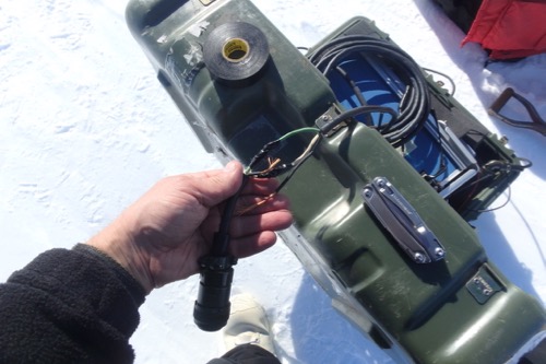 One of the maintenance items we did was place a new battery box, requiring that the cable be spliced. In order to do some of the maintenance, we have to BRIEFLY take our hands out of our mittens, but trust me, it was COLD.
When we service a GPS we also get location using an extremely accurate GPS unit called a "Trimble 5700" so that we know exactly where it was when we were there so that we can accurately predict where it will be the next time it is serviced after we account for the glacial drift of the ice shelf it is on.
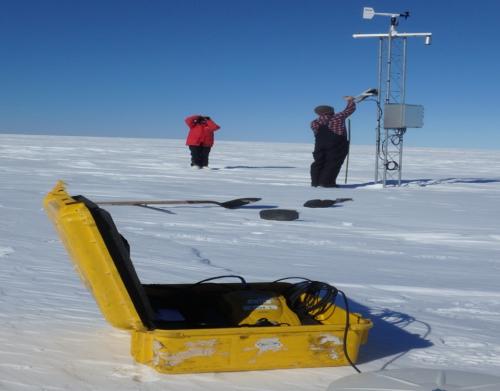 This is an extremely accurate GPS unit used to get an exact location of the AWS so that its location can be accurately predicted in the future.
Windy and Cold!
This location is in what is called the Ross Airstream – the wind generally runs from south (from the pole) to north in a channel that is contained on one side by the Transantarctic Mountains. All of that means that it is windy and cold. Brrrrr!
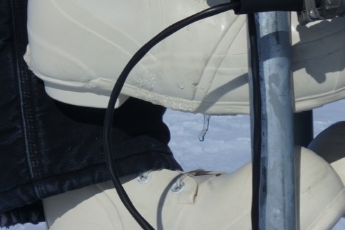 It was very cold today. Snow would melt on our boots and freeze as it dripped off, forming icicles!

Comments
Add new comment