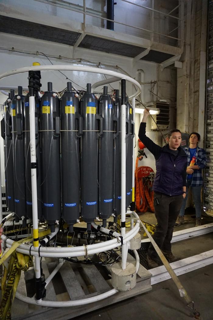
We are still en route to DBO 1-1, which is the first sampling site on our expedition. We passed St. Lawrence Island very early this morning to our east and Russia to the west. Today was a bustle of activity with lab set up and learning how to use some of the more intricate sampling tools. One of these larger pieces of equipment is the CTD, which stands for conductivity (or salinity...higher conductivity means higher salinity), temperature, and depth. The CTD on the Healy also has 24, 12L Niskin bottles around it in order to collect water samples.
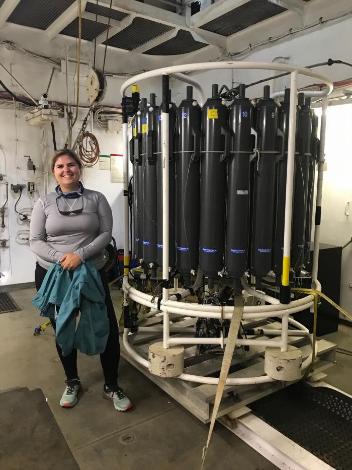 Piper Bartlett-Browne next to the CTD in the loading dock before deployment.
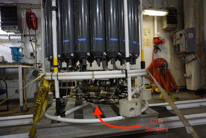 The CTD showing the sensors on the bottom to measure conductivity, temperature, and depth.
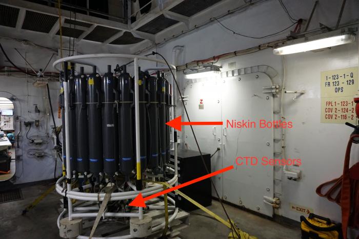 The CTD with the Niskin bottles at the top and the sensors underneath.
To get us all ready to deploy this equipment at the sampling sites, CTD School was offered by Leah McRaven, a cruise administrator, and Kristen Beem from STARC. The CTD is so large that it is kept in its own small hanger on the starboard (right) side of the ship from where it is deployed by a team of technicians.
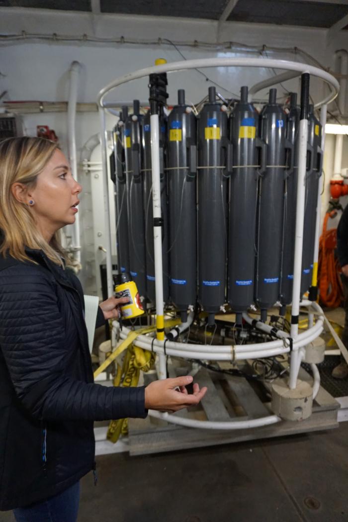 Leah McRaven from WHOI leads the CTD School for scientists on board the ship.
 Kristen Beem from STARC explains how to set up the CTD for deployment.
As the CTD is lowered into the ocean at about 60 meters per minute, the sensors on the bottom collect continuous conductivity, temperature, and depth data. The 24 Niskin bottles are opened on either end before they are deployed (why???). The CTD technicians can then control when each of the Niskin bottles close to collect water. This means that this equipment can take water samples at 24 depths in one deployment! Once the CTD gets back on deck, water samples are collected using the white nozzles at the bottom of the Niskin bottles. This ensures that accurate amounts are taken and that no water is wasted.
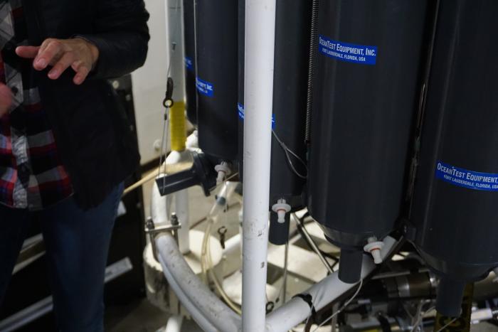 The white sampling nozzle on the Niskin bottles to collect water.
The data from the sensors shows up in the lab in real time as it descends and then provides a readout for all the scientists on board. As the depth increases, these graphs show how conductivity (or again...salinity!) and temperature changes. The data below was taken today showing depth on the y-axis. The temperature decreased drastically (also known as a thermocline) until a certain depth and then leveled off. The salinity increased (also known as halocline) until a certain depth and then also held steady. These CTD readings will be taken at every sampling site throughout the expedition.
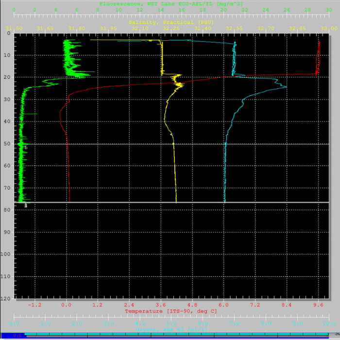 CTD sensor data from August 5, 2019 aboard the Healy.
A Question From the Crow's Nest
Why would Niskin bottles need to be opened before being lowered to deep depths?
Answer from previous post: Albedo is the solar radiation reflected by the planet. The polar regions have high albedo because the white snow and ice reflects this solar radiation. As the sea ice melts, more solar radiation will be absorbed and warm the polar regions very quickly.


Comments
Add new comment