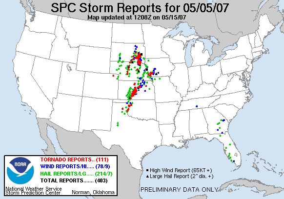
After recieving a few concerning emails, I figured this a good time to address the recent severe weather outbreak over Kansas and Oklahoma. As most of you have heard, the first ever EF5 twister struck Greensburg, a small town in south-central Kansas on Friday, May 4. 95% of the buildings in town were damaged or destroyed and a confirmed number of deaths stands at 10. The outlook doesn't look good as relief efforts have been hampered due to several rounds of severe weather over the weekend. Many more injured or dead are expected to be found in the coming days. Below are storm reports for the Friday and Saturday of one of the most significant severe weather outbreaks in recent memory. The same regions are under fire yet again today.


 Storm Reports - May 4, 2007
 Storm Reports - May 5, 2007
Storm Reports from May 4 and 5, 2007
While the threat of severe weather with strong tornadoes still exists, the main concern at this hour is the torrential rains, with some locations picking up radar estimates of nearly 10 inches in the past 24 hours. With a stalled weather system hanging on over the same regions, more significant weather is anticipated through Wednesday or Thursday of this week.
Most of the severe weather threat remained well to the south of the Kansas City metro area, however, in 24 hours, some areas received 4-8 inches of rain. This has led to boil orders in even some of the larger suburbs of KC. Click here to listen to a sound bite of the storms near KC.
For more information and coverage of severe weather, visit the following links:

