NASA's DC-8 is a Very Special Plane
This plane is very different from one you would normally travel on. There are no flight attendants, so we need to take care of our own food and liquid needs and we use a small galley supplied with hot water, coffee, and a microwave. Scientific instruments mounted on metal racks bolted to the floor are in front of many of the seats close enough to be operated like desktop computers. Because of all the instruments, only about 1/3 the regular number of seats are installed for all of us on board. All the seats are first class seats so they are wide and roomy, which helps us to work on the 11+ hour flights. The seat belts go around our waists and over our shoulders for extra security. To release the buckle, we twist the round plate to disengage all three latches. We feel very secure on this plane.
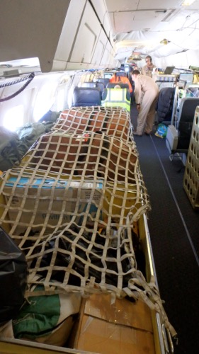
 Life rafts and other survival equipment is strapped under this tough netting at the rear of the aircraft.
Making Connections
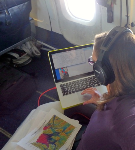
One of my jobs is connecting to classrooms while flying, and through an app called XCHAT, people on the plane can communicate with students and teachers from around the world. Students type in questions and the scientists, pilots, and mission engineers on board answer them. I can chime in too, when I see a question that I can help with, and Dr. Emily Schaller coordinates this either on the ground or in flight. We talked with 4 groups this morning on our 4 hour commute to the target area, making the flight much more fun for us!
 My day is filled with communication, writing, map studying, and learning great science from everyone on board.
Mission to The Ronne Ice Shelf
Our transects today will help the scientists collect data from an area they have not studied before.  This is a high priority flight. The data will tell a tale of four layers: the surface of the ice, the bottom of the ice, the surface of the water and the surface of the bedrock. Getting all these measurements requires several instruments. They will use the ATM (Airborne Topographic Mapper) to investigate the topography of the ice surface, and use Radar (NIDAR) and a gravimeter to map the bottom of the ice where it contacts either water or bedrock. Seeing the depth of the water (called bathymetry) will help the scientists understand the shape of the continent below the ice. This has lots of implications, including the ability to infer general water temperatures and possibly the rate of future ice melt.
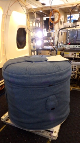
The gravimeter is an extremely sensitive devise that looks like a very expensive washing machine.
 The gravimeter looks like a washing machine or comfy foot stool!
Extremely sensitive to temperature, it must be kept at a constant temp of 48*C 24 hours a day. The gravimeter determines how much rock mass is directly below, which allows the scientists to map the rock topography. As you may remember from school, the force of gravity is strongest when two objects are closer to each other. By remembering what Einstein called the "Happiest thought of my life" or the principle of equivalence, we know that the stronger the pull of the gravimeter to the Earth, the larger the mass must be below the instrument. The stronger the pull on the instrument, the closer the terrain must be below. Thus, a contour map can be constructed along the swaths we travel. This data helps fill in the generalized forms produced by the NIDAR, so that it becomes a highly detailed map of the rocks below.
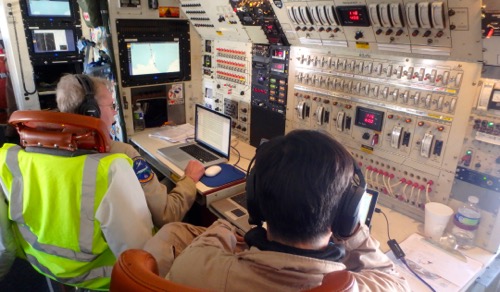
 The mission control coordinates the needs and the scientists and of the mission pilots and equipment.

Comments