What Are They Doing?
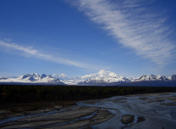
 The Alaska Range near Denali National Park
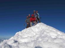
The goal of the team's research was to develop a past climate and precipitation record of Central Alaska over the past 1000 years. In order to accomplish this task, the team extracted and analyzed a series of three ice cores from an ice divide between the North and South Peaks of Mount Hunter within Denali National Park and Preserve. They also continued ice depth and surface velocity surveying of major glaciers within Denali National Park and have plans for using this information to develop improved ice volume estimates and historical glaciological reconstructions of Central Alaska.
Research at this site is important as it completes the development of a spatial ice core array (a range of data) in the North Pacific that has been underway since the early 2000s, including climate records from the St. Elias Mountains, Coast Range, Brooks Range, and Wrangell Mountains. Mt. Hunter in central Alaska lies in a different precipitation and climate regime from these regions, and thus represents the missing piece in this array needed to evaluate spatial precipitation and atmospheric circulation changes on various timescales in this region of the Arctic. Considering the apparent teleconnections (climate phenomena related to each other and occurring large distances from one another) between the Arctic and Antarctic climate and meteorology, completing this array of ice cores may also provide information that is particularly useful for world glaciological and climate modeling purposes. More information about the project can be found at the University of Maine website.
Where Are They?
 The Alaska Range near Mount McKinley
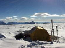
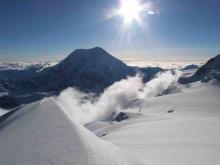
The team conducted research in Denali National Park and Preserve, in the Central Alaska Mountain Range. The team first flew by fixed-wing aircraft equipped with snow skis from Talkeetna, Alaska to a climber's base camp 7600 feet above sea level on the Kahiltna Glacier West Buttress. Once on the Kahiltna Glacier, the team traveled by ski and foot to 11,000-14,200 feet above sea level on the West Buttress, where they performed a variety of scientific objectives while getting acclimatized to the high elevation. Travel was on fixed rope teams for safety from crevasse falls and other hazards. The team conducted research and acclimatized for approximately two weeks on the Kahiltna Glacier prior to helicopter transport to the Mount Hunter Ice Divide at 13,000 feet above sea level where they started the ice core drilling. In the field the team lived in mountaineering tents. Temperatures ranged between -20 to 30 F during early season at the study site with winds from 0 to upwards of 40 mph.
Latest Journals

Seth Campbell is working to complete his doctoral degree through the School of Earth and Climate Sciences at the University of Maine. He is also a research physical scientist at the US Army Cold Regions Research and Engineering Laboratory (CRREL) in Hanover, NH specializing in applications of geophysics to the cryosphere. Excluding dozens of CRREL related projects, Mr. Campbell has led five glaciological research expeditions to Alaska and participated in 15 research expeditions to the Arctic or Antarctica during his career. Research through his PhD and at CRREL range from glaciology, permafrost, and glacial geology, to radio wave propagation studies. Mr. Campbell brings a vast range of other technical and professional experiences as a suitable role model to participating teachers in the PolarTREC program. He is a former rock and ice climbing guide with 17 years of climbing/mountaineering experience, a past emergency medical technician-intermediate, and instructor for Stonehearth Open Learning Opportunities (SOLO), a renowned national leader in wilderness emergency medicine education. In his free time Mr. Campbell enjoys spending time outdoors with his wife Kristin, and their Coonhound, Kinley.


