The GPS team has landed!
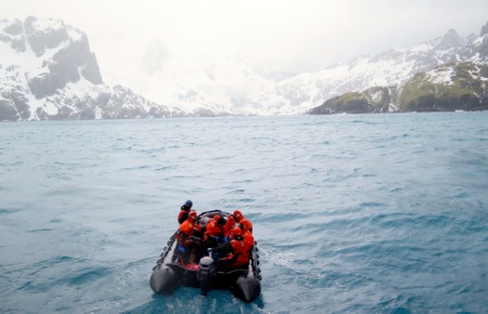 The zodiac approaching Smaaland Cove on its initial reconisance mission approximately 5:00 am.
The third time was the charm and the new GPS station is in and operable.
The day started at 4:00 am, with the ship stationed off the shore of Smaaland Cove. The wind was down, a slight drizzle and the swell appeared to be less than a few meters. With the Captain's go ahead the science party set off to scout out a location.
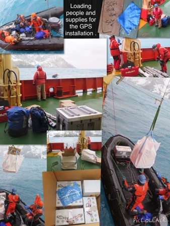 This is the scientific equipment needed to build a GPS station. Once the location was approved, the zodiac team then shuttled out the various equipment and personnel needed to complete the job.
Placement of the GPS is a pivotal component as the device needs a clear view of the horizon on as many sides as possible. If the view is diminished it reduces the unit's ability to talk with orbiting satellites.
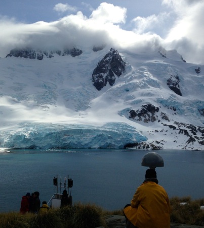 The GPS station consists of two parts; the antenna and then the box system with electricity, solar, and the iridium phone.
 All the materials necessary to run a remote GPS station.
Today was a good day, the weather held and the team was able to deploy the GPS unit. With solar panels and wind turbines, the unit is good to go. In three years the GPS will be pulled from the site or have another grant written to extend its deployment. The new unit receives GPS signals from the satellites and transmits data back through the satellites to the scientists. Every 24 hours a file is uploaded to the satellites with about 800 kilobytes. Due to the precision of the system, the scientists can record movement with an accuracy of millimeters per year, perfect for seeing the motion of tectonic plates. We also talked about trilateration and the phase of a signal but I will save those gems until our next GPS blog.
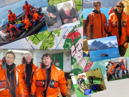 The team is very happy to have the first of three GPS stations established and already collecting data.
A few members of the team managed to get some spectacular wildlife shots. The imperial shag (cormorant), with a wing span of over a meter, is a common sight on South Georgia, as is this second bird. Today’s challenge is to identify the second bird. This species usually stays around their colony all year and feeds within 10 kilometers of the shore. This species also eats predominantly crustaceans and fish on dives up to 100 meters.
 Our first close-up sighting of the magnificent imperial shag.
 A penguin colony on South Georgia. A student challenge: can you identify this penguin species?
When the science team returned to the RV Palmer, I was anxious to ask them about their personal impressions from South Georgia. The GPS was set up at a remote location, no people, or settlements. The descriptions of their time ashore are priceless: “very rugged terrain, dry, windy, snow waist deep, the beach was covered in poop (looked like a slurry mix of krill, a fish market smell, slippery), gentoo penguins, fur seals, giant petrel, pipit (heard birds singing), and elephant seals across the cove. The scenery was untouched by humans, pristine.”
“Just imagine being at a place never before seen by humans, priceless!”
Time for a shout out. Hello Palm Beach Maritime Academy, can you identify any features in the map behind your flag?
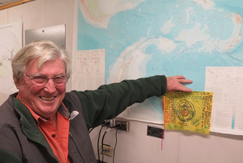 Chief Scientist Ian Dalziel posing in front of a tectonic map of the Scotia Sea with the Palm Beach Maritime Academy's flag!
Before I sign off for the night, I wish to thank all who have so graciously found some of my writing boo boos. There is a decimal error on one post and I challenge any students to find it.
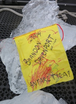 How fitting for Brandon's flag from Georgia, USA to be placed with a piece of glacial ice from South Georgia!
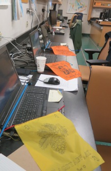 No day is complete without a lot of computer time. With flags from both Sinagua Middle School and our sister school Mount Elden Middle School.

Comments
Pagination