The motion of the ocean
To understand the purpose of our research I have had to travel back in time, a lot of time. It has taken me weeks to understand the magnitude of "this time travel!" Imagine a calendar year: January 1, at 12:01 am the Earth formed. On December 31st of that same year, at 11:59 pm, humans became part of the time line.
Scientists on our cruise want to study the motion of the South Georgia Micro Continent, understanding its relationship to the Scotia Plate and the South American Plate. Now this might sound like an easy study, but we are talking about processes that occur over millions of years.
For the past two weeks, I have been talking about the multibeam, seismic streamer, and chirp. Now we introduce GPS and its role in this research project and South Georgia. GPS is the tool the scientists are using to study this micro continent's movement, and specifically its movement in relation to the South American Plate and the Scotia Plate.
 The beautiful scenery of South Georgia, as the team looks for a GPS location.
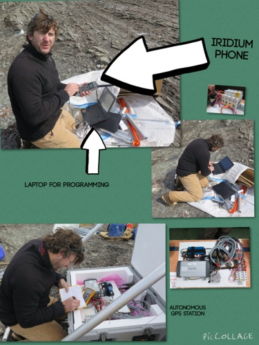
The scientists have chosen three locations for the GPS stations, that combined with a station already on South Georgia, will provide the coverage needed. So let's put in some GPS units.
But wait, South Georgia is an island in the Southern Ocean, we are on a research vessel, and we need to find ways to actually land at some of these remote locations. With the zodiac, it is possible to leave the 308 foot research vessel, but weather also comes into play. 15 foot seas often made zodiac launches impossible.
 There have been many days when the decks have been closed to people due to the wind and sea conditions.
With patience and good reconnaissance, the team was able to place all three GPS stations on South Georgia at Smaaland Cove, Bird Island and Annenkov Island. Combined with the stations already existing at King Edward Point at the center of the north side of South Georgia, the scientists now have excellent coverage to monitor the movement of this microcontinent.
 Using a geologic map to set positions for the three GPS stations.
The purpose for the GPS stations is to collect data for multiple years, documenting the movement of the South Georgia microcontinent, looking for both the horizontal and vertical movement of this amazing continent.
 Each GPS station has two components: the mast and the gear box. Both are connected with an electrical tether.
There is a bit of a power play in action here, where the key players are the major tectonic plates of South America, Africa, and Antarctica. Our little Scotia plate is filling a void created by the movement of the bigger plates around it as they move. In time (millions of years), this tectonic movement can affect the ACC. Again our jigsaw puzzle arises, putting together clues from the geological past to think about the future of the Scotia plate.
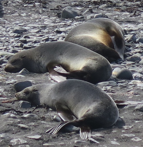
 The mast dome is a bulletproof cover for the antenna, we are mostly concerned about elephant seals.
Don't forget, today is our LIVE web event at 9:00 am Arizona time. Please register and join us for a great discussion on our research and ask questions. Please also drop me an email message if you would like a call to your class. I have been phone calling classes and it has been a joy to share our research around the world.
Tomorrow's journal we dive into fur seals and elephant seals.
 Subantarctic fur seals and southern elephant seals will be our topic of discussion for tomorrow.

Comments