With a Little Help from the Seals
While the Thwaites Offshore Research (THOR) project is focused on seafloor mapping at the edge of the glacier, there are seven other teams of scientists exploring every aspect of the ocean, ice, and climate shifts that will help build a comprehensive picture of Thwaites's past and future. All eight projects are part of the International Thwaites Glacier Consortium (ITGC). In addition to THOR researchers, there are also scientists working on the Thwaites-Amundsen Regional Survey and Network Integrating Atmosphere-Ice-Ocean Processes (which, thankfully, is shortened to the much simpler TARSAN). TARSAN is a ship-based project studying how the atmosphere and ocean are influencing the Thwaites and Dotson Ice Shelves – two neighboring ice shelves that are behaving differently. Because the deep waters of the Amundsen Sea can be difficult to study and because understanding those waters can bring important insights into the effect of the ocean on the glaciers' melting, some TARSAN scientists developed an unusual strategy for collecting data. They recognized that certain species of seals are exceptionally effective at both diving and finding holes in the ice when they surface – something they can do better than even a multi-million dollar Autonomous Underwater Vehicle (AUV) that is also used in this project.
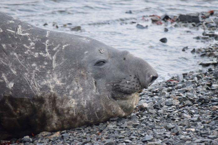
Researchers Lars Boehme and Guilherme Bortolotto knew that Weddell seals frequently dive to depths of greater than 2000 feet, and elephant seals dive into even deeper waters to feed – more than 3000 feet down. Both species, of course, have to return to the surface to breathe, even when the ice creates a near-impermeable barrier between the water and the air. They proposed attaching a tracker to a seal's head, which would be powered by a D-cell battery, able to collect data on water depth, temperature, and salinity as well as the behavior of the seals themselves (where do they go and when do they go there?), and then be able to transmit that data to a satellite whenever the seals surfaced to breath. Last year, on the Nathaniel B. Palmer's expedition to the Southern Ocean, Lars and Gui were able to tag eleven Weddell seals and one elephant seal, and have collected a incredibly detailed picture of the ocean water, thanks to the seals astonishing adaptations for survival in Antarctica - you can read more about last year's work here. Both species of seals molt every year - shedding their old fur and growing a new coat, and because the tracker is attached to the fur (not the skin) by glue, it falls off during the annual molt - both seal and tracker finished with the job of contributing valuable information to our understanding of Thwaites's future.
 A male elephant seal on Edwards Island #4 in the Amundsen Sea off the southwest coast of Antarctica. Photo credit: Linna Neidel, ASC.
Recruiting seals to assist with climate science research is not an easy process, and it is one that begins long before the researchers set foot on the ice to tag the seals. At the University of St. Andrews in the UK, Lars and Gui spend hundreds of hours preparing for a hearing with the Ethical Review Board. They consider every aspect of their proposed research plan, searching for the three R's: Replacement, Reduction, and Refinement.
* Have they overlooked any strategies that would allow them to REPLACE the seals with an inanimate system of data collection, able to achieve the same detailed results without recruiting animals?
* Are there ways they could REDUCE the number of seals that they are using to collect data and still develop an accurate picture of ocean water properties at varying depths?
* Can they REFINE their tagging plan in any way to further minimize disruptions to the seals and their habitat?
After working tirelessly on the preparation process and gaining approval from both the St. Andrews Ethics Review Board and the Foreign Commonwealth Office, Lars and Gui boarded the ship with Permit FCO No. 03/2019-20 that allows them to tag up to 12 seals and authorizes the minimal disruption to the animals' habitat necessary for their tagging efforts. Shortly after we got underway, my name was added to the permit so that I could accompany them to the Edwards Islands for the purposes of documenting their efforts and sharing their story with more people. And to help carry stuff.
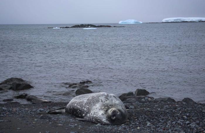
 A Weddell seal sleeps on the rocky beach of Edwards Island #10 in the Amundsen Sea, Antarctica.
In my next post, I'll tell you all about the tagging process and the system that Gui and Lars have developed for identifying, approaching, and interacting with a seal that does everything possible to protect the animal from distress while at the same time recruiting a valuable partner in the effort to better understand the seals' behavior and how their underwater environment is changing.
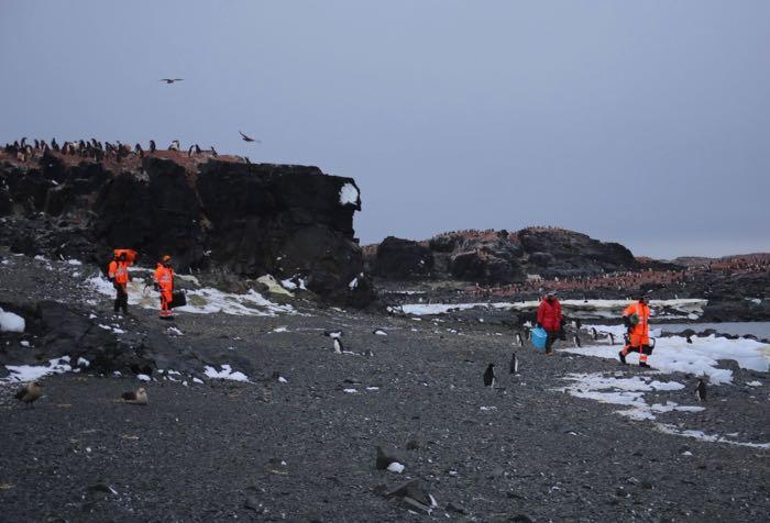
 Researchers Lars Boehme, Gui Bortolotto, Natalie Swaim, and Mark Barham carry their equipment across Edwards Island #4 on the way to the next seal tagging site.
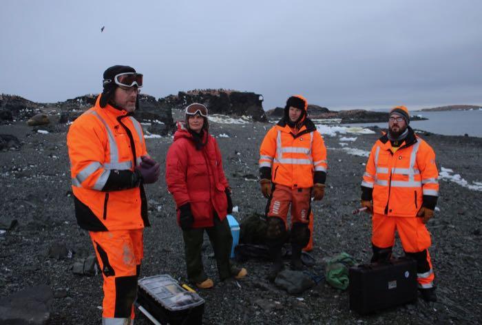
 Researchers Lars Boehme, Natalie Swaim, Mark Barham, and Gui Bortolotto gather for a quick conference before attempting to tag an elephant seal on Edwards Island #4 in the Amundsen Sea, Antarctica.

Comments
Add new comment