We have wrapped up the bulk of our science work and have shifted our attention to the trip home. Although there are a couple of planned stops along the way (to retrieve some science gear that has been collecting data since it was deployed in the first week of our expedition and to run a couple of Conductivity and Temperature by Depth (CTD) tests), we will be spending most of the next ten days transiting back to Punta Arenas, Chile. We all know that is the goal. How we will get there and what happens when we arrive are mired in chaos and confusion right now. From the deck of what is currently the safest place on Earth, you can see almost nothing but white in every direction. We are an icebreaking ship, with a lot of power and a strong and impenetrable hull, but that is a lot of ice. The captain has been trying to find the pathway with the greatest amount of open water, but it's not easy, especially not after dark. For the past two nights, we had to sit and wait until sunrise to start making any progress - otherwise, any distance we travel at night might just have to be retraced and started over when it is finally light.
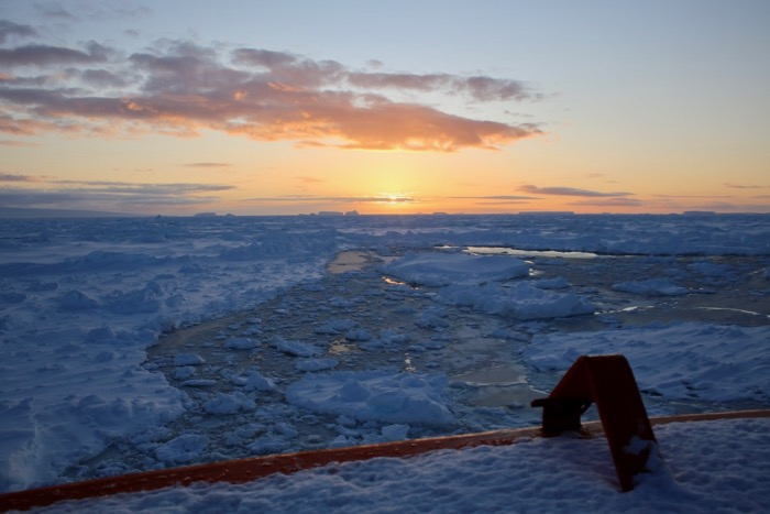
 The view off the bow shows a small break in the ice immediately in front of the ship and then nearly 100% ice coverage for many miles. Onboard the Nathaniel B. Palmer icebreaker in the Amundsen Sea.
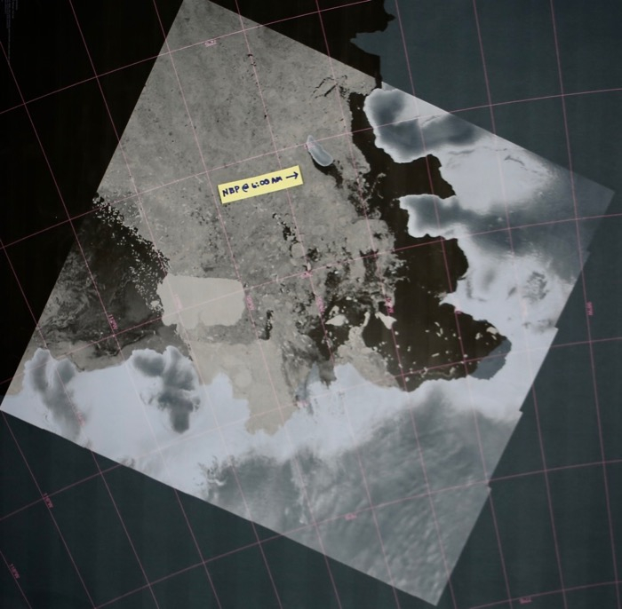
The satellite images show a massive field of nearly 100% ice coverage in front of us for more than 100 miles.
 The Nathaniel B. Palmer is currently located to the southwest of Burke Island with a field of ice stretching in front of us for over 100 miles.
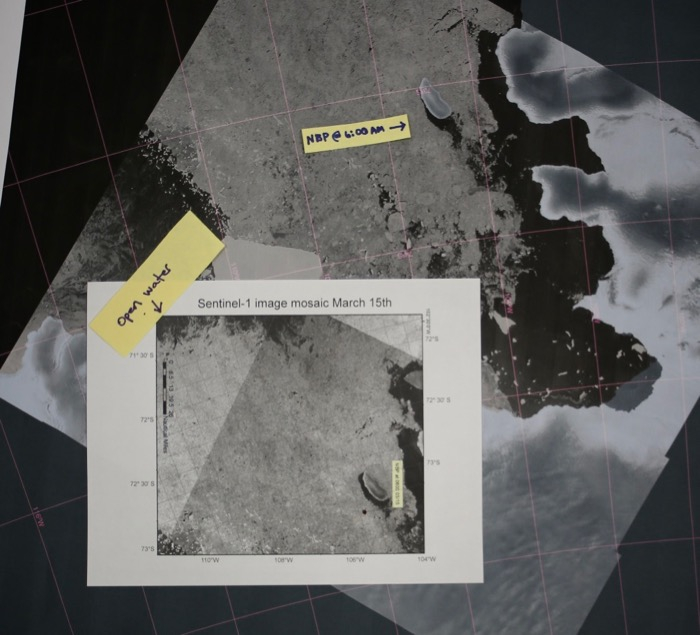
 The Sentinel-1 imagery shows the distance to the nearest open water to the north for the Nathnaiel B. Palmer icebreaker.
And, of course, once we arrive in Chile, we will have to confront the reality of the global upheaval created by the coronavirus.


Comments
Add new comment